File:Thurau fernmeldesektorturm 0820.jpg
Jump to navigation
Jump to search

Size of this preview: 800 × 533 pixels. Other resolutions: 320 × 213 pixels | 640 × 427 pixels | 1,024 × 683 pixels | 1,280 × 853 pixels | 2,048 × 1,365 pixels.
Original file (2,048 × 1,365 pixels, file size: 641 KB, MIME type: image/jpeg)
Captions
Captions
Add a one-line explanation of what this file represents
| Description |
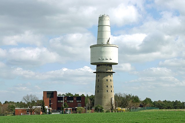
Deutsch: Fernmeldesektorturm mit horizontaler Erweiterung für das LAPAS-Projekt auf dem Thurauer Berg bei Woltersdorf im Landkreis Lüchow-Dannenberg (Niedersachsen). English: Signals intelligence tower with a horizontal extension for the Senior Guardian project near the village Thurau in the district Luechow-Dannenberg in Lower Saxony, Germany. |
||||||||
| Date | |||||||||
| Source | Self-photographed | ||||||||
| Author | Torsten Bätge | ||||||||
| Permission (Reusing this file) |
Deutsch: Die Nutzung außerhalb der Bedingungen der GNU-Lizenz für freie Dokumentation in der Originalfassung oder der deutschen Übersetzung von Hugo Giese jr. ist honorarpflichtig gemäß derzeit gültiger Broschüre Bildhonorare der Mittelstandsgemeinschaft Foto-Marketing (MFM-Liste). Wenn Sie das Bild unter anderen Bedingungen nutzen möchten oder es in einer anderen Auflösung benötigen, kontaktieren Sie mich bitte per E-Mail. |

| Camera location | | View this and other nearby images on: OpenStreetMap |
|---|
File history
Click on a date/time to view the file as it appeared at that time.
| Date/Time | Thumbnail | Dimensions | User | Comment | |
|---|---|---|---|---|---|
| current | 12:04, 17 December 2006 | | 2,048 × 1,365 (641 KB) | Torsten Bätge (talk | contribs) | |
| 00:26, 14 December 2005 |  | 3,072 × 2,048 (259 KB) | Torsten Bätge (talk | contribs) | * Bildbeschreibung: Fernmeldesektorturm auf dem Thurauer Berg bei Woltersdorf in Niedersachsen. * Quelle: selbst fotografiert * Fotograf: Torsten Bätge * Datum: 11.04.2004 {{Bild-GFDL}} |
You cannot overwrite this file.
File usage on Commons
The following page uses this file:
File usage on other wikis
The following other wikis use this file:
- Usage on de.wikipedia.org
- Usage on la.wikipedia.org
- Usage on nl.wikipedia.org
- Usage on pms.wikipedia.org
- Usage on pt.wikipedia.org
- Usage on www.wikidata.org