File:Tillaberi arrondissements.png
Jump to navigation
Jump to search
Size of this preview: 738 × 599 pixels. Other resolutions: 296 × 240 pixels | 591 × 480 pixels | 948 × 770 pixels.
Original file (948 × 770 pixels, file size: 13 KB, MIME type: image/png)
Captions
Captions
Add a one-line explanation of what this file represents
Summary[edit]
| Description |
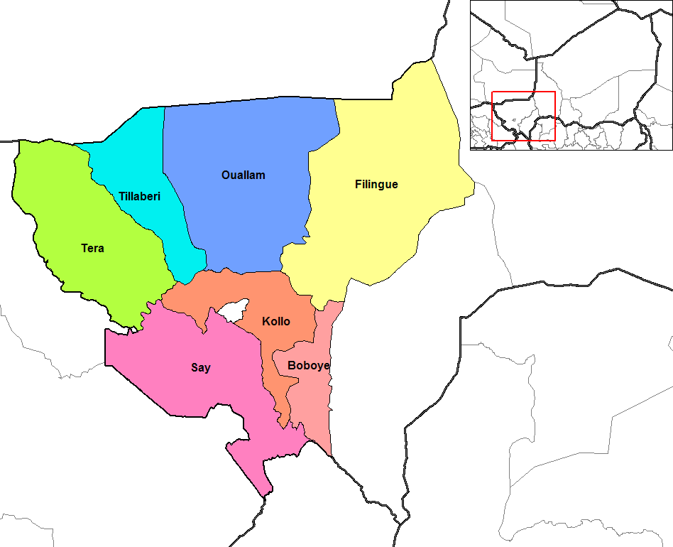
English: Map of the arrondissements of Tillaberi department in Niger. |
| Date | |
| Source | Created by Rarelibra 18:44, 13 September 2006 (UTC) for public domain use, using MapInfo Professional v8.5 and various mapping resources. |
| Author | Rarelibra at English Wikipedia |
| Other versions | Derivative works of this file: Tillaberi Arrondissements.png |
Licensing[edit]
| This work has been released into the public domain by its author, Rarelibra at English Wikipedia. This applies worldwide. In some countries this may not be legally possible; if so: Rarelibra grants anyone the right to use this work for any purpose, without any conditions, unless such conditions are required by law. |
Original upload log[edit]
The original description page was here. All following user names refer to en.wikipedia.
- 2006-09-13 18:44 Rarelibra 1056×816×8 (27966 bytes) Map of the arrondissements of Tillaberi department in Niger. Created by ~~~~ for public domain use, using MapInfo Professional v8.5 and various mapping resources.
File history
Click on a date/time to view the file as it appeared at that time.
| Date/Time | Thumbnail | Dimensions | User | Comment | |
|---|---|---|---|---|---|
| current | 23:23, 11 October 2018 | | 948 × 770 (13 KB) | Ras67 (talk | contribs) | cropped and optimized |
| 14:11, 6 January 2008 |  | 1,056 × 816 (27 KB) | Tomia (talk | contribs) | full resolution from en: | |
| 19:03, 16 February 2007 |  | 776 × 600 (92 KB) | Reyos (talk | contribs) | from http://en.wikipedia.org/wiki/Image:Tillaberi_arrondissements.png |
You cannot overwrite this file.
File usage on Commons
The following 7 pages use this file:
File usage on other wikis
The following other wikis use this file:
- Usage on ar.wikipedia.org
- Usage on de.wikipedia.org
- Usage on en.wikipedia.org
- Usage on es.wikipedia.org
- Usage on fa.wikipedia.org
- Usage on fi.wikipedia.org
- Usage on frr.wikipedia.org
- Usage on fr.wikipedia.org
View more global usage of this file.