File:Tongass NF - map of wilderness areas.jpg
跳转到导航
跳转到搜索
本预览的尺寸:776 × 600像素。 其他分辨率:311 × 240像素 | 621 × 480像素 | 994 × 768像素 | 1,280 × 989像素 | 2,200 × 1,700像素。
原始文件 (2,200 × 1,700像素,文件大小:954 KB,MIME类型:image/jpeg)
说明
说明
添加一行文字以描述该文件所表现的内容
摘要
[编辑]
| 描述 |
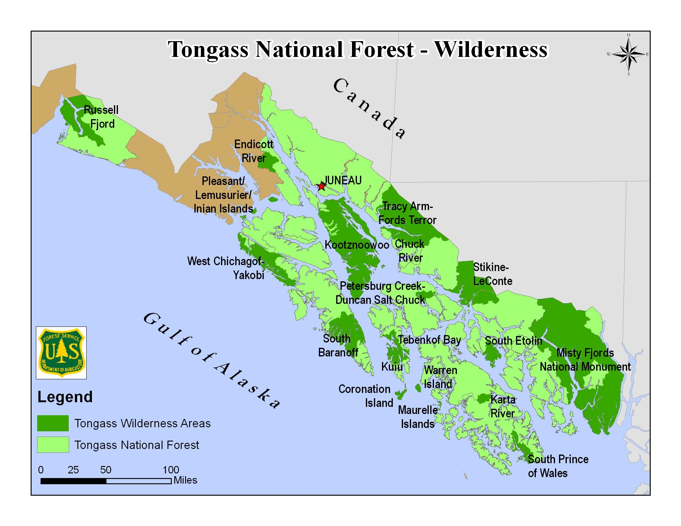
English: Map of the Tongass National Forest in southeast Alaska, USA, showing designated Wilderness Areas |
|||
| 日期 | 未知日期 | |||
| 来源 | https://www.fs.usda.gov/detail/tongass/specialplaces/?cid=stelprdb5393510 | |||
| 作者 | U.S. Forest Service | |||
| 授权 (二次使用本文件) |
|
文件历史
点击某个日期/时间查看对应时刻的文件。
| 日期/时间 | 缩略图 | 大小 | 用户 | 备注 | |
|---|---|---|---|---|---|
| 当前 | 2018年9月21日 (五) 19:41 | | 2,200 × 1,700(954 KB) | Jsayre64(留言 | 贡献) | {{Information |description ={{en|1=Map of the Tongass National Forest in southeast Alaska, USA, showing designated wilderness areas}} |date =Unknown |source =https://www.fs.usda.gov/detail/tongass/specialplaces/?cid=stelprdb5393510 |author =U.S. Forest Service |permission ={{PD-USGov-USDA-FS}} }} Category:Maps of Tongass National Forest Category:Wilderness Areas of Alaska |
您不可以覆盖此文件。
文件用途
以下2个页面使用本文件:
全域文件用途
以下其他wiki使用此文件:
- ca.wikipedia.org上的用途
- de.wikipedia.org上的用途
- en.wikipedia.org上的用途
- fy.wikipedia.org上的用途
- zh.wikipedia.org上的用途