File:Toowoomba LGA Qld 2008.png
跳转到导航
跳转到搜索
没有更高的分辨率。
Toowoomba_LGA_Qld_2008.png (400 × 535像素,文件大小:52 KB,MIME类型:image/png)
说明
说明
添加一行文字以描述该文件所表现的内容
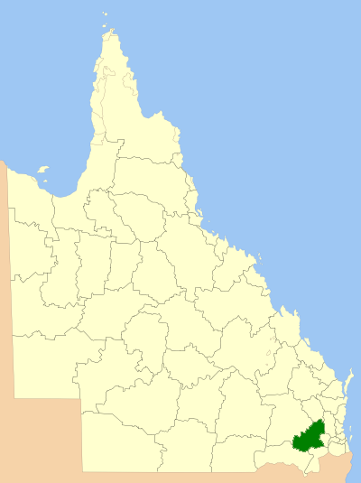
| 描述 | Location of the Local Government Area in Queensland |
| 日期 | |
| 来源 | 自己的作品 |
| 作者 | self |
| 授权 (二次使用本文件) |
GNU Free Documentation License |

|
已授权您依据自由软件基金会发行的无固定段落及封面封底文字(Invariant Sections, Front-Cover Texts, and Back-Cover Texts)的GNU自由文件许可协议1.2版或任意后续版本的条款,复制、传播和/或修改本文件。该协议的副本请见“GNU Free Documentation License”。 |
| 本文件采用知识共享署名-相同方式共享 3.0 未本地化版本许可协议授权。 | ||
| ||
| 本许可协议标签作为GFDL许可协议更新的组成部分被添加至本文件。 |
文件历史
点击某个日期/时间查看对应时刻的文件。
| 日期/时间 | 缩略图 | 大小 | 用户 | 备注 | |
|---|---|---|---|---|---|
| 当前 | 2008年7月8日 (二) 00:35 | | 400 × 535(52 KB) | Roke~commonswiki(留言 | 贡献) | {{Information |Description=Location of the Local Government Area in Queensland |Source=self made |Date=March 2008 |Author=self |Permission=GNU Free Documentation License |other_versions= }} {{GF |
您不可以覆盖此文件。
文件用途
以下页面使用本文件:
全域文件用途
以下其他wiki使用此文件:
- de.wikipedia.org上的用途
- en.wikipedia.org上的用途
- Local government areas of Queensland
- Toowoomba Region
- Birnam, Queensland (Toowoomba Region)
- Finnie, Queensland
- Redwood Park, Toowoomba
- Manapouri, Queensland
- Palmtree, Queensland
- Budgee, Queensland
- Cattle Creek, Queensland (Toowoomba Region)
- Cawdor, Queensland
- Coalbank, Queensland
- Djuan, Queensland
- St Helens, Queensland (Toowoomba Region)
- Jones Gully, Queensland
- Kincora, Queensland
- Kooralgin, Queensland
- Lavelle, Queensland
- Malling, Queensland
- Millwood, Queensland
- Muldu, Queensland
- Nevilton, Queensland
- North Maclagan, Queensland
- Plainby, Queensland
- Rocky Creek, Queensland
- Rossvale, Queensland
- Thornville, Queensland
- Tipton, Queensland
- Woodleigh, Queensland
- Elphinstone, Queensland (Toowoomba Region)
- Punchs Creek
- Cherry Creek, Queensland
- Mount Binga, Queensland
- Sandy Camp, Queensland
- Bulli Creek, Queensland
- Wattle Ridge, Queensland
- Woondul, Queensland
- Forest Ridge, Queensland
- The Pines, Queensland
- Scrubby Mountain, Queensland
- Mount Molar, Queensland
- Missen Flat, Queensland
- Mountain Camp, Queensland
- Template:Toowoomba-geo-stub
- Munro Tramway
- fr.wikipedia.org上的用途
- hy.wikipedia.org上的用途
查看此文件的更多全域用途。