File:Topographic Map of Japan.png
Jump to navigation
Jump to search

Size of this preview: 771 × 600 pixels. Other resolutions: 309 × 240 pixels | 617 × 480 pixels | 988 × 768 pixels | 1,280 × 996 pixels | 1,800 × 1,400 pixels.
Original file (1,800 × 1,400 pixels, file size: 564 KB, MIME type: image/png)
Captions
Captions
Add a one-line explanation of what this file represents
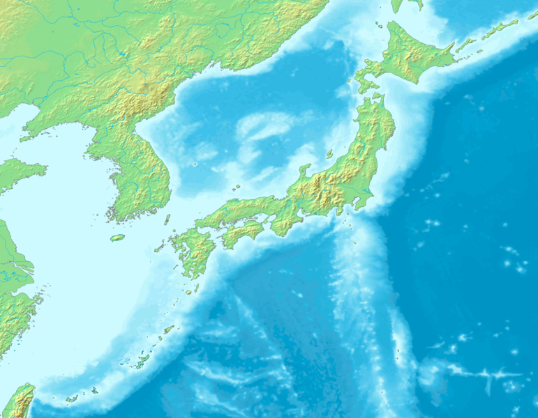
| Description | Topographic map of Japan, composed from Image:Topographic30deg N30E120.png and Image:Topographic30deg N0E120.png, both GFDL images. The maps are originally from DEMIS Mapserver, which are public domain. |
| Date | |
| Source | Own work |
| Author | Kzaral |
| Permission (Reusing this file) |
GFDL |

|
Permission is granted to copy, distribute and/or modify this document under the terms of the GNU Free Documentation License, Version 1.2 or any later version published by the Free Software Foundation; with no Invariant Sections, no Front-Cover Texts, and no Back-Cover Texts. A copy of the license is included in the section entitled GNU Free Documentation License. |
| This file is licensed under the Creative Commons Attribution-Share Alike 3.0 Unported license. | ||
| ||
| This licensing tag was added to this file as part of the GFDL licensing update. |
File history
Click on a date/time to view the file as it appeared at that time.
| Date/Time | Thumbnail | Dimensions | User | Comment | |
|---|---|---|---|---|---|
| current | 05:28, 4 September 2016 | | 1,800 × 1,400 (564 KB) | JohnnyMrNinja (talk | contribs) | increased file compression and indexed colors |
| 16:16, 4 August 2008 |  | 1,800 × 1,400 (1.41 MB) | Kzaral~commonswiki (talk | contribs) | {{Information |Description=Topographic map of Japan, composed from Image:Topographic30deg N30E120.png and Image:Topographic30deg N0E120.png, both GFDL images. The maps are originally from [http://www2.demis.nl/mapserver/mapper.asp DEMIS Mapserve |
You cannot overwrite this file.
File usage on Commons
There are no pages that use this file.
File usage on other wikis
The following other wikis use this file:
- Usage on ar.wikipedia.org
- Usage on en.wikipedia.org
- Usage on fa.wikipedia.org
- Usage on id.wikipedia.org
- Usage on incubator.wikimedia.org
- Usage on ko.wikipedia.org
- Usage on mt.wikipedia.org
- Usage on nl.wikipedia.org
- Usage on zh-yue.wikipedia.org