File:Topographic atlas of the City and County of Denver, Colorado - DPLA - 3f68bd3f513e9d7dfddd8cefbdbf55c0 (page 28).jpg
Jump to navigation
Jump to search
Size of this preview: 716 × 600 pixels. Other resolutions: 287 × 240 pixels | 573 × 480 pixels | 917 × 768 pixels | 1,223 × 1,024 pixels | 2,446 × 2,048 pixels | 7,807 × 6,537 pixels.
Original file (7,807 × 6,537 pixels, file size: 6.84 MB, MIME type: image/jpeg)
Captions
Captions
Add a one-line explanation of what this file represents
Summary
[edit]This file was uploaded by the Digital Public Library of America, and the following item metadata was created by the contributing institution's staff.
Note: this data is being maintained by an automated bot, synced with the source data.
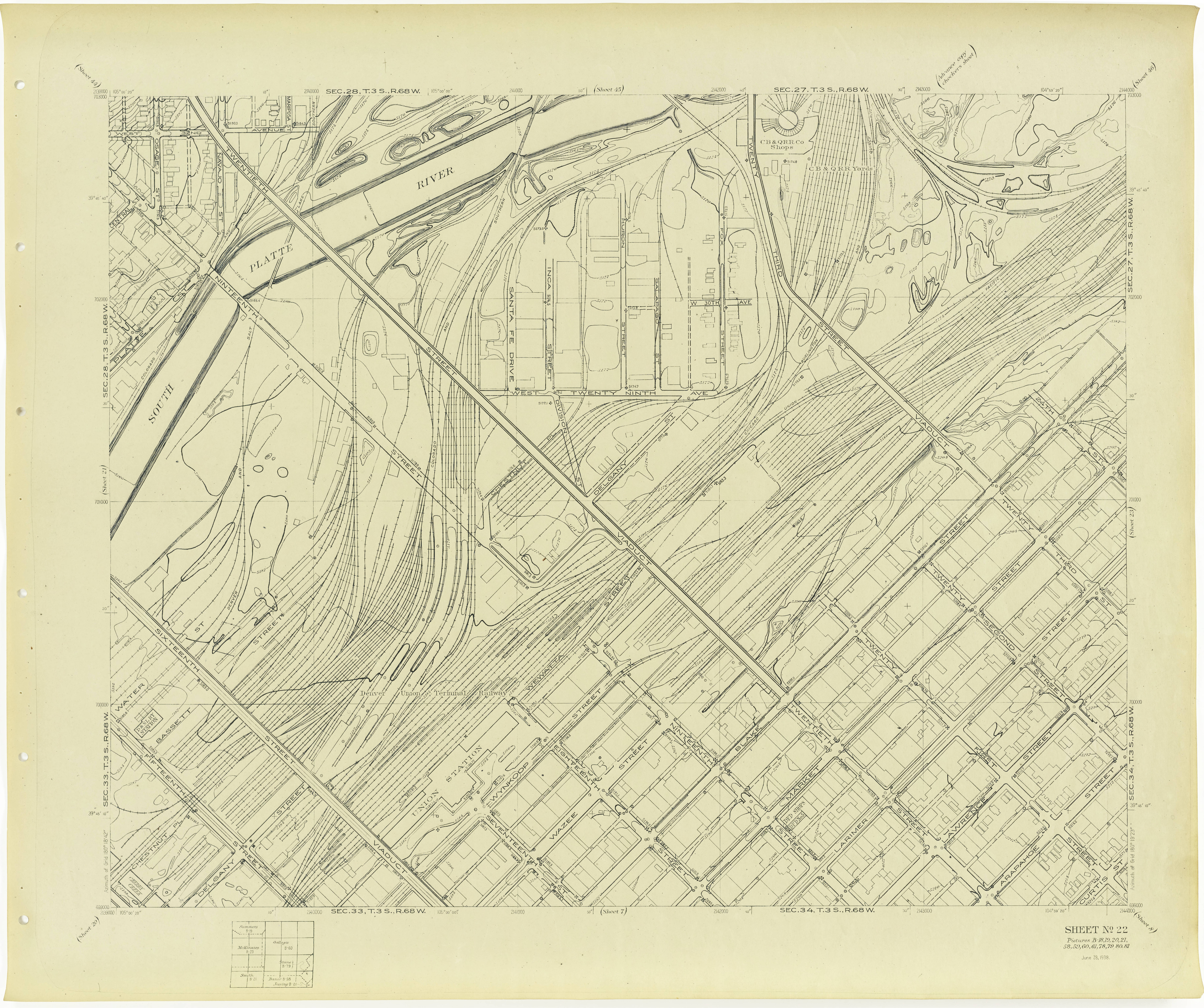
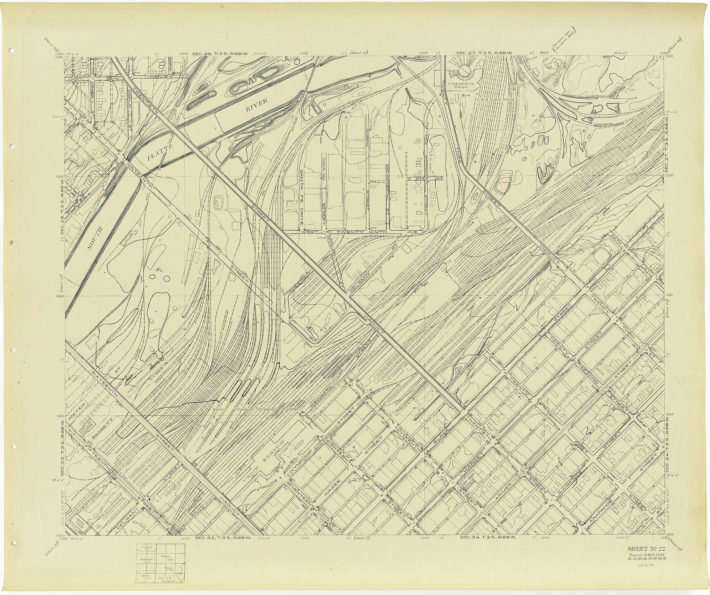
| Description | Shows streets, buildings, with public buildings identified, parks, bodies of water, range and township., Scale [1:2,400]. 1 inch = 200 feet ; Lambert proj | ||||||||||||||||||||
| Title | Topographic atlas of the City and County of Denver, Colorado, U.S.G.S. Denver survey topographic sheets; W.P.A. project no. 674 | ||||||||||||||||||||
| Institution |
|
||||||||||||||||||||
| Subject | |||||||||||||||||||||
| Source |
Plains to Peaks Collective |
||||||||||||||||||||
| Author |
Geological Survey (U.S.) |
||||||||||||||||||||
| Permission (Reusing this file) |
Copyright determination made by Denver Public Library (Q69470198) using RightsStatements.org
|
||||||||||||||||||||
| Partnership |
|
||||||||||||||||||||


.jpg&action=edit§ion=1)
File history
Click on a date/time to view the file as it appeared at that time.
| Date/Time | Thumbnail | Dimensions | User | Comment | |
|---|---|---|---|---|---|
| current | 13:18, 18 December 2020 | | 7,807 × 6,537 (6.84 MB) | DPLA bot (talk | contribs) | Uploading DPLA ID 3f68bd3f513e9d7dfddd8cefbdbf55c0 |
You cannot overwrite this file.
File usage on Commons
There are no pages that use this file.
.jpg&oldid=803239521)