File:Topographical map of Black Mesa.png
Jump to navigation
Jump to search

Size of this preview: 800 × 487 pixels. Other resolutions: 320 × 195 pixels | 640 × 390 pixels | 1,024 × 623 pixels | 1,429 × 870 pixels.
Original file (1,429 × 870 pixels, file size: 399 KB, MIME type: image/png)
Captions
Captions
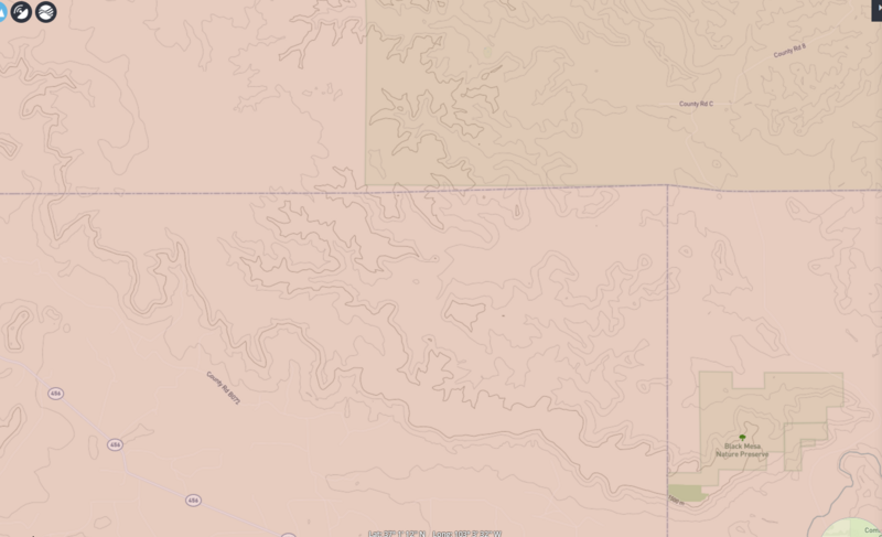
topographical map of Black Mesa in Oklahoma, New Mexico and part of Colorado
Summary
[edit]
| Description |
English: topographical map of Black Mesa in Oklahoma, New Mexico and part of Colorado as shown from 1500 meter elevation contour of a USGS topographical map. |
| Date | |
| Source | USGS online https://ngmdb.usgs.gov/topoview/viewer/#13/36.9763/-103.0669 |
| Author | United States Geological Survey |
Licensing
[edit]
This work is in the public domain in the United States because it is a work prepared by an officer or employee of the United States Government as part of that person’s official duties under the terms of Title 17, Chapter 1, Section 105 of the US Code.
Note: This only applies to original works of the Federal Government and not to the work of any individual U.S. state, territory, commonwealth, county, municipality, or any other subdivision. This template also does not apply to postage stamp designs published by the United States Postal Service since 1978. (See § 313.6(C)(1) of Compendium of U.S. Copyright Office Practices). It also does not apply to certain US coins; see The US Mint Terms of Use.
|
 | |
| This file has been identified as being free of known restrictions under copyright law, including all related and neighboring rights. | ||
File history
Click on a date/time to view the file as it appeared at that time.
| Date/Time | Thumbnail | Dimensions | User | Comment | |
|---|---|---|---|---|---|
| current | 17:15, 23 September 2023 | | 1,429 × 870 (399 KB) | Louis P. Boog (talk | contribs) | Uploaded a work by United States Geological Survey from USGS online https://ngmdb.usgs.gov/topoview/viewer/#13/36.9763/-103.0669 with UploadWizard |
You cannot overwrite this file.
File usage on Commons
There are no pages that use this file.