File:Tormenta tropical sin nombre - Marzo de 2020 - Atlántico sur.png
Jump to navigation
Jump to search

Size of this preview: 699 × 600 pixels. Other resolutions: 280 × 240 pixels | 560 × 480 pixels | 895 × 768 pixels | 1,194 × 1,024 pixels | 2,388 × 2,048 pixels | 3,184 × 2,731 pixels.
Original file (3,184 × 2,731 pixels, file size: 8.62 MB, MIME type: image/png)
Captions
Captions
Add a one-line explanation of what this file represents
Summary
[edit]
| Description |
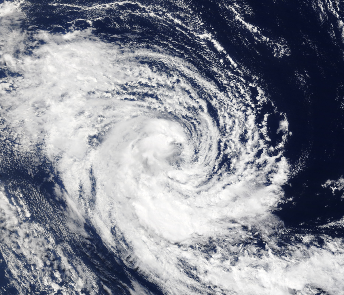
Español: Imagen satelital de la tormenta tropical sin nombre observada entre el 4 y el 6 de marzo de 2020 en el Atlántico sur |
| Date | |
| Source | https://wvs.earthdata.nasa.gov/api/v1/snapshot?REQUEST=GetSnapshot&LAYERS=MODIS_Terra_CorrectedReflectance_TrueColor&CRS=EPSG:4326&TIME=2020-03-05&WRAP=DAY&BBOX=-32,-45,-26,-37&FORMAT=image/png&WIDTH=3641&HEIGHT=2731&AUTOSCALE=TRUE&ts=1668185119654 |
| Author | Worldview Snapshots |
| Camera location | | View this and other nearby images on: OpenStreetMap |
|---|
Licensing
[edit]
| This file is in the public domain in the United States because it was solely created by NASA. NASA copyright policy states that "NASA material is not protected by copyright unless noted". (See Template:PD-USGov, NASA copyright policy page or JPL Image Use Policy.) | ||
 |
Warnings:
|
File history
Click on a date/time to view the file as it appeared at that time.
| Date/Time | Thumbnail | Dimensions | User | Comment | |
|---|---|---|---|---|---|
| current | 16:53, 11 November 2022 | | 3,184 × 2,731 (8.62 MB) | Luxin1989 (talk | contribs) | Uploaded a work by Worldview Snapshots from https://wvs.earthdata.nasa.gov/api/v1/snapshot?REQUEST=GetSnapshot&LAYERS=MODIS_Terra_CorrectedReflectance_TrueColor&CRS=EPSG:4326&TIME=2020-03-05&WRAP=DAY&BBOX=-32,-45,-26,-37&FORMAT=image/png&WIDTH=3641&HEIGHT=2731&AUTOSCALE=TRUE&ts=1668185119654 with UploadWizard |
You cannot overwrite this file.
File usage on Commons
There are no pages that use this file.
File usage on other wikis
The following other wikis use this file:
- Usage on es.wikipedia.org