File:Torrent de Pareis R05.jpg
From Wikimedia Commons, the free media repository
Jump to navigation
Jump to search
![File:Torrent de Pareis R05.jpg](https://upload.wikimedia.org/wikipedia/commons/thumb/d/d6/Torrent_de_Pareis_R05.jpg/800px-Torrent_de_Pareis_R05.jpg?20141007184019)
Size of this preview: 800 × 533 pixels. Other resolutions: 320 × 213 pixels | 640 × 426 pixels | 1,024 × 682 pixels | 1,280 × 852 pixels | 2,560 × 1,705 pixels | 4,465 × 2,973 pixels.
Original file (4,465 × 2,973 pixels, file size: 10.14 MB, MIME type: image/jpeg)
File information
Structured data
Captions
Captions
Add a one-line explanation of what this file represents
Summary
[edit]DescriptionTorrent de Pareis R05.jpg |
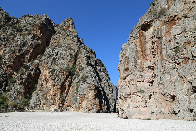
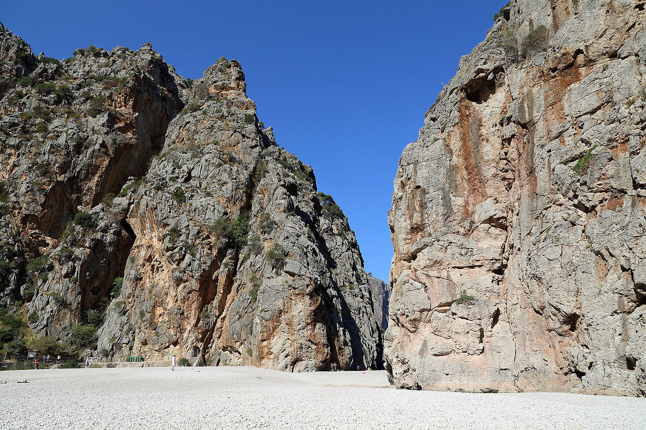
Nederlands: De canyon van de Torrent de Pareis, natuurmonument in het noorden van het eiland Majorca (Spanje) - rotsformaties bij de monding English: The canyon of the Torrent de Pareis, natural monument in the north of Majorca (Spain) - rocks at the mouth Français : Le canyon du Torrent de Pareis, monument naturel au nord de l'Île de Majorque (Espagne) - formations rocheuses près de l'embouchure |
Date | |
Source | Own work |
Author | Marc Ryckaert (MJJR) |
Camera location | 39° 51′ 09.79″ N, 2° 48′ 23.36″ E ![]() | View this and other nearby images on: OpenStreetMap | ![]() |
---|
Licensing
[edit]I, the copyright holder of this work, hereby publish it under the following license:
![w:en:Creative Commons](https://upload.wikimedia.org/wikipedia/commons/thumb/7/79/CC_some_rights_reserved.svg/90px-CC_some_rights_reserved.svg.png)
![attribution](https://upload.wikimedia.org/wikipedia/commons/thumb/1/11/Cc-by_new_white.svg/24px-Cc-by_new_white.svg.png)
This file is licensed under the Creative Commons Attribution 3.0 Unported license.
- You are free:
- to share – to copy, distribute and transmit the work
- to remix – to adapt the work
- Under the following conditions:
- attribution – You must give appropriate credit, provide a link to the license, and indicate if changes were made. You may do so in any reasonable manner, but not in any way that suggests the licensor endorses you or your use.
File history
Click on a date/time to view the file as it appeared at that time.
Date/Time | Thumbnail | Dimensions | User | Comment | |
---|---|---|---|---|---|
current | 18:40, 7 October 2014 | ![]() | 4,465 × 2,973 (10.14 MB) | MJJR (talk | contribs) | User created page with UploadWizard |
You cannot overwrite this file.
File usage on Commons
There are no pages that use this file.
Metadata
This file contains additional information such as Exif metadata which may have been added by the digital camera, scanner, or software program used to create or digitize it. If the file has been modified from its original state, some details such as the timestamp may not fully reflect those of the original file. The timestamp is only as accurate as the clock in the camera, and it may be completely wrong.
Camera manufacturer | Canon |
---|---|
Camera model | Canon EOS 6D |
Exposure time | 1/200 sec (0.005) |
F-number | f/10 |
ISO speed rating | 100 |
Date and time of data generation | 11:22, 12 September 2014 |
Lens focal length | 24 mm |
Latitude | 39° 51′ 9.79″ N |
Longitude | 2° 48′ 23.36″ E |
Altitude | 106.6 meters below sea level |
Orientation | Normal |
Horizontal resolution | 350 dpi |
Vertical resolution | 350 dpi |
Software used | Adobe Photoshop Elements 6.0 Macintosh |
File change date and time | 18:31, 7 October 2014 |
Y and C positioning | Centered |
Exif version | 2.3 |
Date and time of digitizing | 11:22, 12 September 2014 |
Meaning of each component |
|
APEX shutter speed | 7.625 |
APEX aperture | 6.625 |
APEX exposure bias | 0 |
Flash | Flash did not fire, compulsory flash suppression |
Supported Flashpix version | 1 |
Color space | sRGB |
Focal plane X resolution | 3,810.5849582173 |
Focal plane Y resolution | 3,815.89958159 |
Focal plane resolution unit | inches |
Custom image processing | Normal process |
Exposure mode | Auto exposure |
White balance | Auto white balance |
Scene capture type | Standard |
GPS time (atomic clock) | 09:18:41.034 |
Satellites used for measurement | 9 |
Receiver status | Measurement in progress |
Geodetic survey data used | WGS-84 |
GPS date | 12 September 2014 |
GPS tag version | 0.0.3.2 |
Supported Flashpix version | 1 |
Image width | 4,465 px |
Image height | 2,973 px |
Rating (out of 5) | 0 |
Date metadata was last modified | 20:31, 7 October 2014 |