File:Tottenham cake by A.O.jpg
Jump to navigation
Jump to search
Size of this preview: 480 × 600 pixels. Other resolutions: 192 × 240 pixels | 384 × 480 pixels | 614 × 768 pixels | 1,236 × 1,545 pixels.
Original file (1,236 × 1,545 pixels, file size: 360 KB, MIME type: image/jpeg)
Captions
Captions
Add a one-line explanation of what this file represents
Summary[edit]
| Description |
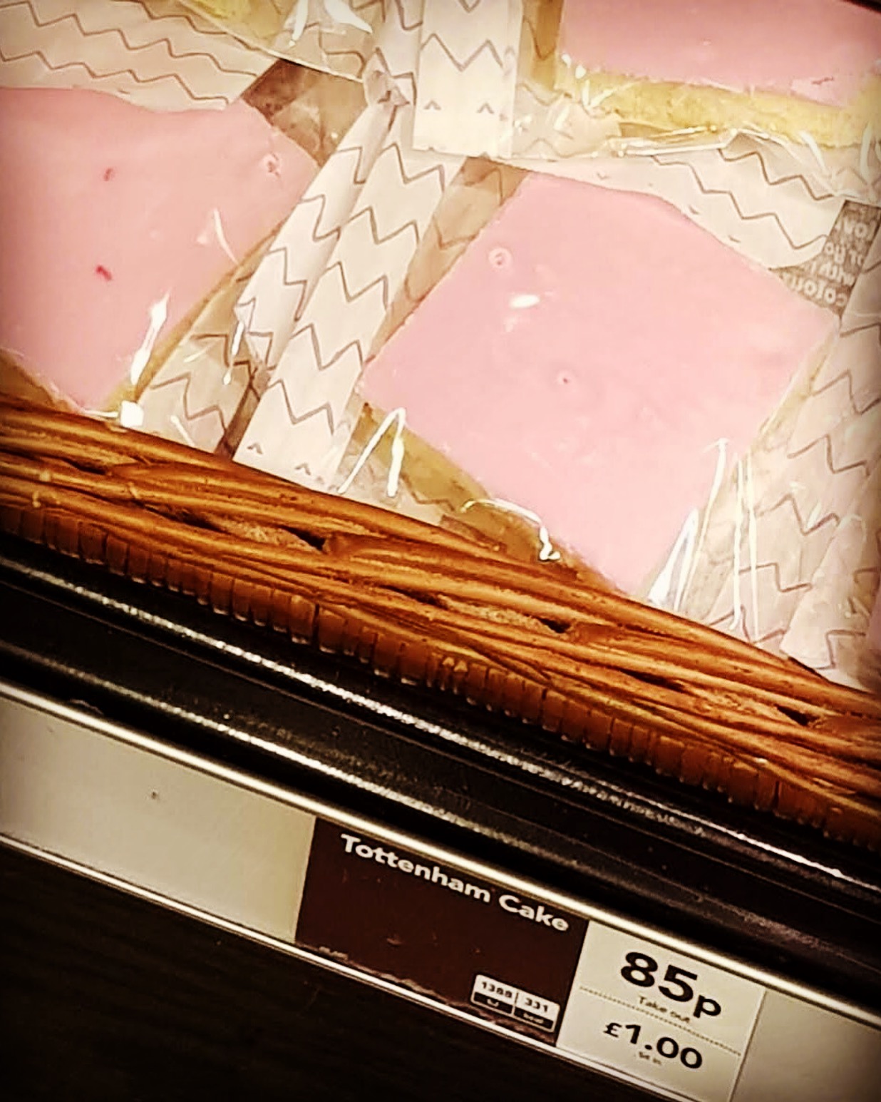
English: Tottenham cake, a British tray-baked sponge cake topped with pink icing. Originally from the Tottenham district of north London. Sold by the bakery chain Greggs.
Norsk bokmål: Tottenham cake («Tottenham-kake») er en britisk kake, med opprinnelse i Tottenham-distriktet i Nord-London. Akkurat denne varianten er i salg hos bakerikjeden Greggs. |
| Date | |
| Source | Own work |
| Author | A.O. |
| Camera location | | View this and other nearby images on: OpenStreetMap |
|---|
Licensing[edit]
I, the copyright holder of this work, hereby publish it under the following license:
This file is licensed under the Creative Commons Attribution-Share Alike 4.0 International license.
- You are free:
- to share – to copy, distribute and transmit the work
- to remix – to adapt the work
- Under the following conditions:
- attribution – You must give appropriate credit, provide a link to the license, and indicate if changes were made. You may do so in any reasonable manner, but not in any way that suggests the licensor endorses you or your use.
- share alike – If you remix, transform, or build upon the material, you must distribute your contributions under the same or compatible license as the original.
File history
Click on a date/time to view the file as it appeared at that time.
| Date/Time | Thumbnail | Dimensions | User | Comment | |
|---|---|---|---|---|---|
| current | 21:05, 22 October 2018 | | 1,236 × 1,545 (360 KB) | Spurs-alexander (talk | contribs) | User created page with UploadWizard |
You cannot overwrite this file.
File usage on Commons
The following page uses this file:
File usage on other wikis
The following other wikis use this file:
- Usage on no.wikipedia.org