File:Tour Madeloc est.jpg

Original file (3,438 × 2,541 pixels, file size: 1.91 MB, MIME type: image/jpeg)
Captions
Captions
Summary
[edit]
| Description |
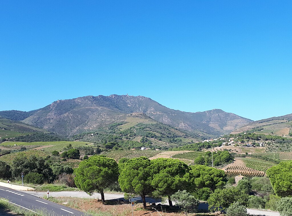
English: The Tour Madeloc (Torre de Madaloc) ridge, Port-Vendres commune, France, seen from the east.
The ridge faces the Mediterranean Sea, and is situated at the eastern end of the Albères massif. (That massif is near the far eastern end of the Pyrenees Mountains Axial Zone, the rocks of which are mostly of Paleozoic and earlier ages.) The predominant geological formations in this area are lower Cambrian and upper Ediacaran ("Cabrils") metasediments (over 500 Ma), especially schists. However, the Madeloc ridge is situated on a distinctive zone, about 200 metres wide, consisting of fine-grained sandstones of volcanosedimentary origin which are intercalated with thin pelitic layers. This zone is shown on the geological map as GTM ("Grès de la Tour Madeloc"). B. Laumonier et al., "Notice explicative de la feuille Argelès-sur-Mer - Cerbère (1097) à 1/50 000", BRGM Éditions, Orléans, 2015 (page 22), online at: http://ficheinfoterre.brgm.fr/Notices/1097N.pdf. On Géoportail: https://www.geoportail.gouv.fr/carte?c=3.07,42.4909&z=0.0001&l0=GEOLOGY.GEOLOGY::EXTERNAL:OGC:EXTERNALWMS%281%29&permalink=yes |
| Date | |
| Source | Own work |
| Author | Alan Mattingly |
| Camera location | | View this and other nearby images on: OpenStreetMap |
|---|
Licensing
[edit]
- You are free:
- to share – to copy, distribute and transmit the work
- to remix – to adapt the work
- Under the following conditions:
- attribution – You must give appropriate credit, provide a link to the license, and indicate if changes were made. You may do so in any reasonable manner, but not in any way that suggests the licensor endorses you or your use.
- share alike – If you remix, transform, or build upon the material, you must distribute your contributions under the same or compatible license as the original.
File history
Click on a date/time to view the file as it appeared at that time.
| Date/Time | Thumbnail | Dimensions | User | Comment | |
|---|---|---|---|---|---|
| current | 20:10, 18 October 2023 | | 3,438 × 2,541 (1.91 MB) | Alan Mattingly (talk | contribs) | Uploaded own work with UploadWizard |
You cannot overwrite this file.
File usage on Commons
There are no pages that use this file.
File usage on other wikis
The following other wikis use this file:
- Usage on en.wikipedia.org
- Usage on fr.wikipedia.org