File:Transformatorenturm Gruendau-Lieblos.jpg
![File:Transformatorenturm Gruendau-Lieblos.jpg](https://upload.wikimedia.org/wikipedia/commons/thumb/b/b7/Transformatorenturm_Gruendau-Lieblos.jpg/610px-Transformatorenturm_Gruendau-Lieblos.jpg?20201129230718)
Original file (3,444 × 3,383 pixels, file size: 1.55 MB, MIME type: image/jpeg)
Captions
Captions
Summary
[edit]{
DescriptionTransformatorenturm Gruendau-Lieblos.jpg |
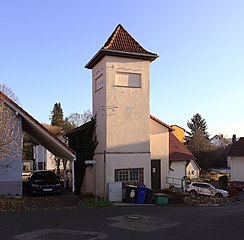
Deutsch: Transformatorenturm, Langer Rain in Gruendau-Lieblos, erbaut 1919
|
|||
Date | ||||
Source | Own work | |||
Author | R.Raab | |||
Permission (Reusing this file) |
|
Camera location | 50° 12′ 45.36″ N, 9° 08′ 18.43″ E ![]() | View this and other nearby images on: OpenStreetMap | ![]() |
---|
Licensing
[edit]![w:en:Creative Commons](https://upload.wikimedia.org/wikipedia/commons/thumb/7/79/CC_some_rights_reserved.svg/90px-CC_some_rights_reserved.svg.png)
![attribution](https://upload.wikimedia.org/wikipedia/commons/thumb/1/11/Cc-by_new_white.svg/24px-Cc-by_new_white.svg.png)
![share alike](https://upload.wikimedia.org/wikipedia/commons/thumb/d/df/Cc-sa_white.svg/24px-Cc-sa_white.svg.png)
- You are free:
- to share – to copy, distribute and transmit the work
- to remix – to adapt the work
- Under the following conditions:
- attribution – You must give appropriate credit, provide a link to the license, and indicate if changes were made. You may do so in any reasonable manner, but not in any way that suggests the licensor endorses you or your use.
- share alike – If you remix, transform, or build upon the material, you must distribute your contributions under the same or compatible license as the original.
File history
Click on a date/time to view the file as it appeared at that time.
Date/Time | Thumbnail | Dimensions | User | Comment | |
---|---|---|---|---|---|
current | 23:07, 29 November 2020 | ![]() | 3,444 × 3,383 (1.55 MB) | Surveyor54 (talk | contribs) | Retusche |
22:58, 29 November 2020 | ![]() | 3,444 × 3,383 (4.95 MB) | Surveyor54 (talk | contribs) | {{{Information |description={{de|Transformatorenturm, Langer Rain in Gruendau-Lieblos, erbaut 1919}} {{Kulturdenkmal Hessen|}} |date=2020-11-29 |source={{own}} |author=R.Raab |permission={{User:Surveyor54/Lizenz/Ergaenzung 4.0}} |other versions= }} {{GPS EXIF}} == {{int:license-header}} == {{self|cc-by-sa-4.0}} Category:Cultural heritage monuments in Gründau |
You cannot overwrite this file.
File usage on Commons
The following page uses this file:
File usage on other wikis
The following other wikis use this file:
- Usage on de.wikipedia.org
Metadata
This file contains additional information such as Exif metadata which may have been added by the digital camera, scanner, or software program used to create or digitize it. If the file has been modified from its original state, some details such as the timestamp may not fully reflect those of the original file. The timestamp is only as accurate as the clock in the camera, and it may be completely wrong.
Camera manufacturer | Canon |
---|---|
Camera model | Canon EOS 600D |
Copyright holder | R.RAAB |
Exposure time | 1/100 sec (0.01) |
F-number | f/9 |
ISO speed rating | 200 |
Date and time of data generation | 14:56, 29 November 2020 |
Lens focal length | 18 mm |
Latitude | 50° 12′ 45.36″ N |
Longitude | 9° 8′ 18.43″ E |
City shown | Gründau |
Orientation | Normal |
Horizontal resolution | 300 dpi |
Vertical resolution | 300 dpi |
Software used | GIMP 2.10.20 |
File change date and time | 00:04, 30 November 2020 |
Exposure Program | Aperture priority |
Exif version | 2.3 |
Date and time of digitizing | 14:56, 29 November 2020 |
Meaning of each component |
|
APEX shutter speed | 6.625 |
APEX aperture | 6.375 |
APEX exposure bias | 1 |
Metering mode | Pattern |
Flash | Flash did not fire, compulsory flash suppression |
DateTime subseconds | 54 |
DateTimeOriginal subseconds | 54 |
DateTimeDigitized subseconds | 54 |
Supported Flashpix version | 1 |
Focal plane X resolution | 5,728.1767955801 |
Focal plane Y resolution | 5,808.4033613445 |
Focal plane resolution unit | inches |
Custom image processing | Normal process |
Exposure mode | Auto bracket |
White balance | Auto white balance |
Scene capture type | Standard |
GPS tag version | 0.0.2.2 |
Code for country shown | DEU |
Keywords |
|
Sublocation of city shown | Lieblos |
Supplemental categories |
|
Structured data
Items portrayed in this file
depicts
29 November 2020
50°12'45.364"N, 9°8'18.427"E
0.01 second
18 millimetre
200
- Template Unknown (unspecified)
- Cultural heritage monuments in Hesse without ID
- Cultural heritage monuments in Hesse missing SDC depicts
- Cultural heritage monuments in Hesse missing SDC location of creation
- Files with coordinates missing SDC location of creation (50° N, 9° E)
- CC-BY-SA-4.0
- Self-published work
- Pages with maps