File:Treaty of Traverse des Sioux 1851 MN.png
Jump to navigation
Jump to search
Size of this preview: 707 × 599 pixels. Other resolutions: 283 × 240 pixels | 566 × 480 pixels | 906 × 768 pixels | 1,208 × 1,024 pixels | 1,600 × 1,356 pixels.
Original file (1,600 × 1,356 pixels, file size: 4.06 MB, MIME type: image/png)
Captions
Captions
Add a one-line explanation of what this file represents
Summary
[edit]| Description |
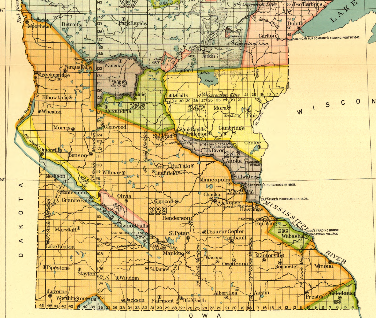
English: Map of the Minnesota portion of w:Treaty of Traverse des Sioux. This portion is designated 289 on the map, shown in orange. |
| Date | |
| Source | Plate No. 33 (Minnesota No. 1) of the Eighteenth Annual Report of the w:Bureau of American Ethnology to the Secretary of the w:Smithsonian Institution, 1896-1897 showing Indian Land Cessions in the United States, 1784 to 1894 |
| Author |
Charles C. Royce, editor Published by United States Bureau of American Ethnology, Washington, DC Lithography by A. Moen & Co., Baltimore, MD |
| Other versions |

Licensing
[edit]
This work is in the public domain in the United States because it was published (or registered with the U.S. Copyright Office) before January 1, 1929.
Public domain works must be out of copyright in both the United States and in the source country of the work in order to be hosted on the Commons. If the work is not a U.S. work, the file must have an additional copyright tag indicating the copyright status in the source country.
Note: This tag should not be used for sound recordings. |
File history
Click on a date/time to view the file as it appeared at that time.
| Date/Time | Thumbnail | Dimensions | User | Comment | |
|---|---|---|---|---|---|
| current | 16:53, 2 September 2009 | | 1,600 × 1,356 (4.06 MB) | Elkman (talk | contribs) | {{Information |Description={{en|1=Map of the Minnesota portion of w:http://en.wikipedia.org/wiki/Treaty_of_Traverse_des_Sioux. This portion is designated 289 on the map.}} |Source=[http://memory.loc.gov/cgi-bin/query/r?ammem/hlaw:@field(DOCID+@lit(ll |
You cannot overwrite this file.
File usage on Commons
The following 5 pages use this file: