File:Tropical Cyclone Elita 2004.jpg
Jump to navigation
Jump to search

Size of this preview: 473 × 599 pixels. Other resolutions: 189 × 240 pixels | 379 × 480 pixels | 606 × 768 pixels | 808 × 1,024 pixels | 1,617 × 2,048 pixels | 6,000 × 7,600 pixels.
Original file (6,000 × 7,600 pixels, file size: 6.41 MB, MIME type: image/jpeg)
Captions
Captions
Add a one-line explanation of what this file represents
Summary[edit]
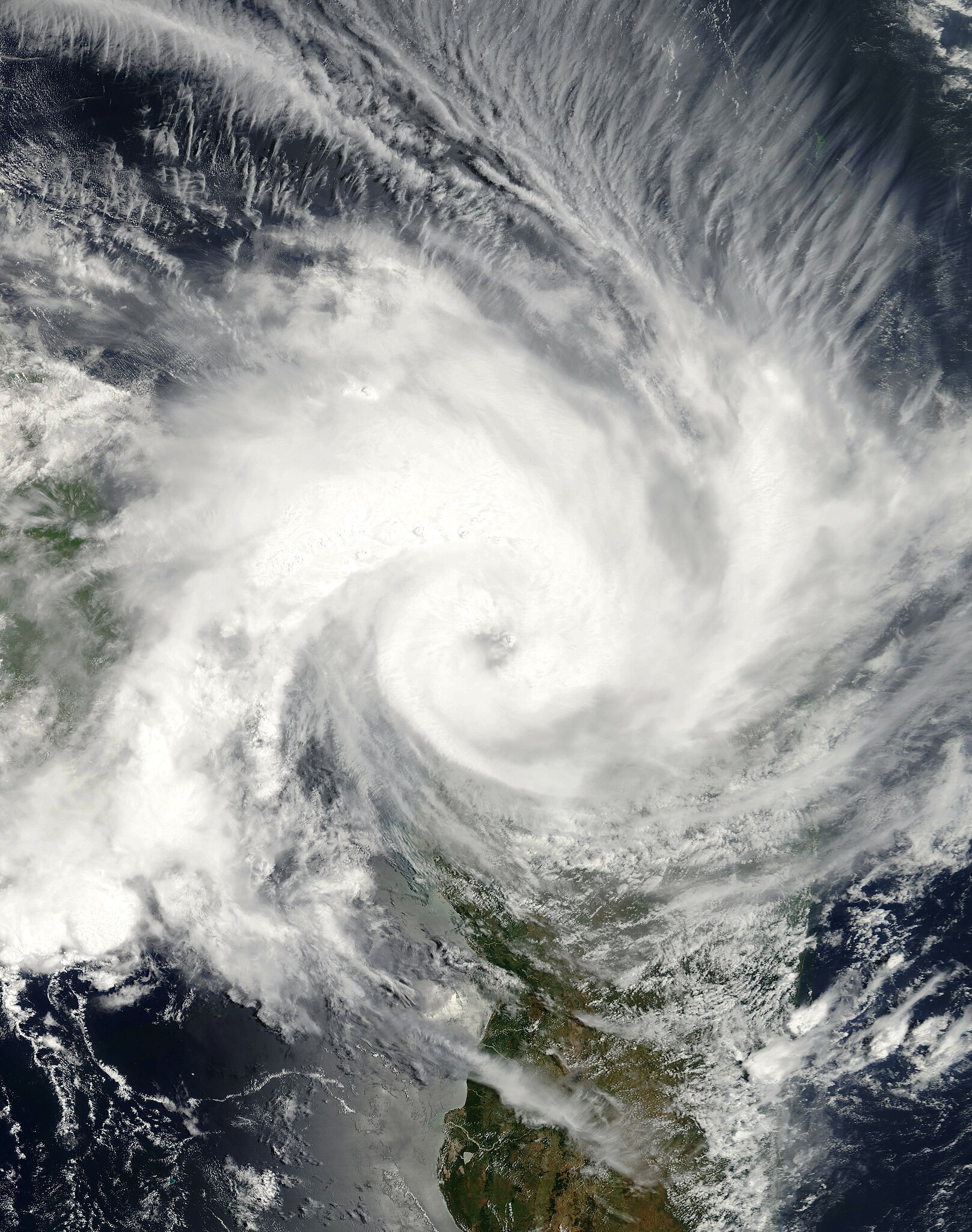
| Description | The Moderate Resolution Imaging Spectroradiometer (MODIS)instrument onboard NASA’s Terra satellite captured this true-color image of Tropical Cyclone Elita as it was making landfall off the coast of Mahajanga, Madagascar on January 28, 2004. Elita’s maximum sustained winds were near 60 knots (70 mph) with gusts to 75 knots (85 mph). The storm was expected to dissipate over the next 24-36 hours at it interacted with the Madagascar land body. | |||||
| Date | ||||||
| Source | http://visibleearth.nasa.gov/view_rec.php?id=6139 | |||||
| Author | Jeff Schmaltz, MODIS Rapid Response Team, NASA/GSFC | |||||
| Permission (Reusing this file) |
|
|||||
| Other versions | Image:TC Elita 28 jan 2004 0735Z.jpg |

File history
Click on a date/time to view the file as it appeared at that time.
| Date/Time | Thumbnail | Dimensions | User | Comment | |
|---|---|---|---|---|---|
| current | 22:51, 1 December 2018 | | 6,000 × 7,600 (6.41 MB) | FleurDeOdile (talk | contribs) | show more of the storm |
| 21:49, 1 September 2006 |  | 6,800 × 6,800 (5.09 MB) | Good kitty (talk | contribs) | == Summary == {{Information |Description=The Moderate Resolution Imaging Spectroradiometer (MODIS)instrument onboard NASA’s Terra satellite captured this true-color image of Tropical Cyclone Elita as it was making landfall off the coast of Mahajanga, Ma |
You cannot overwrite this file.
File usage on Commons
The following page uses this file:
File usage on other wikis
The following other wikis use this file:
- Usage on en.wikipedia.org
- Portal:Africa/Featured article
- Portal:Tropical cyclones/Did you know/Archive
- 2003–04 South-West Indian Ocean cyclone season
- Portal:Africa/Featured article/18
- Cyclone Elita
- Portal:Madagascar/Featured article/1
- Portal:Madagascar/Featured article
- Wikipedia:Today's featured article/March 2012
- User:Grondemar/Drafts/TFA/New
- Wikipedia:Today's featured article/March 7, 2012
- Wikipedia:Main Page history/2012 March 7
- User talk:Hurricanehink/Archive 23
- User:Jarda2020/2021–22 South-West Indian Ocean cyclone season
- Usage on pt.wikipedia.org
- Usage on zh.wikipedia.org