File:Tropical Storm Greg 2005.jpg
跳转到导航
跳转到搜索

本预览的尺寸:480 × 600像素。 其他分辨率:192 × 240像素 | 384 × 480像素 | 614 × 768像素 | 819 × 1,024像素 | 1,638 × 2,048像素 | 6,400 × 8,000像素。
原始文件 (6,400 × 8,000像素,文件大小:10.3 MB,MIME类型:image/jpeg)
说明
说明
添加一行文字以描述该文件所表现的内容
摘要
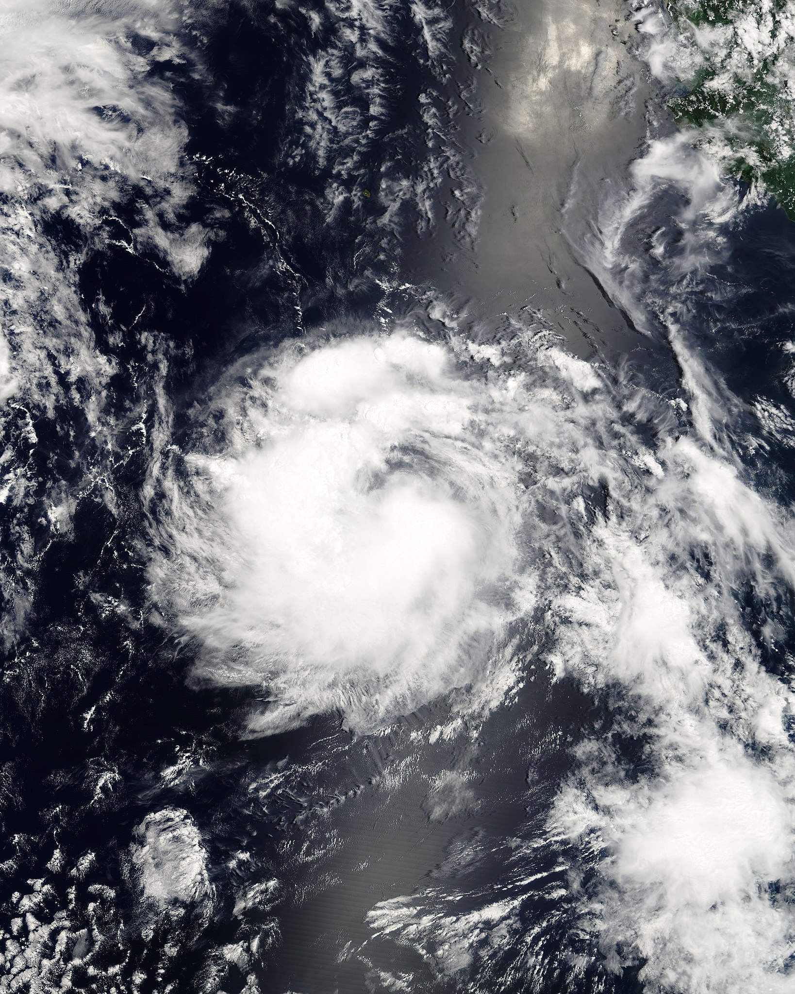
[编辑]| 描述 | This image, captured by the MODIS instrument on NASA's Terra satellite, shows Tropical Storm Greg in the eastern Pacific Ocean at 1801 UTC on August 11, 2005. The storm's maximum sustained winds were about 45 mph (75 km/h) and its minimum central pressure was 1002 mb. | ||||||
| 日期 | |||||||
| 来源 | http://www.nrlmry.navy.mil/tc_pages/tc_home.html | ||||||
| 作者 | Naval Research Laboratory | ||||||
| 授权 (二次使用本文件) |
|
||||||

文件历史
点击某个日期/时间查看对应时刻的文件。
| 日期/时间 | 缩略图 | 大小 | 用户 | 备注 | |
|---|---|---|---|---|---|
| 当前 | 2022年5月25日 (三) 18:49 | | 6,400 × 8,000(10.3 MB) | Sandy14156(留言 | 贡献) | actual Terra coverage |
| 2018年3月2日 (五) 03:39 |  | 1,500 × 1,500(408 KB) | HurricaneDude2016(留言 | 贡献) | Color MODIS version | |
| 2006年9月11日 (一) 21:11 |  | 3,500 × 3,500(1.69 MB) | Good kitty(留言 | 贡献) | == Summary == {{Information |Description=This image, captured by the MODIS instrument on NASA's Terra satellite, shows Tropical Storm Greg in the eastern Pacific Ocean at 1801 UTC on August 11, 2005. The storm's maximum sustained winds were about 45 mph ( |
您不可以覆盖此文件。
文件用途
全域文件用途
以下其他wiki使用此文件:
- de.wikipedia.org上的用途
- en.wikipedia.org上的用途
- es.wikipedia.org上的用途
- pt.wikipedia.org上的用途
- zh.wikipedia.org上的用途