File:Tusayan Lookout Tree 2018 (48943619553).jpg
Jump to navigation
Jump to search

Size of this preview: 800 × 450 pixels. Other resolutions: 320 × 180 pixels | 640 × 360 pixels | 1,024 × 576 pixels | 1,280 × 720 pixels | 2,560 × 1,440 pixels | 3,750 × 2,109 pixels.
Original file (3,750 × 2,109 pixels, file size: 7.08 MB, MIME type: image/jpeg)
Captions
Captions
Add a one-line explanation of what this file represents
Summary[edit]
.jpg&action=edit§ion=1)
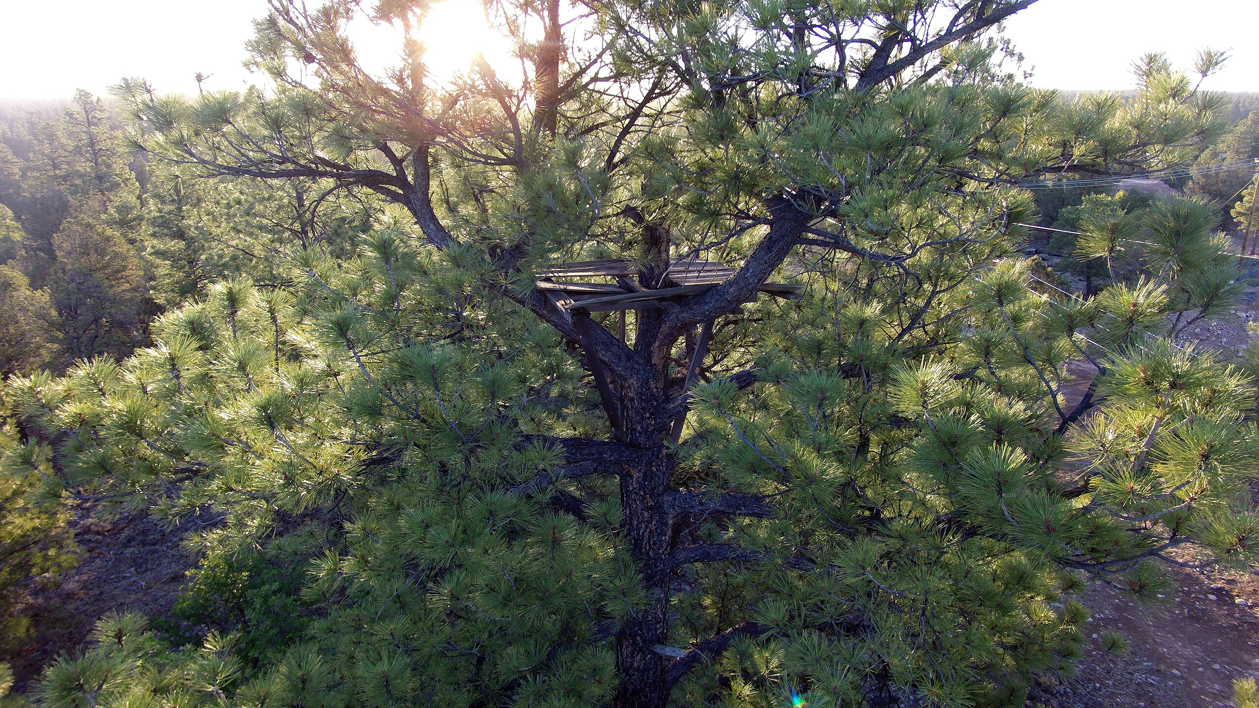
| Description | The Tusayan Lookout Tree is an example of the one of the earliest fire detection systems in American history built in the early 1900's. Rangers would venture to the highest point on the landscape and look for fires. Forest managers have protected it over the years during controlled fires. It is easily accessed by taking Forest Road 605, aka South Long Jim Loop road (off of State Route 64) and parking by the APS substation then walking to the northwest side of the substation. Tusayan district. Arizona. 7-4-18. G0012141a. Photo taken by the Grand Canyon National Park Aviation team. |
| Date | |
| Source | Tusayan Lookout Tree 2018 |
| Author | Kaibab National Forest |
| Camera location | | View this and other nearby images on: OpenStreetMap |
|---|
.jpg¶ms=035.971329_N_-112.137944_E_globe:Earth_type:camera_source:Flickr_&language=en)
Licensing[edit]
.jpg&action=edit§ion=2)
This image is a work of the Forest Service of the United States Department of Agriculture. As a work of the U.S. federal government, the image is in the public domain.
|
| This image was originally posted to Flickr by Kaibab National Forest at https://flickr.com/photos/48448783@N06/48943619553. It was reviewed on 22 November 2019 by FlickreviewR 2 and was confirmed to be licensed under the terms of the Public Domain Mark. |
File history
Click on a date/time to view the file as it appeared at that time.
| Date/Time | Thumbnail | Dimensions | User | Comment | |
|---|---|---|---|---|---|
| current | 22:53, 20 November 2019 | | 3,750 × 2,109 (7.08 MB) | Ser Amantio di Nicolao (talk | contribs) | Transferred from Flickr via #flickr2commons |
You cannot overwrite this file.
File usage on Commons
The following page uses this file:
File usage on other wikis
The following other wikis use this file:
- Usage on fr.wikipedia.org
- Usage on www.wikidata.org
.jpg&oldid=708367520)