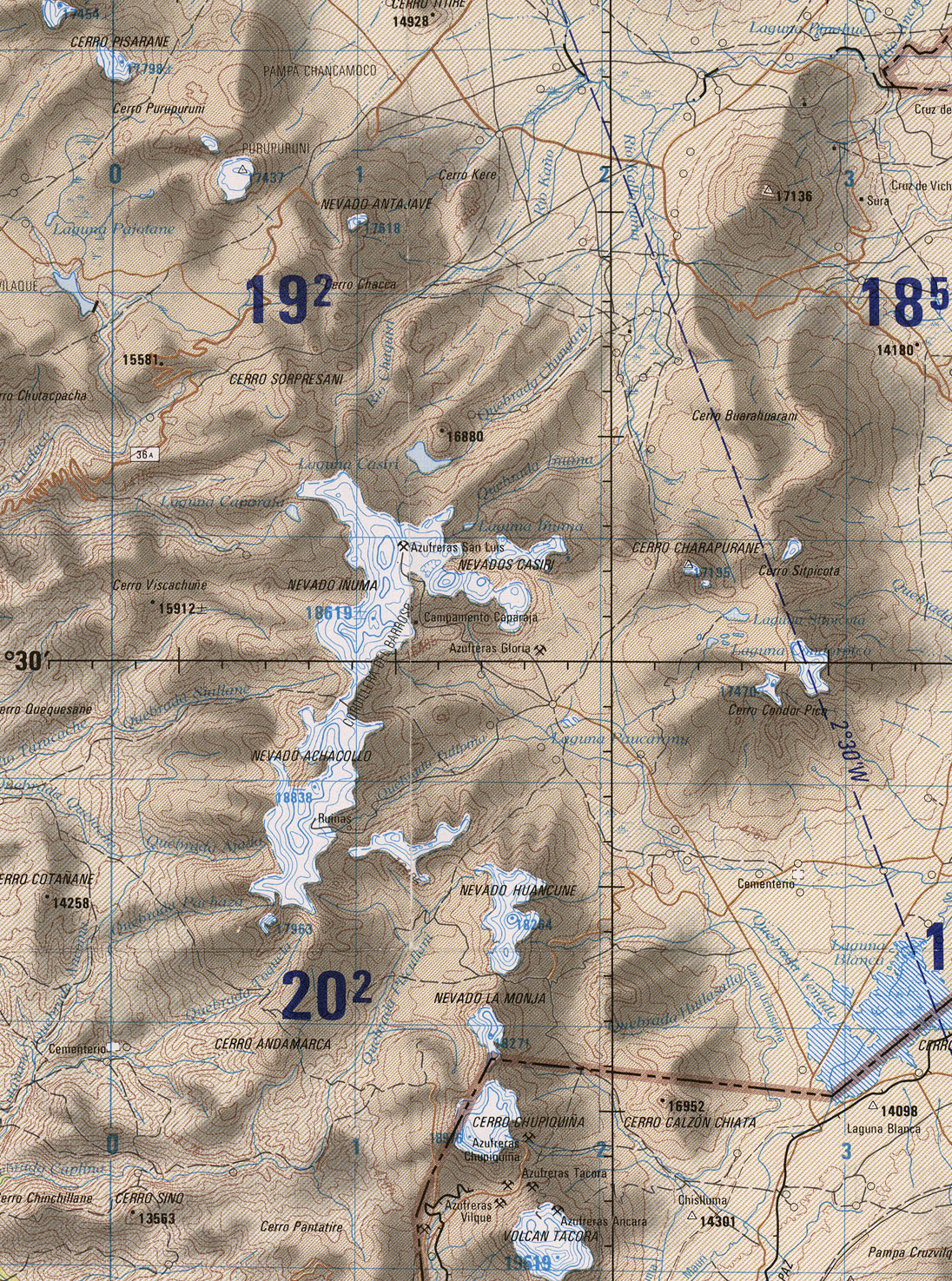
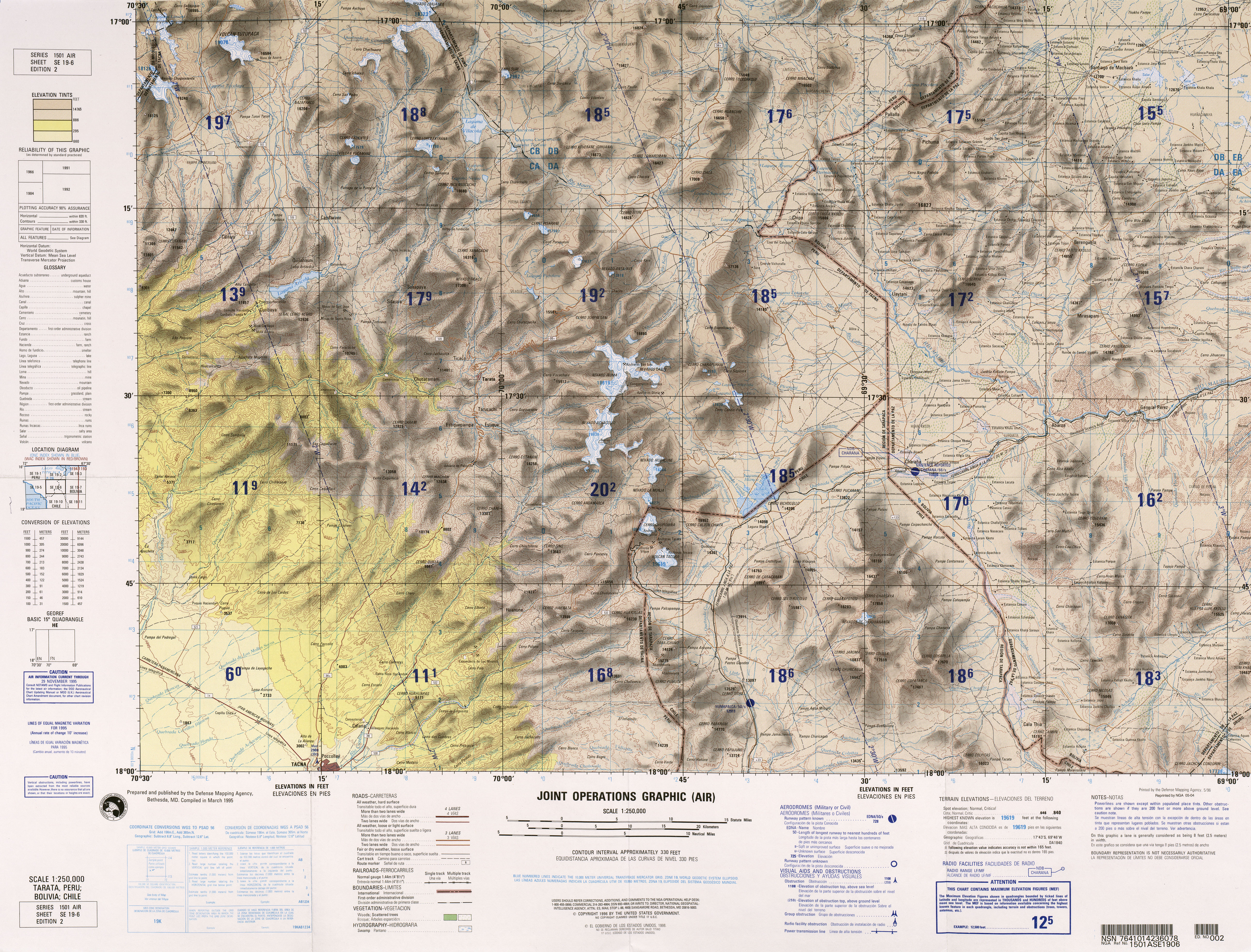
File:Txu-oclc-224300691-se19-6 (cropped on Casiri).jpg
Jump to navigation
Jump to search
Size of this preview: 445 × 599 pixels. Other resolutions: 178 × 240 pixels | 357 × 480 pixels | 571 × 768 pixels | 1,096 × 1,475 pixels.
Original file (1,096 × 1,475 pixels, file size: 1.42 MB, MIME type: image/jpeg)
Captions
Captions
Add a one-line explanation of what this file represents
Summary[edit]
| Description |
English: frontera Chile-Peru-Bolivia, Tacna |
|||
| Date | ||||
| Source | http://www.lib.utexas.edu/maps/jog/latin_america/txu-oclc-224300691-se19-6.jpg | |||
| Author | This work is in the public domain in the United States because it is a work of the United States Federal Government under the terms of 17 U.S.C. § 105. See Copyright. | |||
| Permission (Reusing this file) |
|
|||
| Other versions | Derivative works of this file: Río-cosapilla.png |


.jpg&action=edit§ion=1)
File history
Click on a date/time to view the file as it appeared at that time.
| Date/Time | Thumbnail | Dimensions | User | Comment | |
|---|---|---|---|---|---|
| current | 19:56, 28 May 2019 | | 1,096 × 1,475 (1.42 MB) | Jo-Jo Eumerus (talk | contribs) | File:Txu-oclc-224300691-se19-6.jpg cropped 79 % horizontally, 62 % vertically using CropTool with precise mode. |
You cannot overwrite this file.
File usage on Commons
The following 2 pages use this file:
File usage on other wikis
The following other wikis use this file:
- Usage on en.wikipedia.org
.jpg&oldid=837163676)