File:Typhoon Ketsana 2003.jpg
跳转到导航
跳转到搜索
本预览的尺寸:492 × 600像素。 其他分辨率:197 × 240像素 | 394 × 480像素 | 630 × 768像素 | 840 × 1,024像素 | 1,680 × 2,048像素 | 6,400 × 7,800像素。
原始文件 (6,400 × 7,800像素,文件大小:6.79 MB,MIME类型:image/jpeg)
说明
说明
添加一行文字以描述该文件所表现的内容
摘要
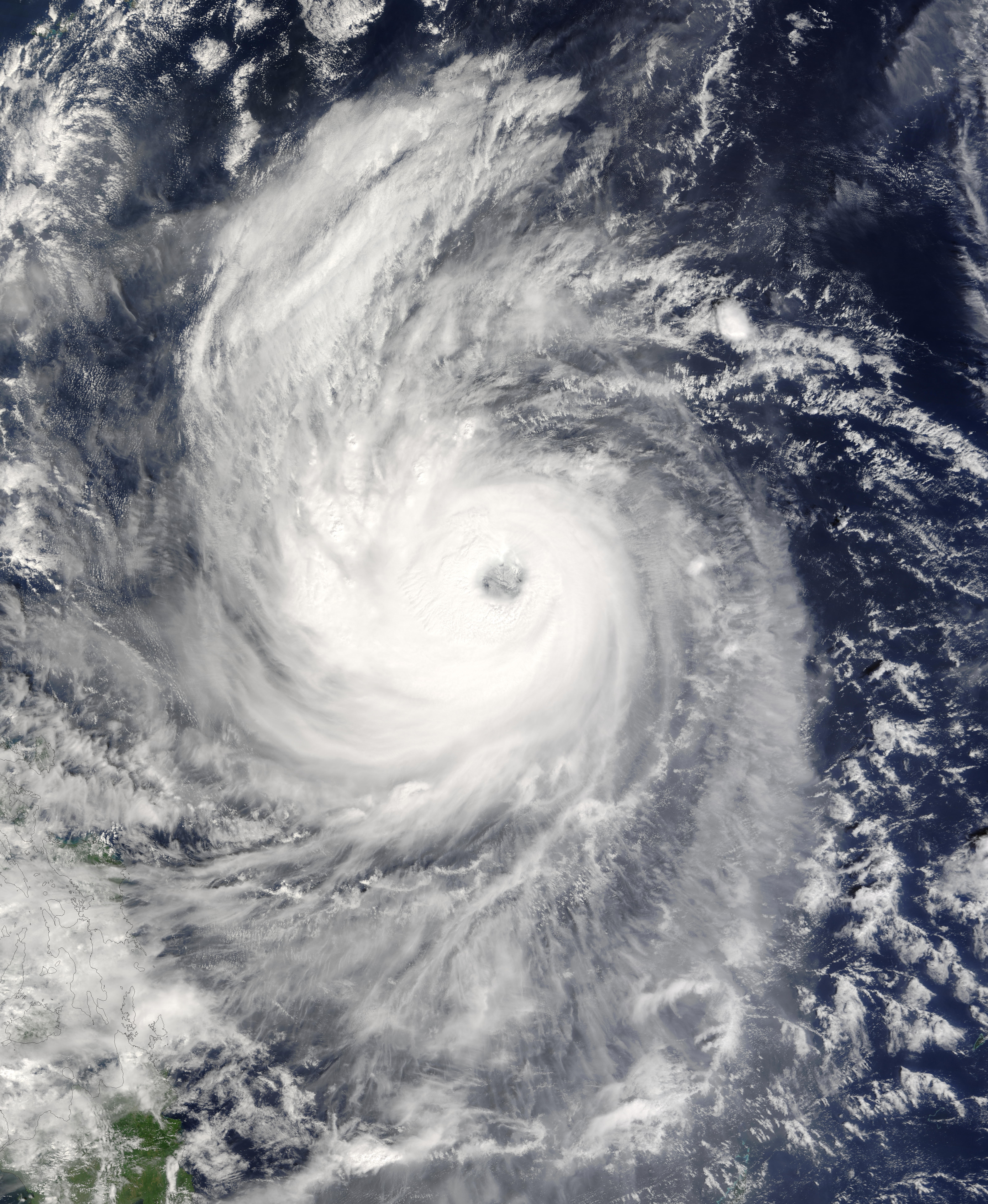
[编辑]| 描述 | Typhoon Ketsana spins north, northeast away from the Philippine Islands in this Moderate Resolution Imaging Spectroradiometer (MODIS) image captured by the Terra satellite on October 21, 2003, at 1:55 UTC. At the time this image was taken, the storm had sustained winds of 144 miles per hour with gusts to 173 miles per hour, the equivalent of a Category 4 hurricane on the Saffir-Simpson Hurricane Scale. | |||||
| 日期 | ||||||
| 来源 | http://visibleearth.nasa.gov/view_rec.php?id=5952 | |||||
| 作者 | Jeff Schmaltz, MODIS Rapid Response Team, NASA/GSFC | |||||
| 授权 (二次使用本文件) |
|

文件历史
点击某个日期/时间查看对应时刻的文件。
| 日期/时间 | 缩略图 | 大小 | 用户 | 备注 | |
|---|---|---|---|---|---|
| 当前 | 2006年9月4日 (一) 17:06 | | 6,400 × 7,800(6.79 MB) | Good kitty(留言 | 贡献) | == Summary == {{Information |Description=Typhoon Ketsana spins north, northeast away from the Philippine Islands in this Moderate Resolution Imaging Spectroradiometer (MODIS) image captured by the Terra satellite on October 21, 2003, at 1:55 UTC. At the t |
您不可以覆盖此文件。
文件用途
没有页面使用本文件。
全域文件用途
以下其他wiki使用此文件:
- en.wikipedia.org上的用途
- ja.wikipedia.org上的用途
- ko.wikipedia.org上的用途
- pt.wikipedia.org上的用途
- th.wikipedia.org上的用途
- vi.wikipedia.org上的用途
- zh.wikipedia.org上的用途