File:Typhoon Utor 13 dec 2006 0305Z.jpg
跳转到导航
跳转到搜索
本预览的尺寸:533 × 600像素。 其他分辨率:213 × 240像素 | 427 × 480像素 | 683 × 768像素 | 910 × 1,024像素 | 1,820 × 2,048像素 | 6,400 × 7,200像素。
原始文件 (6,400 × 7,200像素,文件大小:5 MB,MIME类型:image/jpeg)
说明
说明
添加一行文字以描述该文件所表现的内容
摘要
[编辑]| 描述 |
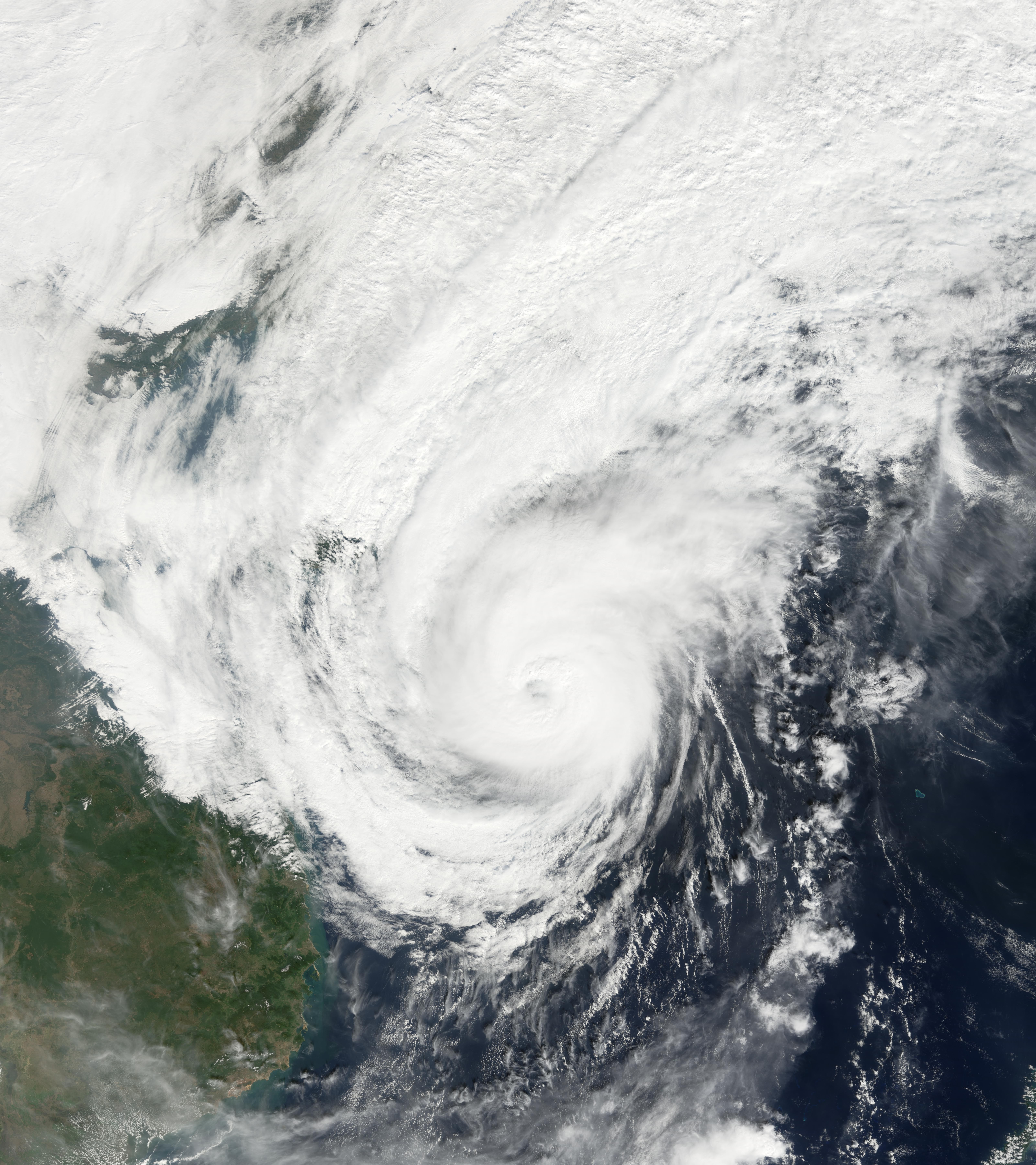
Typhoon Utor struck the Philippines on December 9, 2006. Coming just a week after Super Typhoon Durian passed through the island chain on a parallel path just to the north, Utor brought heavy rain and strong winds to sodden ground and swollen rivers. Xangsane, Cimaron, and Chebi earlier in the year had also followed very similar tracks to Utor. Like Durian before it, Utor then crossed the South China Sea and come ashore in mainland Asia along the Vietnam coast. This photo-like image was acquired by the Moderate Resolution Imaging Spectroradiometer (MODIS) on the Terra satellite on December 13, 2006, at 10:05 a.m. local time (3:05 UTC), while the storm’s center was still far off the Vietnamese shoreline. The storm system had the well-defined shape of a powerful typhoon, with a cloud-filled but quite distinct eye. Utor’s spiral cloud arms were bringing strong winds and rain over a wide area from southern China to Thailand and beyond, even with the typhoon’s center well offshore. Sustained winds were around 175 kilometers per hour (110 miles per hour), according to the University of Hawaii’s Tropical Storm Information Center. |
|||||
| 日期 | ||||||
| 来源 | http://earthobservatory.nasa.gov/NaturalHazards/natural_hazards_v2.php3?img_id=14030 | |||||
| 作者 | NASA image by Jesse Allen, Earth Observatory, using data provided courtesy of the MODIS Rapid Response Team, Goddard Space Flight Center. | |||||
| 授权 (二次使用本文件) |
|

文件历史
点击某个日期/时间查看对应时刻的文件。
| 日期/时间 | 缩略图 | 大小 | 用户 | 备注 | |
|---|---|---|---|---|---|
| 当前 | 2006年12月15日 (五) 16:19 | | 6,400 × 7,200(5 MB) | Good kitty(留言 | 贡献) | == Summary == {{Information |Description=Typhoon Utor struck the Philippines on December 9, 2006. Coming just a week after Super Typhoon Durian passed through the island chain on a parallel path just to the north, Utor brought heavy rain and strong winds |
您不可以覆盖此文件。
文件用途
以下页面使用本文件:
全域文件用途
以下其他wiki使用此文件:
- de.wikipedia.org上的用途
- en.wikipedia.org上的用途
- fr.wikipedia.org上的用途
- ja.wikipedia.org上的用途
- nl.wikipedia.org上的用途
- pt.wikipedia.org上的用途
- vi.wikipedia.org上的用途
- zh.wikipedia.org上的用途