File:USACE Tom Bevill Lock and Dam aerial view.jpg
Jump to navigation
Jump to search
Size of this preview: 800 × 533 pixels. Other resolutions: 320 × 213 pixels | 640 × 427 pixels | 1,024 × 683 pixels | 1,500 × 1,000 pixels.
Original file (1,500 × 1,000 pixels, file size: 994 KB, MIME type: image/jpeg)
Captions
Captions
Add a one-line explanation of what this file represents
| Description |
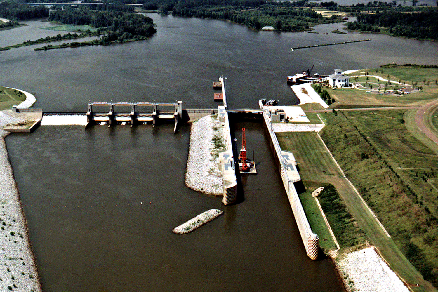
English: Aerial View of Tom Bevill Lock and Dam on the Tombigbee River near Pickensville in Pickens County, Alabama, USA. The lock and dam are a part of the Tennessee-Tombigbee Waterway, providing a navigation channel between the Tennessee River and the Tombigbee River. The dam impounds Aliceville Lake. View is upriver to the north-northwest.
Coordinates: 33°12′38.6″N 88°17′16.26″W / 33.210722°N 88.28785°W |
|||
| Location | Pickens County, Alabama, USA | |||
| Date | (Caveat: Dates provided by U.S. Army Corps of Engineers Digital Visual Library are not reliable and are often wrong.) | |||
| Source |
U.S. Army Corps of Engineers Digital Visual Library Image page Image description page Digital Visual Library home page |
|||
| Author | Adrien Lamarre, U.S. Army Corps of Engineers | |||
| Permission (Reusing this file) |
|
File history
Click on a date/time to view the file as it appeared at that time.
| Date/Time | Thumbnail | Dimensions | User | Comment | |
|---|---|---|---|---|---|
| current | 15:31, 28 April 2007 | | 1,500 × 1,000 (994 KB) | DanMS (talk | contribs) | {{Information | Description = {{en|Aerial View of Tom Bevill Lock and Dam on the Tombigbee River near Pickensville in Pickens County, Alabama, USA. The lock and dam are a part of the Tennessee-Tombigbee Waterway, providing a navigation channel between |
You cannot overwrite this file.
File usage on Commons
There are no pages that use this file.
File usage on other wikis
The following other wikis use this file:
- Usage on en.wikipedia.org