File:USA Maryland location map.svg

Fichier d’origine (Fichier SVG, nominalement de 1 200 × 764 pixels, taille : 452 kio)
Légendes
Légendes
Description[modifier]
| Description |
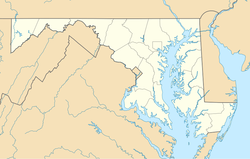
Quadratische Plattkarte, N-S-Streckung 130.0 %. Geographische Begrenzung der Karte:
Equirectangular projection, N/S stretching 130.0 %. Geographic limits of the map:
|
| Date | |
| Source | Travail personnel |
| Auteur | Alexrk2 |
| Autres versions |
Œuvres dérivées de ce fichier : Wawa footprint 2012-07.png Œuvres dérivées de ce fichier : |

|
Cette carte a été créée ou améliorée dans le Kartenwerkstatt (Atelier cartographique allemand). Vous pouvez également y proposer des cartes à améliorer.
|
Conditions d’utilisation[modifier]

|
Vous avez la permission de copier, distribuer et modifier ce document selon les termes de la GNU Free Documentation License version 1.2 ou toute version ultérieure publiée par la Free Software Foundation, sans sections inaltérables, sans texte de première page de couverture et sans texte de dernière page de couverture. Un exemplaire de la licence est inclus dans la section intitulée GNU Free Documentation License. |
- Vous êtes libre :
- de partager – de copier, distribuer et transmettre cette œuvre
- d’adapter – de modifier cette œuvre
- Sous les conditions suivantes :
- paternité – Vous devez donner les informations appropriées concernant l'auteur, fournir un lien vers la licence et indiquer si des modifications ont été faites. Vous pouvez faire cela par tout moyen raisonnable, mais en aucune façon suggérant que l’auteur vous soutient ou approuve l’utilisation que vous en faites.
Historique du fichier
Cliquer sur une date et heure pour voir le fichier tel qu'il était à ce moment-là.
| Date et heure | Vignette | Dimensions | Utilisateur | Commentaire | |
|---|---|---|---|---|---|
| actuel | 22 juin 2009 à 11:30 | | 1 200 × 764 (452 kio) | Alexrk2 (d | contributions) | fixed border |
| 22 juin 2009 à 11:23 |  | 1 200 × 764 (449 kio) | Alexrk2 (d | contributions) | crop height | |
| 22 juin 2009 à 11:03 |  | 1 201 × 955 (445 kio) | Alexrk2 (d | contributions) | renderer bug | |
| 22 juin 2009 à 10:42 |  | 800 × 636 (311 kio) | Alexrk2 (d | contributions) | == Beschreibung == {{Information |Description= {{de|Positionskarte von Maryland, USA}} Quadratische Plattkarte, N-S-Streckung 130.0 %. Geographische Begrenzung der Karte: * N: 40.3° N * S: 37.3° N * W: 79.7° W * O: 74.8° W |
Vous ne pouvez pas remplacer ce fichier.
Utilisations locales du fichier
Plus de 100 pages utilisent ce fichier. La liste suivante affiche seulement les 100 premières pages qui utilisent ce fichier. Une liste complète est disponible.
- Maryland
- Category:1872 in Maryland
- Category:1873 in Maryland
- Category:1880 in Maryland
- Category:1884 in Maryland
- Category:1889 in Maryland
- Category:1896 in Maryland
- Category:1897 in Maryland
- Category:1899 in Maryland
- Category:1926 in Maryland
- Category:1938 in Maryland
- Category:Airports in Maryland
- Category:Archaeological sites in Maryland
- Category:Architecture of Maryland
- Category:Art Deco architecture in Maryland
- Category:Baseball venues in Maryland
- Category:Basketball venues in Maryland
- Category:Bays of Maryland
- Category:Beaches of Maryland
- Category:Bikeways in Maryland
- Category:Bodies of water in Maryland
- Category:Bridges in Maryland
- Category:Canals in Maryland
- Category:Caves of Maryland
- Category:Cemeteries in Maryland
- Category:Churches in Maryland
- Category:Cities in Maryland
- Category:Courthouses in Maryland
- Category:Cycling in Maryland
- Category:Demographics of Maryland
- Category:Education in Maryland
- Category:Energy in Maryland
- Category:Events in Maryland
- Category:Federal architecture in Maryland
- Category:Fire stations in Maryland
- Category:Flora of Maryland
- Category:Gardens in Maryland
- Category:Government buildings in Maryland
- Category:Higher education institutions in Maryland
- Category:Historic districts in Maryland
- Category:Hospitals in Maryland
- Category:Hotels in Maryland
- Category:Houses in Maryland
- Category:Islands of Maryland
- Category:Lakes of Maryland
- Category:Libraries in Maryland
- Category:Lighthouses in Maryland
- Category:Maps of Maryland
- Category:Maryland
- Category:Maryland by decade
- Category:Maryland in the 1800s
- Category:Maryland in the 1810s
- Category:Maryland in the 1820s
- Category:Maryland in the 1830s
- Category:Maryland in the 1840s
- Category:Maryland in the 1850s
- Category:Maryland in the 1860s
- Category:Maryland in the 1870s
- Category:Maryland in the 1880s
- Category:Maryland in the 1890s
- Category:Maryland in the 1900s
- Category:Maryland in the 1910s
- Category:Maryland in the 1920s
- Category:Maryland in the 1930s
- Category:Maryland in the 1940s
- Category:Maryland in the 1950s
- Category:Maryland in the 1960s
- Category:Maryland in the 1970s
- Category:Maryland in the 1980s
- Category:Maryland in the 1990s
- Category:Maryland in the 19th century
- Category:Maryland in the 2000s
- Category:Maryland in the 20th century
- Category:Maryland in the 21st century
- Category:Mountains of Maryland
- Category:Museums in Maryland
- Category:National Historic Landmarks in Maryland
- Category:National Register of Historic Places in Maryland
- Category:National Wildlife Refuges in Maryland
- Category:Nuclear power plants in Maryland
- Category:Parks in Maryland
- Category:Plantations in Maryland
- Category:Politicians of Maryland
- Category:Protected areas of Maryland
- Category:Queen Anne architecture in Maryland
- Category:Rail transport in Maryland
- Category:Railway bridges in Maryland
- Category:Religion in Maryland
- Category:Reservoirs in Maryland
- Category:Rivers of Maryland
- Category:Roads in Maryland
- Category:Schools in Maryland
- Category:Sports venues in Maryland
- Category:Streets in Maryland
- Category:Symbols of Maryland
- Category:Theaters in Maryland
- Category:Towers in Maryland
- Category:Transport in Maryland
- Category:Tunnels in Maryland
- Category:U.S. Highways in Maryland
Voir plus de liens vers ce fichier.
Utilisations du fichier sur d’autres wikis
Les autres wikis suivants utilisent ce fichier :
- Utilisation sur af.wikipedia.org
- Utilisation sur als.wikipedia.org
- Utilisation sur an.wikipedia.org
- Utilisation sur ar.wikipedia.org
- Utilisation sur azb.wikipedia.org
- الیوت، مریلند
- لایهیل، مریلند
- ویتون، مریلند
- نشنال، مریلند
- تیلقمنتون، مریلند
- اوشن، مریلند
- بقتاون، مریلند
- بیکرزویل، مریلند
- دیویدسونویل، مریلند
- قرانیت، مریلند
- باتلر، مریلند
- ارلویل، مریلند
- آوندیل، مریلند
- مکهنری، مریلند
- اسپاروز پوینت، مریلند
- بالدوین، مریلند
- فرلند، مریلند
- قلنکو، مریلند
- فیرهیل، مریلند
- ونسویل، مریلند
- فیقاویل، مریلند
- چرچتون، مریلند
- هنریتون، مریلند
- ساویج، مریلند
- وتیپکوئین، مریلند
- هانت ولی، مریلند
- وست فرندشیپ، مریلند
- دیتون، مریلند
- بازمن، مریلند
- مونپلیه مریلند
- لیسبون، مریلند
- قریسهام، مریلند
- برتدزویل، مریلند
- اجمانت، مریلیند
- بارتونزویل، مریلند
- میلرزویل، مریلند
- جسترویل، مریلند
- لانقبیج، مریلند
- ترقو- راهرسویل استیشن، مریلند
Voir davantage sur l’utilisation globale de ce fichier.