File:USA Texas location map.svg
跳转到导航
跳转到搜索

此SVG文件的PNG预览的大小:606 × 600像素。 其他分辨率:243 × 240像素 | 485 × 480像素 | 776 × 768像素 | 1,035 × 1,024像素 | 2,070 × 2,048像素 | 1,500 × 1,484像素。
原始文件 (SVG文件,尺寸为1,500 × 1,484像素,文件大小:695 KB)
说明
说明
添加一行文字以描述该文件所表现的内容
摘要
[编辑]
| 描述 |
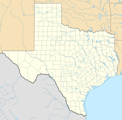
Quadratische Plattkarte, N-S-Streckung 120 %. Geographische Begrenzung der Karte:
Equirectangular projection, N/S stretching 120 %. Geographic limits of the map:
本图片使用GeoTools创作. |
| 日期 | |
| 来源 | 自己的作品 |
| 作者 | Alexrk |
| 其他版本 |
Derivative works of this file: |

|
|
许可协议
[编辑]
我,本作品著作权人,特此采用以下许可协议发表本作品:

|
已授权您依据自由软件基金会发行的无固定段落及封面封底文字(Invariant Sections, Front-Cover Texts, and Back-Cover Texts)的GNU自由文件许可协议1.2版或任意后续版本的条款,复制、传播和/或修改本文件。该协议的副本请见“GNU Free Documentation License”。 |
本文件采用知识共享署名 3.0 未本地化版本许可协议授权。
- 您可以自由地:
- 共享 – 复制、发行并传播本作品
- 修改 – 改编作品
- 惟须遵守下列条件:
- 署名 – 您必须对作品进行署名,提供授权条款的链接,并说明是否对原始内容进行了更改。您可以用任何合理的方式来署名,但不得以任何方式表明许可人认可您或您的使用。
您可以选择您需要的许可协议。
文件历史
点击某个日期/时间查看对应时刻的文件。
| 日期/时间 | 缩略图 | 大小 | 用户 | 备注 | |
|---|---|---|---|---|---|
| 当前 | 2009年6月17日 (三) 20:30 | | 1,500 × 1,484(695 KB) | Alexrk2(留言 | 贡献) | enh |
| 2009年6月7日 (日) 13:05 |  | 1,500 × 1,484(558 KB) | Alexrk(留言 | 贡献) | water bodies 1:10mio | |
| 2009年6月6日 (六) 21:43 |  | 1,500 × 1,484(850 KB) | Alexrk(留言 | 贡献) | GeneralizationDistance = 2px | |
| 2009年6月6日 (六) 17:41 |  | 1,500 × 1,485(1.48 MB) | Alexrk(留言 | 贡献) | == Beschreibung == {{Information |Description= {{de|Positionskarte von Texas, USA}} Quadratische Plattkarte, N-S-Streckung 120 %. Geographische Begrenzung der Karte: * N: 36.8° N * S: 25.5° N * W: 106.9° W * O: 93.2° W {{en|L |
您不可以覆盖此文件。
文件用途
以下19个页面使用本文件:
- File:Checkers and Rally's footprint.png
- File:Citgo locations 2020 September.png
- File:Costco footprint map USA 2021-01.png
- File:Dollar Tree footprint map 2020-12.png
- File:Family Dollar footprint map 2020-12.png
- File:Kum&GoFootprint July2020.png
- File:QuikTrip Footprint 2020 October.png
- File:RaceTrac+RaceWay footprint 2020-01.png
- File:RaceTrac US footprint.png
- File:RaceWay US footprint.png
- File:Rooms To Go footprint map 2021-01.png
- File:Save-A-Lot footprint map.png
- File:Speedway Footprint 2020 August.png
- File:Speedway Jun2018 to Aug2020 comparison.png
- File:Target stores footprint 2020-12.png
- File:Texas proposed boundaries.svg
- File:Valero brands branded gas stations 2020-12.png
- File:Walmart branded fuel stations map 2020-12.png
- File:Walmart locations with on-site fuel stations map 2020-20.png
全域文件用途
以下其他wiki使用此文件:
- af.wikipedia.org上的用途
- als.wikipedia.org上的用途
- an.wikipedia.org上的用途
- ar.wikipedia.org上的用途
- ast.wikipedia.org上的用途
- azb.wikipedia.org上的用途
- سایپرس، تکزاس
- ونکورت، تکزاس
- شابلون:Location map Texas
- لوپ، تکزاس
- اوریسن، تکزاس
- لاس پالماس ۲، تکزاس
- قلیدن، تکزاس
- آنیون کریک، آستین، تکزاس
- کوپلند، تکزاس
- ساوانا، تکزاس
- آرویو قاردنز-لاتینا رنچ، تکزاس
- تییرا بونتیا، تکزاس
- لیک مردیت استیتس، تکزاس
- منچاکا، تکزاس
- باوزل اند الیس، تکزاس
- وست پیرسال، تکزاس
- بونانزا هیلز، تکزاس
- تاندربیرد بی، تکزاس
- لاس پالماس، تکزاس
- آریو آلتو، تکزاس
- پینت کریت، تکزاس
- مونتاژ، تکزاس
- پالوما کریک ساوت، تکزاس
- کولورادو ایکرز، تکزاس
- امارقوسا، تکزاس
- لینکلن، تکزاس
- نورتکلیف، تکزاس
查看此文件的更多全域用途。