File:USA Virginia location map.svg
ナビゲーションに移動
検索に移動

この SVG ファイルのこの PNG プレビューのサイズ: 800 × 514 ピクセル. その他の解像度: 320 × 206 ピクセル | 640 × 411 ピクセル | 1,024 × 658 ピクセル | 1,280 × 823 ピクセル | 2,560 × 1,645 ピクセル | 1,500 × 964 ピクセル。
元のファイル (SVG ファイル、1,500 × 964 ピクセル、ファイルサイズ: 941キロバイト)
キャプション
キャプション
このファイルの内容を1行で記述してください
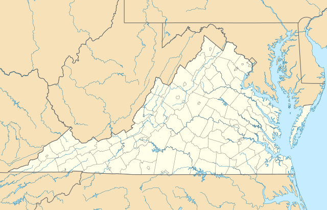
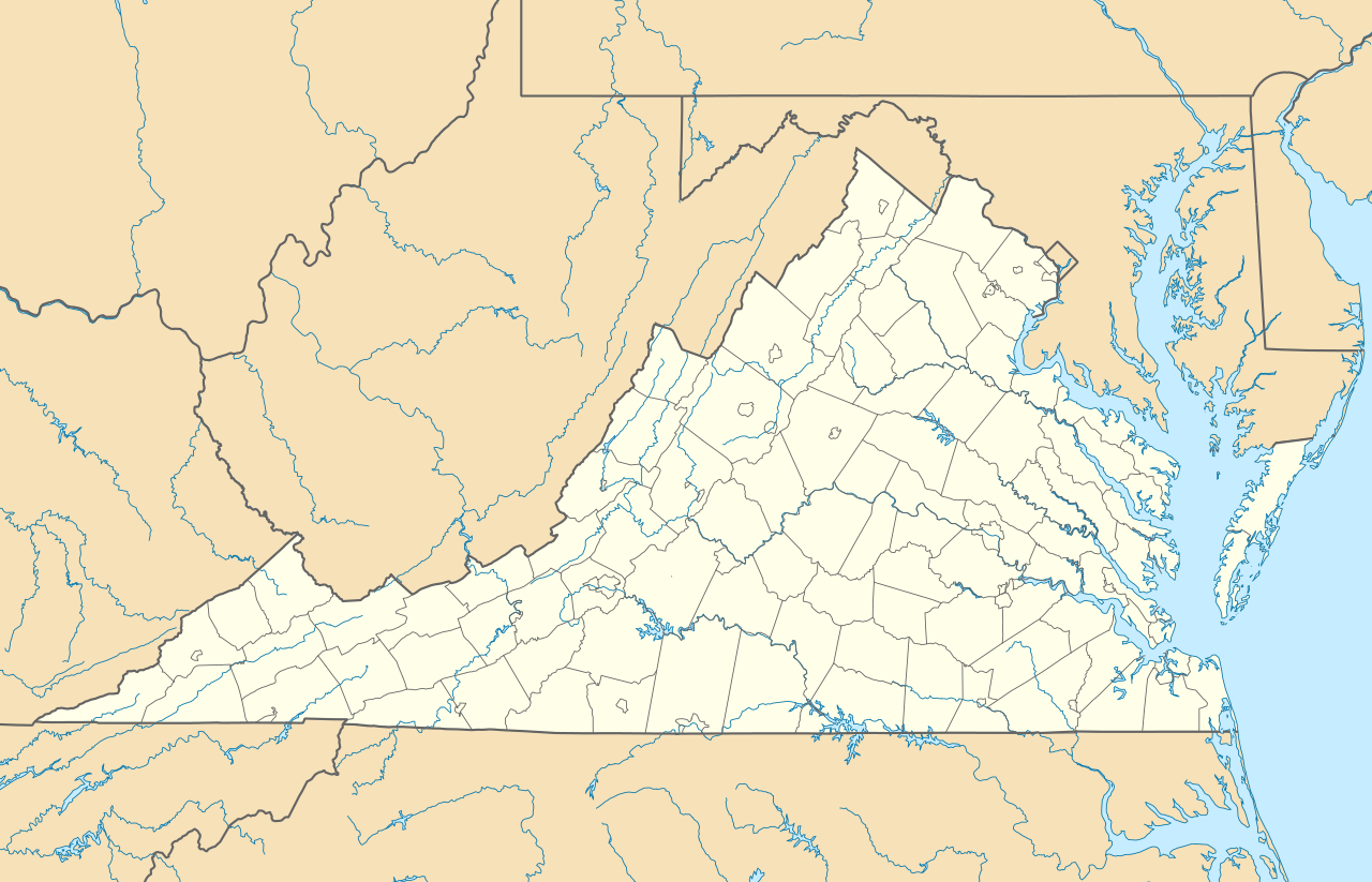
Location map of the state of Virginia.
概要
[編集]| 解説 |
Quadratische Plattkarte, N-S-Streckung 130.0 %. Geographische Begrenzung der Karte:
Equirectangular projection, N/S stretching 130.0 %. Geographic limits of the map:
|
| 日付 | |
| 原典 | 投稿者自身による著作物 |
| 作者 | Alexrk2 |
| その他のバージョン |
このファイルの派生的著作物: Wawa footprint 2012-07.png このファイルの派生的著作物: |
| SVG 開発 |

ライセンス
[編集]
この作品の著作権者である私は、この作品を以下のライセンスで提供します。

|
この文書は、フリーソフトウェア財団発行のGNUフリー文書利用許諾書 (GNU Free Documentation License) 1.2またはそれ以降のバージョンの規約に基づき、複製や再配布、改変が許可されます。不可変更部分、表紙、背表紙はありません。このライセンスの複製は、GNUフリー文書利用許諾書という章に含まれています。 |
このファイルはクリエイティブ・コモンズ 表示 3.0 非移植ライセンスのもとに利用を許諾されています。
- あなたは以下の条件に従う場合に限り、自由に
- 共有 – 本作品を複製、頒布、展示、実演できます。
- 再構成 – 二次的著作物を作成できます。
- あなたの従うべき条件は以下の通りです。
- 表示 – あなたは適切なクレジットを表示し、ライセンスへのリンクを提供し、変更があったらその旨を示さなければなりません。これらは合理的であればどのような方法で行っても構いませんが、許諾者があなたやあなたの利用行為を支持していると示唆するような方法は除きます。
あなたは上記のライセンスから、どれか一つ以上を選択できます。
ファイルの履歴
過去の版のファイルを表示するには、その版の日時をクリックしてください。
| 日付と時刻 | サムネイル | 寸法 | 利用者 | コメント | |
|---|---|---|---|---|---|
| 現在の版 | 2017年1月1日 (日) 14:20 | | 1,500 × 964 (941キロバイト) | Maproom (トーク | 投稿記録) | Removed Bedford, as no longer a city. Edit requested at https://en.wikipedia.org/wiki/Wikipedia:Graphics_Lab/Map_workshop#Remove_a_no-longer-extant_city |
| 2009年7月6日 (月) 18:02 |  | 1,500 × 964 (941キロバイト) | Alexrk2 (トーク | 投稿記録) | resize | |
| 2009年6月26日 (金) 16:42 |  | 1,201 × 772 (944キロバイト) | Alexrk2 (トーク | 投稿記録) | == Beschreibung == {{Information |Description= {{de|Positionskarte von Virginia, USA}} Quadratische Plattkarte, N-S-Streckung 130.0 %. Geographische Begrenzung der Karte: * N: 40.2° N * S: 35.8° N * W: 83.9° W * O: 75.0° W |
このファイルは上書きできません。
ファイルの使用状況
以下の 34 ページがこのファイルを使用しています:
- File:BJ's Gas Station locations 2020 December.png
- File:BJ's store locations.png
- File:BJ's store locations 2020 December.png
- File:Checkers and Rally's footprint.png
- File:Citgo locations 2020 September.png
- File:Convenience stores of Mid-Atlantic.png
- File:Costco footprint map USA 2021-01.png
- File:Dollar Tree footprint map 2020-12.png
- File:Family Dollar footprint map 2020-12.png
- File:GetGo20-01.png
- File:Harris Teeter footprint 2020-12.png
- File:Harris Teeter footprint 2020-12 fuel.png
- File:M&T Bank footprint.png
- File:Publix footprint 2020 November.png
- File:QuikTrip Footprint 2020 October.png
- File:RaceTrac+RaceWay footprint 2020-01.png
- File:RaceTrac US footprint.png
- File:RaceWay US footprint.png
- File:Rooms To Go footprint map 2021-01.png
- File:Royal Farms stores footprint map.png
- File:Save-A-Lot footprint map.png
- File:Somerset Trust footprint 2020-12.png
- File:Speedway Footprint 2020 August.png
- File:Speedway Jun2018 to Aug2020 comparison.png
- File:Target stores footprint 2020-12.png
- File:USA Virginia relief location map.svg
- File:Valero brands branded gas stations 2020-12.png
- File:Walmart branded fuel stations map 2020-12.png
- File:Walmart locations with on-site fuel stations map 2020-20.png
- File:Wawa footprint 2012-07.png
- File:Wawa footprint 2019-10.png
- File:Wawa footprint 2019-12.png
- File:Wawa footprint 2019-12 (fuel locations).png
- File:Wawa footprint 2019-12 (non-fuel locations).png
.png)
.png)
グローバルなファイル使用状況
以下に挙げる他のウィキがこの画像を使っています:
- an.wikipedia.org での使用状況
- ar.wikipedia.org での使用状況
- ast.wikipedia.org での使用状況
- azb.wikipedia.org での使用状況
- بیرینجی آوبرن دؤیوشو
- برمو بلاف، ویرجینیا
- کروزت، ویرجینیا
- ویندام، ویرجینیا
- لیمنتاون، ویرجینیا
- لیک کارولینا، ویرجینیا
- کارزویل، ویرجینیا
- ویلا هایتس، ویرجینیا
- کلوردیل، ویرجینیا
- ماسانتا اسپرینقز، ویرجینیا
- مکمولین، ویرجینیا
- تمپلتون، ویرجینیا
- بلند، ویرجینیا
- ناتالی، ویرجینیا
- الیستون-لافایت، ویرجینیا
- مریماک، ویرجینیا
- اسپری ویل، ویرجینیا
- کتاوبا، ویرجینیا
- پنتاپس، ویرجینیا
- بردشا، ویرجینیا
- اسکایلر، ویرجینیا
- الیستون، ویرجینیا
- چارلز سیتی، ویرجینیا
- هنری فورک، ویرجینیا
- تویین لیک، ویرجینیا
- یوقاویل، ویرجینیا
- دینویدی، ویرجینیا
- مدیلبروک، ویرجینیا
- اسکاتلند، ویرجینیا
- بریسی، ویرجینیا
- تاینادیل، ویرجینیا
- ماساناتن، ویرجینیا
- چرچویل، ویرجینیا
- فری یونیون، ویرجینیا
- کلوور، ویرجینیا
- دانته، ویرجینیا
- یونیون لول، ویرجینیا
- شاونی لند، ویرجینیا
- میدوبروک، ویرجینیا
- دیلویل، ویرجینیا
- ریون، ویرجینیا
- کاپرهیل، ویرجینیا
- سندی لول، ویرجینیا
- پنهوک، ویرجینیا
このファイルのグローバル使用状況を表示する。