File:US 101.svg
跳至導覽
跳至搜尋

此 SVG 檔案的 PNG 預覽的大小:750 × 600 像素。 其他解析度:300 × 240 像素 | 600 × 480 像素 | 960 × 768 像素 | 1,280 × 1,024 像素 | 2,560 × 2,048 像素。
原始檔案 (SVG 檔案,表面大小:750 × 600 像素,檔案大小:4 KB)
說明
說明
添加單行說明來描述出檔案所代表的內容
摘要
[編輯]
| 描述 |
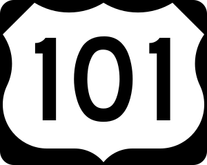
English: 750 mm × 600 mm (30 in × 24 in) U.S. Highway shield, made to the specifications of the 2004 edition of Standard Highway Signs. (Note that there is a missing "J" label on the left side of the diagram.) Uses the Roadgeek 2005 fonts. (United States law does not permit the copyrighting of typeface designs, and the fonts are meant to be copies of a U.S. Government-produced work anyway.) |
| 日期 | (UTC) |
| 來源 | 2004 MUTCD Standard Highway Signs |
| 作者 | Fredddie, originally SPUI |
授權條款
[編輯]
This file is in the public domain because it comes from the Manual on Uniform Traffic Control Devices, sign number M1-4, which states specifically on page I-1 that:
|
.svg) |
檔案歷史
點選日期/時間以檢視該時間的檔案版本。
| 日期/時間 | 縮圖 | 尺寸 | 使用者 | 備註 | |
|---|---|---|---|---|---|
| 目前 | 2017年8月26日 (六) 01:18 | | 750 × 600(4 KB) | Fredddie(留言 | 貢獻) | |
| 2006年5月31日 (三) 15:41 |  | 750 × 600(4 KB) | SPUI~commonswiki(留言 | 貢獻) | wider numbers | |
| 2006年1月27日 (五) 07:43 |  | 750 × 600(3 KB) | SPUI~commonswiki(留言 | 貢獻) | {{spuiother}} 750 mm by 600 mm (30 in by 24 in) U.S. Route shield, made to the specifications of the [http://mutcd.fhwa.dot.gov/SHSm/Guide.pdf 2004 edition of Standard Highway Signs]. (Note that there is a missing "J" label on the left side of the diagram |
無法覆蓋此檔案。
檔案用途
下列9個頁面有用到此檔案:
全域檔案使用狀況
以下其他 wiki 使用了這個檔案:
- bn.wikipedia.org 的使用狀況
- da.wikipedia.org 的使用狀況
- de.wikipedia.org 的使用狀況
- San Francisco International Airport
- U.S. Highway 101
- Liste der United States Highways
- Arcata-Eureka Airport
- Benutzer Diskussion:Daniel73480/Archiv
- Wilson River Bridge No. 01499
- Benutzer:Daniel73480/Baustelle/US 30
- Hollywood Split
- Interstate 380 (Kalifornien)
- Washington State Route 106
- Flughafen San José
- Yaquina Bay Bridge
- Washington State Route 113
- Washington State Route 8
- Astoria Bridge
- Rogue River Bridge
- Liste der Brücken, Fähren, Staustufen und Seilbahnen über den Columbia River
- Depoe Bay Bridge
- Cape Creek Bridge
- Universal CityWalk
- U.S. Highway 26
- Liste der größten Trestle-Brücken
- de.wikivoyage.org 的使用狀況
- en.wikipedia.org 的使用狀況
- U.S. Route 101
- Interstate 5
- Interstate 80
- Interstate 10
- Thurston County, Washington
- Pacific County, Washington
- Mason County, Washington
- Grays Harbor County, Washington
- Clallam County, Washington
- Clatsop County, Oregon
- List of United States Numbered Highways
- U.S. Route 12
- U.S. Route 30
- U.S. Route 26
- U.S. Route 20
- U.S. Route 99
- Clatsop Plains
- Washington State Route 104
- U.S. Route 163
- Astoria–Megler Bridge
檢視此檔案的更多全域使用狀況。