File:US 50 (1961 cutout).svg
跳至導覽
跳至搜尋

此 SVG 檔案的 PNG 預覽的大小:384 × 384 像素。 其他解析度:240 × 240 像素 | 480 × 480 像素 | 768 × 768 像素 | 1,024 × 1,024 像素 | 2,048 × 2,048 像素。
原始檔案 (SVG 檔案,表面大小:384 × 384 像素,檔案大小:8 KB)
說明
說明
添加單行說明來描述出檔案所代表的內容
This file is in the public domain because it comes from the California Manual on Uniform Traffic Control Devices, sign number G26-2 (CA), which states specifically in its introduction, on page 44 that:
|
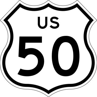
24 in by 24 in (610 mm by 610 mm) California-style U.S. Route shield, made to the specifications of the 2002 edition of Standard Highway Signs with 10 in (250 mm) numerals. Uses the Roadgeek fonts archive copy at the Wayback Machine. (United States law does not permit the copyrighting of typeface designs, and the fonts are meant to be copies of a U.S. Government-produced work anyway.)
.svg)
SVG開發
本向量圖形使用Adobe Illustrator創作。
檔案歷史
點選日期/時間以檢視該時間的檔案版本。
| 日期/時間 | 縮圖 | 尺寸 | 使用者 | 備註 | |
|---|---|---|---|---|---|
| 目前 | 2017年4月1日 (六) 06:03 | | 384 × 384(8 KB) | Rschen7754(留言 | 貢獻) | why? |
| 2017年4月1日 (六) 05:58 |  | 384 × 384(8 KB) | Blanding Cassatt(留言 | 貢獻) | Reverted to version as of 11:50, 28 January 2006 (UTC) | |
| 2006年7月3日 (一) 09:22 |  | 384 × 384(8 KB) | Scott5114(留言 | 貢獻) | Fix border | |
| 2006年1月28日 (六) 11:50 |  | 384 × 384(8 KB) | SPUI~commonswiki(留言 | 貢獻) | {{spuiother}} 24 in by 24 in (610 mm by 610 mm) California-style U.S. Route shield, made to the specifications of the [http://www.dot.ca.gov/hq/traffops/signtech/signdel/specs/G26-2.pdf 2002 edition of Standard Highway Signs] with 10 in (250 mm) numerals. |
無法覆蓋此檔案。
檔案用途
下列9個頁面有用到此檔案:
.svg&redirect=no)
全域檔案使用狀況
以下其他 wiki 使用了這個檔案:
- ar.wikipedia.org 的使用狀況
- bn.wikipedia.org 的使用狀況
- da.wikipedia.org 的使用狀況
- de.wikipedia.org 的使用狀況
- de.wikivoyage.org 的使用狀況
- en.wikipedia.org 的使用狀況
- Sacramento County, California
- Yolo County, California
- El Dorado County, California
- Northern California
- Interstate 880 (California)
- U.S. Route 285
- U.S. Route 50
- U.S. Route 160
- U.S. Route 350
- U.S. Route 99
- California State Route 99
- U.S. Route 150
- U.S. Route 250
- U.S. Route 550
- California State Route 84
- California State Route 49
- Eastern California
- California State Route 16
- Interstate 80 Business (Sacramento, California)
- Wikipedia:WikiProject U.S. Roads/Redirects/California
- California State Route 89
- Interstate 80 in California
- Sierra Highway
- U.S. Route 50 in Nevada
- U.S. Route 50 in California
- Tower Bridge (Sacramento, California)
- Transportation in California
- User:Happy5214
- User:Happy5214/Userboxes
- Interstate 5 in California
- Folsom Boulevard
- List of state highways in California (pre-1964)
- Sacramento metropolitan area
- U.S. Route 99 in California
- List of crossings of the Sacramento River
- Echo Summit
檢視此檔案的更多全域使用狀況。
.svg)
.svg&oldid=803485562)