File:US Geo survey hurricane jose 2017.jpg
跳至導覽
跳至搜尋

預覽大小:800 × 464 像素。 其他解析度:320 × 186 像素 | 640 × 371 像素 | 1,024 × 594 像素 | 1,280 × 743 像素 | 2,048 × 1,188 像素。
原始檔案 (2,048 × 1,188 像素,檔案大小:224 KB,MIME 類型:image/jpeg)
說明
說明
添加單行說明來描述出檔案所代表的內容
摘要
[編輯]
| 描述 |
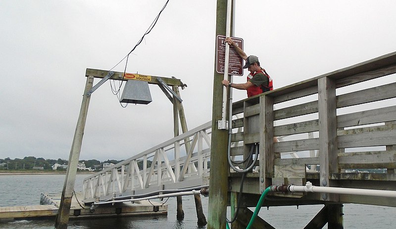
English: In response to Hurricane Jose, U.S. Geological Survey specialists across three states installed 17 storm-tide sensors – seven in Connecticut, seven in Massachusetts and three in Rhode Island – along shorelines likely to receive some large waves and storm surge from the storm.
These scientific instruments were put in place ahead of Jose to collect information about the hurricane’s effects on the coast. The retrieval of the sensors and the valuable data they hold will begin once Jose has passed. To learn where the storm-tide sensors were deployed for Jose, visit the USGS Hurricane Jose Flood Event Viewer. The U.S. Geological Survey use many forms of technology to track and document the effects of hurricanes along the Gulf and Atlantic coasts. |
| 日期 | |
| 來源 | https://www.facebook.com/USGeologicalSurvey/photos/a.169734339739224.34845.102635589782433/1544019712310673/?type=3&theater |
| 作者 | US Geological Survey |
授權條款
[編輯]
|
|
檔案歷史
點選日期/時間以檢視該時間的檔案版本。
| 日期/時間 | 縮圖 | 尺寸 | 用戶 | 備註 | |
|---|---|---|---|---|---|
| 目前 | 2017年9月19日 (二) 23:46 | | 2,048 × 1,188(224 KB) | Victorgrigas(對話 | 貢獻) | User created page with UploadWizard |
無法覆蓋此檔案。
檔案用途
沒有使用此檔案的頁面。
全域檔案使用狀況
以下其他 wiki 使用了這個檔案:
- en.wikipedia.org 的使用狀況
- es.wikipedia.org 的使用狀況
- zh.wikipedia.org 的使用狀況