File:US Navy 071120-M-8966H-005 An aerial view over southern Bangladesh reveals extensive flooding as a result of Cyclone Sidr.jpg
跳转到导航
跳转到搜索

本预览的尺寸:800 × 533像素。 其他分辨率:320 × 213像素 | 640 × 427像素 | 1,024 × 683像素 | 1,280 × 853像素 | 2,560 × 1,707像素 | 3,072 × 2,048像素。
原始文件 (3,072 × 2,048像素,文件大小:807 KB,MIME类型:image/jpeg)
说明
说明
添加一行文字以描述该文件所表现的内容
摘要
[编辑]| 描述 |
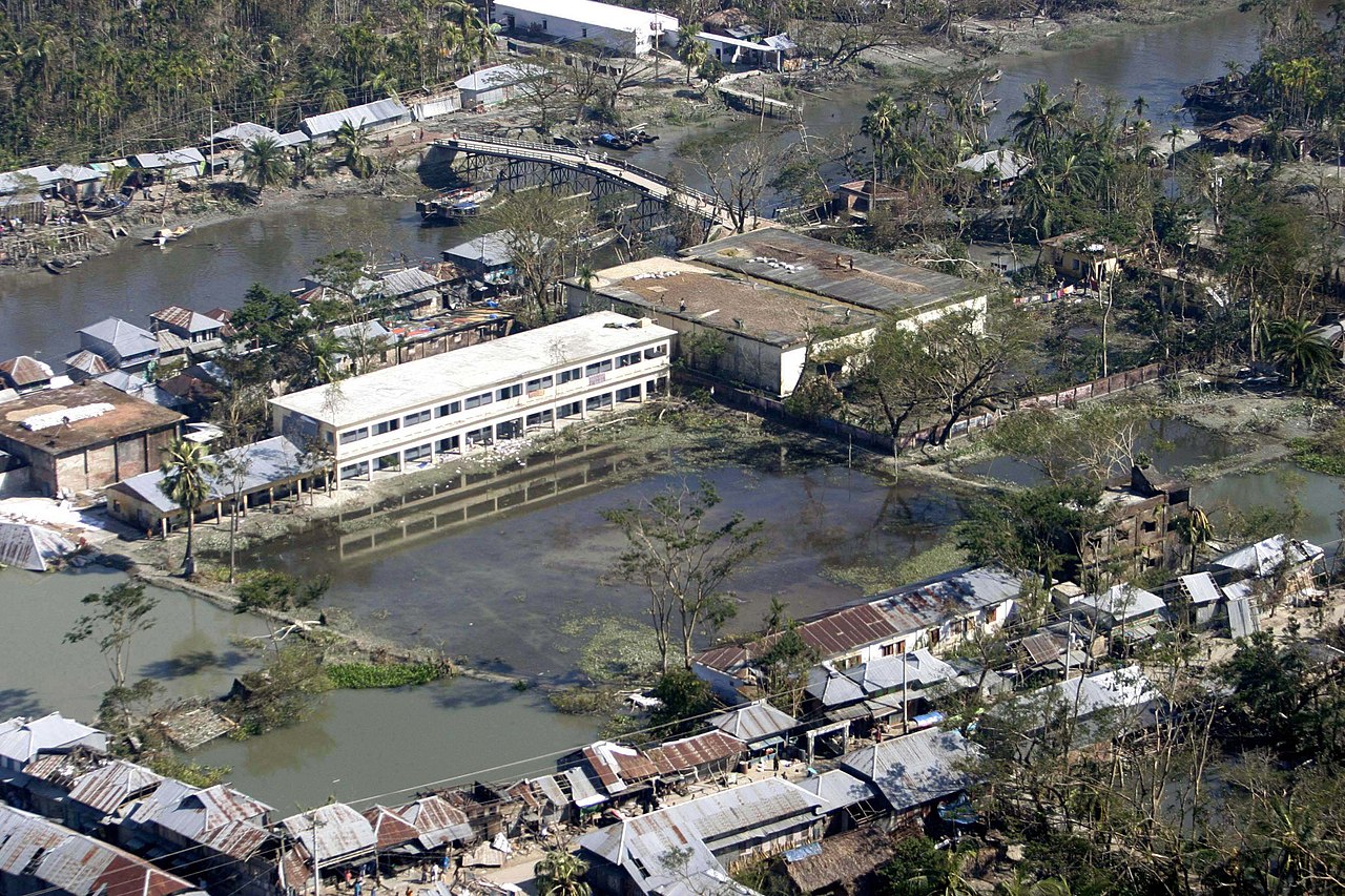
English: BANGLADESH (Nov. 20, 2007) An aerial view over southern Bangladesh reveals extensive flooding as a result of Cyclone Sidr. The Third Marine Expeditionary Force Humanitarian Assistance Survey Team conducted a flyover to assess the damage to affected areas in southern Bangladesh. U.S. Marine Corps photo by Staff Sgt. Julius Hawkins (RELEASED) |
|||
| 日期 | ||||
| 来源 |
|
|||
| 作者 | U.S. Marine Corps photo by Staff Sgt. Julius Hawkins |

许可协议
[编辑]
|
|
 |
|
According to Sec. 72 of the "2000 Copyright Act of Bangladesh", the following acts shall not constitute infringement of copyright, namely:
|
文件历史
点击某个日期/时间查看对应时刻的文件。
| 日期/时间 | 缩略图 | 大小 | 用户 | 备注 | |
|---|---|---|---|---|---|
| 当前 | 2009年10月23日 (五) 17:59 | | 3,072 × 2,048(807 KB) | BotMultichillT(留言 | 贡献) | == {{int:filedesc}} == {{Information |description={{en|1=BANGLADESH (Nov. 20, 2007) An aerial view over southern Bangladesh reveals extensive flooding as a result of Cyclone Sidr. The Third Marine Expeditionary Force Humanitarian Assistance Survey Team c |
您不可以覆盖此文件。
文件用途
没有页面使用本文件。
全域文件用途
以下其他wiki使用此文件:
- az.wikipedia.org上的用途
- bn.wikipedia.org上的用途
- en.wikipedia.org上的用途
- eo.wikipedia.org上的用途
- fa.wikipedia.org上的用途
- fr.wikipedia.org上的用途
- ig.wikipedia.org上的用途
- ka.wikipedia.org上的用途
- ko.wikipedia.org上的用途
- kw.wikipedia.org上的用途
- ms.wikipedia.org上的用途
- mt.wikipedia.org上的用途
- rw.wikipedia.org上的用途
- te.wikipedia.org上的用途
- tl.wikipedia.org上的用途
- tr.wikipedia.org上的用途
- vi.wikipedia.org上的用途
- zh.wikipedia.org上的用途