File:US Navy 110320-N-OB360-166 An aerial view of ships washed ashore and overturned at a port near the Japan Air Self-Defense Force Matsushima Air Base.jpg
跳至導覽
跳至搜尋
預覽大小:800 × 531 像素。 其他解析度:320 × 212 像素 | 640 × 425 像素 | 1,024 × 680 像素 | 1,280 × 850 像素 | 2,500 × 1,660 像素。
原始檔案 (2,500 × 1,660 像素,檔案大小:835 KB,MIME 類型:image/jpeg)
說明
說明
添加單行說明來描述出檔案所代表的內容
摘要
[編輯]| 描述 |
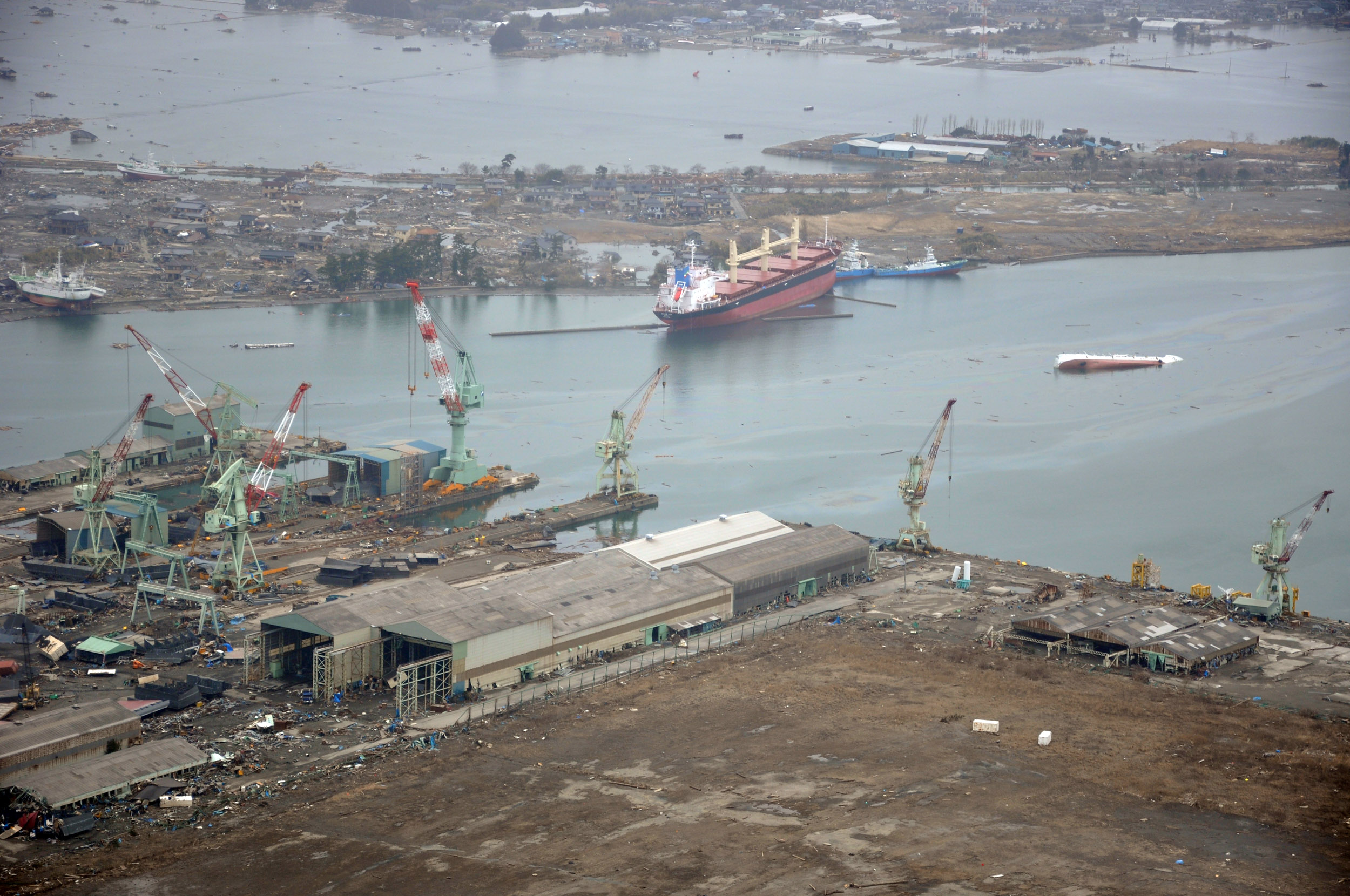
English: NORTHERN JAPAN (March 20, 2011) An aerial view of ships washed ashore and overturned at the port of Ishinomaki near the Japan Air Self-Defense Force Matsushima Air Base. The air base is serving as a refueling station for CH-46 Sea Knight helicopters assigned to Marine Medium Helicopter Squadron (HMM) 265 as they conduct humanitarian assistance missions in Northern Japan as part of Operation Tomodachi. (U.S. navy photo by Mass Communication Specialist 1st Class Ben Farone/Released)
|
|||
| 日期 | 攝於2011年3月20日 | |||
| 來源 |
|
|||
| 作者 | U.S. navy photo by Mass Communication Specialist 1st Class Ben Farone |

| 拍攝地點 | | 位於此地的本圖片與其他圖片: OpenStreetMap |
|---|
授權條款
[編輯]
 | ||
| 此作品無已知的著作權限制,亦不受所有相關和鄰接的權利限制。 | ||
檔案歷史
點選日期/時間以檢視該時間的檔案版本。
| 日期/時間 | 縮圖 | 尺寸 | 使用者 | 備註 | |
|---|---|---|---|---|---|
| 目前 | 2011年3月22日 (二) 02:14 | | 2,500 × 1,660(835 KB) | BotMultichillT(留言 | 貢獻) | == {{int:filedesc}} == {{Information |description={{en|1=NORTHERN JAPAN (March 20, 2011) An aerial view of ships washed ashore and overturned at a port near the Japan Air Self-Defense Force Matsushima Air Base. The air base is serving as a refueling stat |
無法覆蓋此檔案。
檔案用途
下列頁面有用到此檔案:
全域檔案使用狀況
以下其他 wiki 使用了這個檔案:
- de.wikipedia.org 的使用狀況
- en.wikipedia.org 的使用狀況
- fr.wikipedia.org 的使用狀況
- ja.wikipedia.org 的使用狀況
- ko.wikipedia.org 的使用狀況
- ms.wikipedia.org 的使用狀況
- nl.wikipedia.org 的使用狀況
- tl.wikipedia.org 的使用狀況
- tr.wikipedia.org 的使用狀況
- zh.wikipedia.org 的使用狀況
詮釋資料
分類:
- United States Navy images from Miyagi prefecture
- 2011 Tōhoku earthquake damage and effects in Ishinomaki, Miyagi
- Grounded ships by the 2011 Tōhoku tsunami in Japan
- Debris of the 2011 Tohoku tsunami
- Aerial photographs of Miyagi prefecture
- Aerial photographs of ports and harbours in Japan
- Port of Ishinomaki
- Yamanishi
- Shipwrecks in Japan
- C.S. Victory (ship, 2003)
- Teizan Canal
- Overturned vehicles
- Nishihamachō, Ishinomaki