File:Umbria Plantation 02.jpg
Jump to navigation
Jump to search
Size of this preview: 800 × 562 pixels. Other resolutions: 320 × 225 pixels | 640 × 450 pixels | 956 × 672 pixels.
Original file (956 × 672 pixels, file size: 202 KB, MIME type: image/jpeg)
Captions
Captions
Add a one-line explanation of what this file represents
| Description |
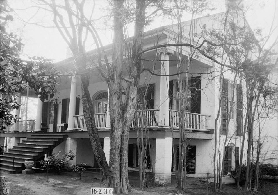
English: Governor Samuel Pickens House, best known as Umbria, State Route 14, Sawyerville vicinity, Hale, AL. FRONT VIEW. - NORTHWEST. Completed circa 1830 for Samuel Pickens, destroyed by fire on December 30, 1971. |
|||||
| Date | ||||||
| Source |
Historic American Buildings Survey, Library of Congress, Prints & Photographs Division, HABS [or HAER or HALS], Reproduction number "HABS ALA,33-SAWV.V,1-2"
|
|||||
| Author | W. N. Manning | |||||
| Permission (Reusing this file) |
|


| Camera location | | View this and other nearby images on: OpenStreetMap |
|---|
File history
Click on a date/time to view the file as it appeared at that time.
| Date/Time | Thumbnail | Dimensions | User | Comment | |
|---|---|---|---|---|---|
| current | 03:35, 26 December 2010 | | 956 × 672 (202 KB) | Altairisfar (talk | contribs) | {{Information |Description={{en|'''Governor Samuel Pickens House''', best known as '''Umbria''', State Route 14, Sawyerville vicinity, Hale, AL. FRONT VIEW. - NORTHWEST. Completed circa 1830 for Samuel Pickens, destroyed by fire on December 30, 1971.}} |S |
You cannot overwrite this file.
File usage on Commons
The following page uses this file:
File usage on other wikis
The following other wikis use this file:
- Usage on en.wikipedia.org
- Usage on www.wikidata.org