File:Un-eastern-congo.png

پروندهٔ اصلی (۲٬۰۵۷ × ۲٬۵۸۲ پیکسل، اندازهٔ پرونده: ۱٫۳ مگابایت، نوع MIME پرونده: image/png)
گزینهها
عنوان
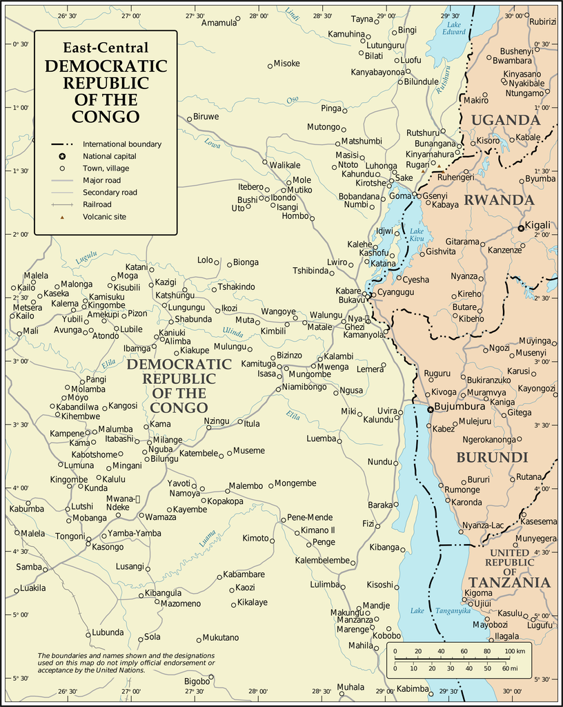
| This image is a map derived from a United Nations map.
Unless stated otherwise, UN maps are to be considered in the public domain. This applies worldwide. UN maps are, in principle, open source material and you can use them in your work or for making your own map. UN requests however that you delete the UN name, logo and reference number upon any modification to the map. Content of your map will be your responsibility. You can state in your publication, if you wish, something like: based on UN map … (map name, map number, revision number and date). See: Geospatial Information Section. And: Geospatial, location data for a better world. |
 |
تاریخچهٔ پرونده
روی تاریخ/زمانها کلیک کنید تا نسخهٔ مربوط به آن هنگام را ببینید.
| تاریخ/زمان | بندانگشتی | ابعاد | کاربر | توضیح | |
|---|---|---|---|---|---|
| کنونی | ۲۴ اکتبر ۲۰۰۷، ساعت ۰۰:۴۹ | | ۲٬۰۵۷ در ۲٬۵۸۲ (۱٫۳ مگابایت) | Jeroen (بحث | مشارکتها) | {{UN map}} Category:Maps of the Democratic Republic of the Congo |
نمیتوانید این پرونده را رونویسی کنید.
کاربرد پرونده
این پرونده در هیچ صفحهای به کار نرفته است.
کاربرد سراسری پرونده
ویکیهای دیگر زیر از این پرونده استفاده میکنند:
- کاربرد در ca.wikipedia.org
- کاربرد در ckb.wikipedia.org
- کاربرد در de.wikinews.org
- کاربرد در en.wikipedia.org
- کاربرد در fa.wikipedia.org
- کاربرد در id.wikipedia.org
- کاربرد در mzn.wikipedia.org
- کاربرد در nl.wikipedia.org
- کاربرد در www.wikidata.org