File:Union Bank & Reefs (Spratly Islands).png
跳至導覽
跳至搜尋

預覽大小:800 × 551 像素。 其他解析度:320 × 220 像素 | 640 × 441 像素 | 1,024 × 705 像素 | 1,200 × 826 像素。
原始檔案 (1,200 × 826 像素,檔案大小:337 KB,MIME 類型:image/png)
說明
說明
添加單行說明來描述出檔案所代表的內容
摘要[編輯]
.png&action=edit§ion=1)
| 拍攝地點 | | 位於此地的本圖片與其他圖片: OpenStreetMap |
|---|
.png¶ms=010.000000_N_0114.500000_E_globe:Earth_type:camera__&language=zh-hant)
| 這是一張修飾過的圖片,即本圖片是用軟體修改過後的版本,修改的方式或內容有:Darkened, rotated, cleared much cloud then resized it。
|
| 描述 |
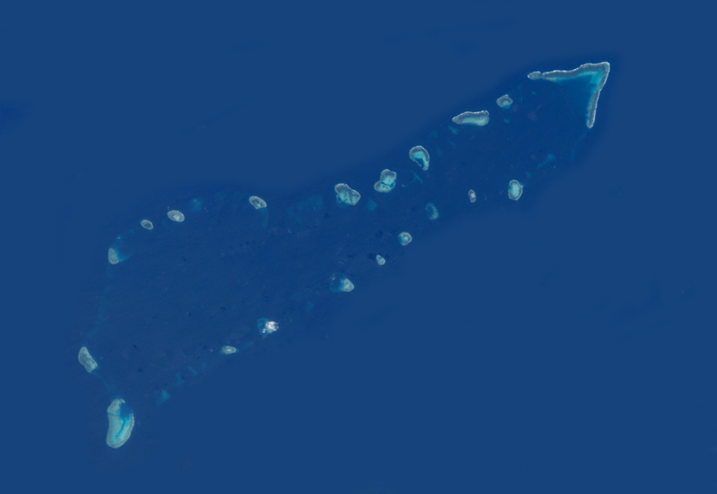
English: Union Bank & Reefs in Spratly Islands. |
||
| 日期 | |||
| 來源 | http://earth.jsc.nasa.gov/scripts/sseop/QuickView.pl?directory=ESC&ID=ISS006-E-21721 | ||
| 作者 | NASA | ||
| 授權許可 (重用此檔案) |
|
檔案歷史
點選日期/時間以檢視該時間的檔案版本。
| 日期/時間 | 縮圖 | 尺寸 | 使用者 | 備註 | |
|---|---|---|---|---|---|
| 目前 | 2012年8月16日 (四) 11:09 | | 1,200 × 826(337 KB) | Dispassionatepers(留言 | 貢獻) |
無法覆蓋此檔案。
檔案用途
下列頁面有用到此檔案:
- File:Cut2.png (檔案重新導向)
全域檔案使用狀況
以下其他 wiki 使用了這個檔案:
- de.wikipedia.org 的使用狀況
- en.wikipedia.org 的使用狀況
- fr.wikipedia.org 的使用狀況
- ja.wikipedia.org 的使用狀況
- vi.wikipedia.org 的使用狀況
- zh.wikipedia.org 的使用狀況
檢視此檔案的更多全域使用狀況。
.png)
.png&oldid=575233424)