File:Unterfeistritz & Lebing 294A6138.jpg
From Wikimedia Commons, the free media repository
Jump to navigation
Jump to search
![File:Unterfeistritz & Lebing 294A6138.jpg](https://upload.wikimedia.org/wikipedia/commons/thumb/d/df/Unterfeistritz_%26_Lebing_294A6138.jpg/800px-Unterfeistritz_%26_Lebing_294A6138.jpg?20210130183409)
Size of this preview: 800 × 481 pixels. Other resolutions: 320 × 192 pixels | 640 × 384 pixels | 1,024 × 615 pixels | 1,280 × 769 pixels | 2,560 × 1,538 pixels | 5,001 × 3,004 pixels.
Original file (5,001 × 3,004 pixels, file size: 9.49 MB, MIME type: image/jpeg)
File information
Structured data
Captions
Captions
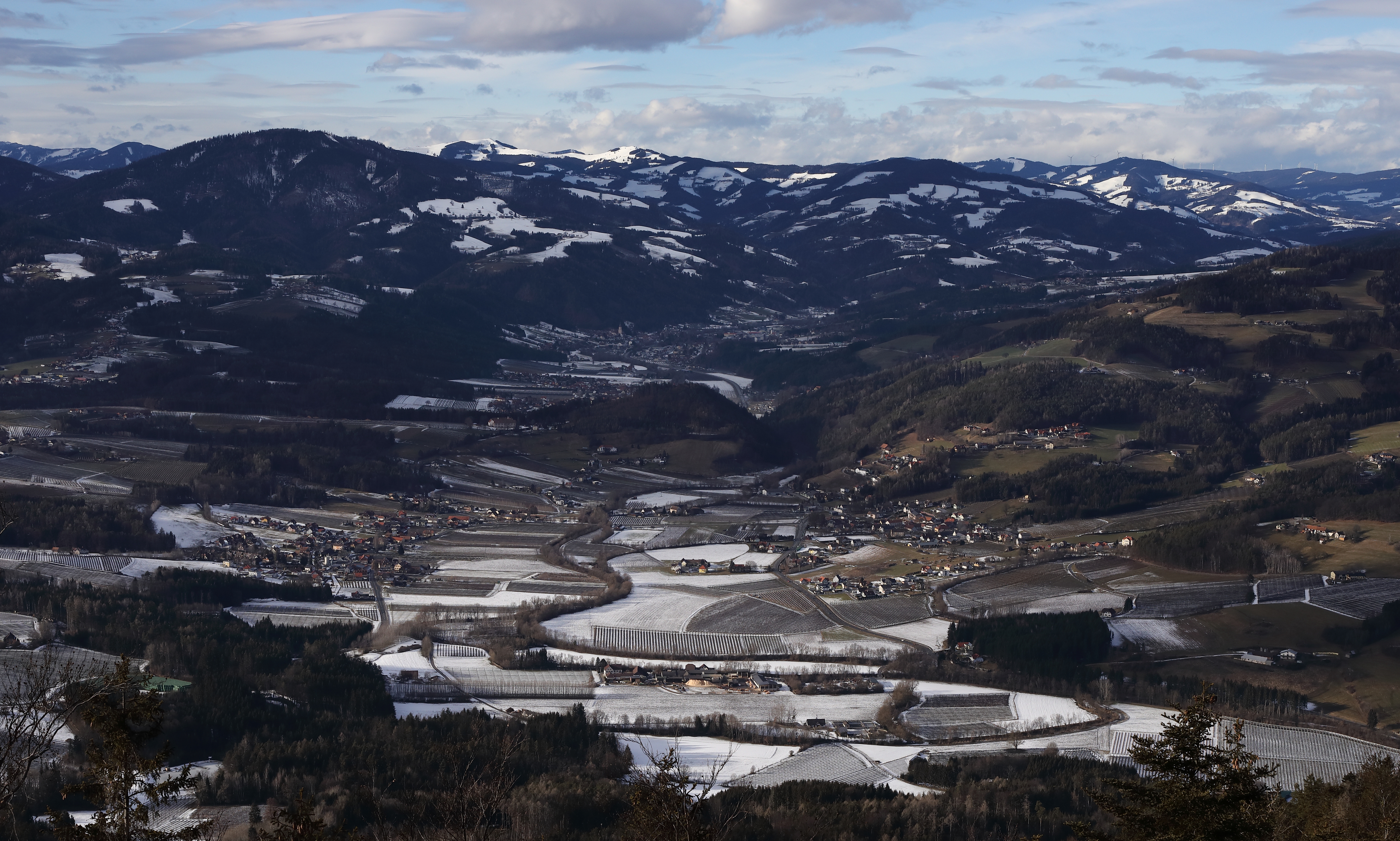
The villages Unterfeistritz and Lebing in the municipality Floing, Styria, Austria
Summary
[edit]DescriptionUnterfeistritz & Lebing 294A6138.jpg |
Deutsch: Unterfeistritz (links) und Lebing (rechts) in der Gemeinde Floing, Steiermark. Im (dunklen) Hintergrund die Ortschaft Anger. |
Date | |
Source | Own work |
Author | Christian Pirkl |
Permission (Reusing this file) |
Camera location | 47° 13′ 27.04″ N, 15° 45′ 25.3″ E ![]() | View this and other nearby images on: OpenStreetMap | ![]() |
---|
Licensing
[edit]I, the copyright holder of this work, hereby publish it under the following license:
![w:en:Creative Commons](https://upload.wikimedia.org/wikipedia/commons/thumb/7/79/CC_some_rights_reserved.svg/90px-CC_some_rights_reserved.svg.png)
![attribution](https://upload.wikimedia.org/wikipedia/commons/thumb/1/11/Cc-by_new_white.svg/24px-Cc-by_new_white.svg.png)
![share alike](https://upload.wikimedia.org/wikipedia/commons/thumb/d/df/Cc-sa_white.svg/24px-Cc-sa_white.svg.png)
This file is licensed under the Creative Commons Attribution-Share Alike 4.0 International license.
- You are free:
- to share – to copy, distribute and transmit the work
- to remix – to adapt the work
- Under the following conditions:
- attribution – You must give appropriate credit, provide a link to the license, and indicate if changes were made. You may do so in any reasonable manner, but not in any way that suggests the licensor endorses you or your use.
- share alike – If you remix, transform, or build upon the material, you must distribute your contributions under the same or compatible license as the original.
File history
Click on a date/time to view the file as it appeared at that time.
Date/Time | Thumbnail | Dimensions | User | Comment | |
---|---|---|---|---|---|
current | 18:34, 30 January 2021 | ![]() | 5,001 × 3,004 (9.49 MB) | Christian Pirkl (talk | contribs) | Uploaded own work with UploadWizard |
You cannot overwrite this file.
File usage on Commons
The following page uses this file:
File usage on other wikis
The following other wikis use this file:
- Usage on bs.wikipedia.org
- Usage on ceb.wikipedia.org
- Usage on ce.wikipedia.org
- Usage on de.wikipedia.org
- Usage on eo.wikipedia.org
- Usage on es.wikipedia.org
- Usage on fr.wikipedia.org
- Usage on it.wikipedia.org
- Usage on lmo.wikipedia.org
- Usage on nl.wikipedia.org
- Usage on pl.wikipedia.org
- Usage on pt.wikipedia.org
- Usage on ru.wikipedia.org
- Usage on sk.wikipedia.org
- Usage on tt.wikipedia.org
- Usage on uz.wikipedia.org
- Usage on vec.wikipedia.org
- Usage on vi.wikipedia.org
- Usage on www.wikidata.org
Metadata
This file contains additional information such as Exif metadata which may have been added by the digital camera, scanner, or software program used to create or digitize it. If the file has been modified from its original state, some details such as the timestamp may not fully reflect those of the original file. The timestamp is only as accurate as the clock in the camera, and it may be completely wrong.
Camera manufacturer | Canon |
---|---|
Camera model | Canon EOS 5D Mark IV |
Author | C.Pirkl/AIOLOS |
Copyright holder | TURTLETREE Images |
Exposure time | 1/640 sec (0.0015625) |
F-number | f/11 |
ISO speed rating | 320 |
Date and time of data generation | 15:52, 30 January 2021 |
Lens focal length | 50 mm |
Latitude | 47° 13′ 27.04″ N |
Longitude | 15° 45′ 25.3″ E |
Altitude | 988.4 meters above sea level |
Orientation | Normal |
Horizontal resolution | 350 dpi |
Vertical resolution | 350 dpi |
Software used | Digital Photo Professional |
File change date and time | 15:52, 30 January 2021 |
Y and C positioning | Centered |
Exposure Program | Aperture priority |
Exif version | 2.31 |
Date and time of digitizing | 15:52, 30 January 2021 |
Meaning of each component |
|
APEX shutter speed | 9.375 |
APEX aperture | 7 |
APEX exposure bias | −0.66666666666667 |
Metering mode | Spot |
Flash | Flash did not fire, compulsory flash suppression |
DateTime subseconds | 00 |
DateTimeOriginal subseconds | 00 |
DateTimeDigitized subseconds | 00 |
Supported Flashpix version | 1 |
Color space | sRGB |
Focal plane X resolution | 5,719.1489361702 |
Focal plane Y resolution | 5,728.9002557545 |
Focal plane resolution unit | inches |
Custom image processing | Normal process |
Exposure mode | Auto exposure |
White balance | Auto white balance |
Scene capture type | Standard |
GPS time (atomic clock) | 13:49:40.266 |
Satellites used for measurement | 4 |
Receiver status | Measurement in progress |
Measurement mode | 3-dimensional measurement |
Measurement precision | Poor (4.5) |
Geodetic survey data used | WGS-84 |
GPS date | 30 January 2021 |
GPS tag version | 0.0.3.2 |