File:Urban heat island.svg
跳转到导航
跳转到搜索

此SVG文件的PNG预览的大小:687 × 382像素。 其他分辨率:320 × 178像素 | 640 × 356像素 | 1,024 × 569像素 | 1,280 × 712像素 | 2,560 × 1,423像素。
原始文件 (SVG文件,尺寸为687 × 382像素,文件大小:252 KB)
说明
说明
添加一行文字以描述该文件所表现的内容
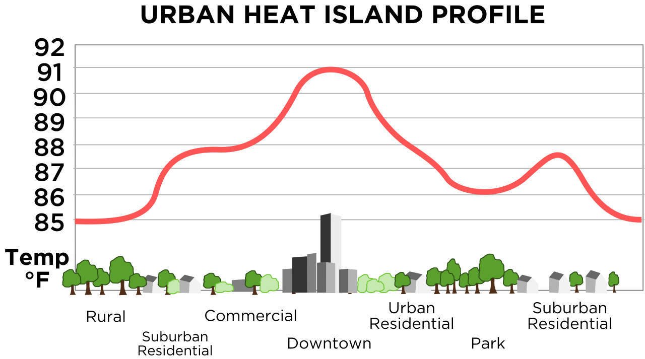
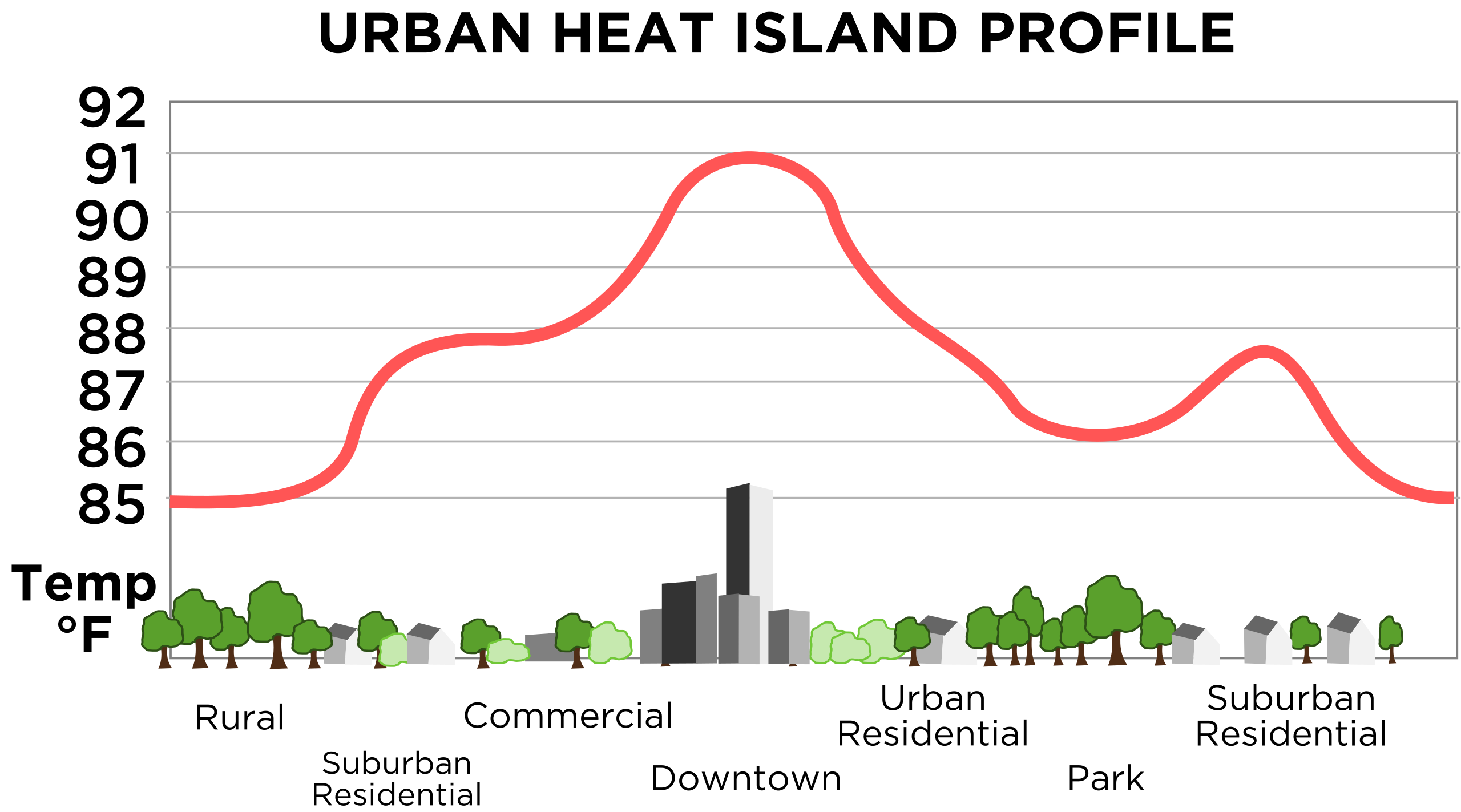
Mechanism of the urban heat island effect: the densely-built downtown areas tend to be warmer than suburban residential areas or rural areas.
| 描述 |
English: Vastly improved version of this, retraced in SVG. Original images source is this image from NOAA. |
|||
| 日期 | 11/23/08 | |||
| 来源 | 自己的作品 | |||
| 作者 | TheNewPhobia | |||
| 授权 (二次使用本文件) |
|
|||
| 其他版本 | Derivative works of this file: Urban heat island (Celsius).png |
.png)
文件历史
点击某个日期/时间查看对应时刻的文件。
| 日期/时间 | 缩略图 | 大小 | 用户 | 备注 | |
|---|---|---|---|---|---|
| 当前 | 2008年11月23日 (日) 16:55 | | 687 × 382(252 KB) | TheNewPhobia(留言 | 贡献) | {{Information |Description={{en|1=Vastly improved version of this, retraced in SVG. Original images source is [http://www.crh.noaa.gov/images/lsx/recent_event/urban.gif this image] from NOAA.}} |Source=Own work by |
您不可以覆盖此文件。
文件用途
全域文件用途
以下其他wiki使用此文件:
- en.wikipedia.org上的用途
- fi.wikipedia.org上的用途
- gl.wikipedia.org上的用途
- it.wikipedia.org上的用途
- www.wikidata.org上的用途
- zh.wikipedia.org上的用途