File:Vennbahn.png
跳转到导航
跳转到搜索
本预览的尺寸:593 × 600像素。 其他分辨率:237 × 240像素 | 475 × 480像素 | 718 × 726像素。
原始文件 (718 × 726像素,文件大小:75 KB,MIME类型:image/png)
说明
说明
添加一行文字以描述该文件所表现的内容
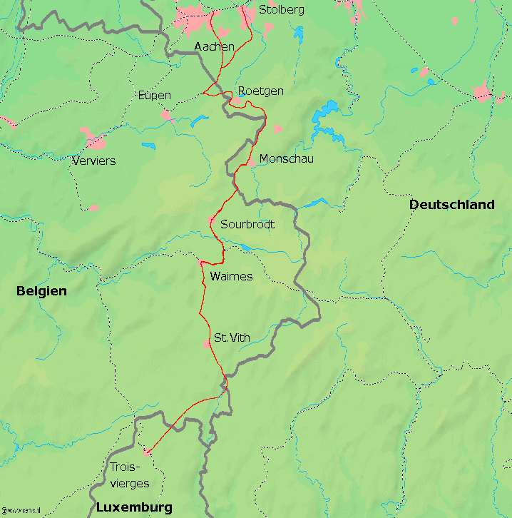
Map of the Venn railway between Belgium and Germany, map source: [1][失效链接]
This image is in the public domain because it came from the site https://www.demis.nl/products/web-map-server/examples/ and was released by the copyright holder. Permission is granted to copy, distribute and/or modify this map since it is based on free of copyright images from: www.demis.nl. See also approval email on de.wp and its clarification.
|
| This work has been released into the public domain by its copyright holder, www.demis.nl. This applies worldwide. 在一些国家这可能不合法;如果是这样的话,那么: www.demis.nl无条件地授予任何人以任何目的使用本作品的权利,除非这些条件是法律规定所必需的。
|
文件历史
点击某个日期/时间查看对应时刻的文件。
| 日期/时间 | 缩略图 | 大小 | 用户 | 备注 | |
|---|---|---|---|---|---|
| 当前 | 2004年12月20日 (一) 21:36 | | 718 × 726(75 KB) | Markus Schweiss(留言 | 贡献) | Map of the Venn railway between Belgium and Germany, map source: [http://www.demis.nl/mapserver/mapper.asp] {{GFDL}} |
您不可以覆盖此文件。
文件用途
全域文件用途
以下其他wiki使用此文件:
- cs.wikipedia.org上的用途
- da.wikipedia.org上的用途
- de.wikipedia.org上的用途
- en.wikipedia.org上的用途
- es.wikipedia.org上的用途
- fr.wikipedia.org上的用途
- id.wikipedia.org上的用途
- it.wikipedia.org上的用途
- ja.wikipedia.org上的用途
- li.wikipedia.org上的用途
- nl.wikipedia.org上的用途
- no.wikipedia.org上的用途
- pl.wikipedia.org上的用途
- pt.wikipedia.org上的用途
- sk.wikipedia.org上的用途
- www.wikidata.org上的用途
- zh.wikipedia.org上的用途