File:Verhovje1917.jpg
Verhovje1917.jpg (400 × 100 pixels, file size: 22 KB, MIME type: image/jpeg)
Captions
Captions
Summary
[edit]
| Description |
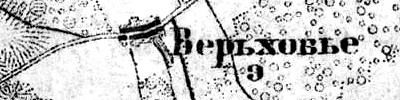
Русский: Деревня Верховье на карте 1917 года. |
| Date | |
| Source | http://www.etomesto.ru/shubert-map/3-12/ |
| Author | «Военно-топографическая карта Петроградской и Новгородской губерний», ряд III, лист 12 |
Licensing
[edit]
|
This work is in the public domain in its country of origin and other countries and areas where the copyright term is the author's life plus 70 years or fewer.
| |
| This file has been identified as being free of known restrictions under copyright law, including all related and neighboring rights. | |
File history
Click on a date/time to view the file as it appeared at that time.
| Date/Time | Thumbnail | Dimensions | User | Comment | |
|---|---|---|---|---|---|
| current | 01:23, 24 December 2016 | 400 × 100 (22 KB) | Valeriy10f (talk | contribs) | размер | |
| 03:37, 21 December 2016 |  | 240 × 120 (18 KB) | Valeriy10f (talk | contribs) | {{Information |Description ={{ru|1=== {{int:filedesc}} == {{Information |Description ={{ru|1= Деревня Верховье на карте 1917 года.}} |Source = http://www.etomesto.ru/shubert-map/3-12/ |Author = «Военно-топогр... |
You cannot overwrite this file.
File usage on Commons
There are no pages that use this file.
File usage on other wikis
The following other wikis use this file:
- Usage on ru.wikipedia.org