File:Vicinity of Troy (William R. Shepherd).jpg
Jump to navigation
Jump to search

No higher resolution available.
Vicinity_of_Troy_(William_R._Shepherd).jpg (327 × 371 pixels, file size: 80 KB, MIME type: image/jpeg)
Captions
Captions
Add a one-line explanation of what this file represents
Summary
[edit]| Description |
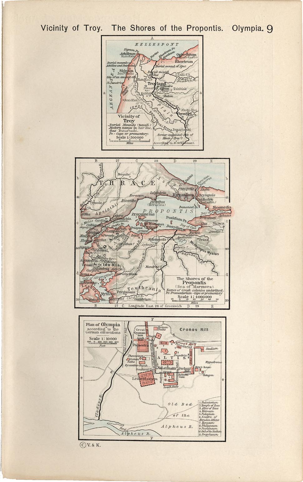
English: Vicinity of Troy. The Shores of the Propontis. Plan of Olympia . Historical Atlas by William R. Shepherd, 1911. Courtesy of the University of Texas Libraries, The University of Texas at Austin.
From The Historical Atlas by William R. Shepherd, 1911 edition |
| Date | 7 March 2008 (upload date) |
| Source | Historical Atlas by William R. Shepherd 1911 edition |
| Author | Historical Atlas by William R. Shepherd 1911 edition |
| Permission (Reusing this file) |
This image is in the public domain due to its age. See also http://www.lib.utexas.edu/usage_statement.html?maps=yes |
| Other versions |

.jpg&action=edit§ion=1)
Licensing
[edit].jpg&action=edit§ion=2)
|
This work is in the public domain in its country of origin and other countries and areas where the copyright term is the author's life plus 70 years or fewer. | |
| This file has been identified as being free of known restrictions under copyright law, including all related and neighboring rights. | |
File history
Click on a date/time to view the file as it appeared at that time.
| Date/Time | Thumbnail | Dimensions | User | Comment | |
|---|---|---|---|---|---|
| current | 10:41, 27 September 2021 | | 327 × 371 (80 KB) | GPinkerton (talk | contribs) | File:Shepherd-c-009.jpg cropped 66 % horizontally, 76 % vertically using CropTool with lossless mode. |
You cannot overwrite this file.
File usage on Commons
The following page uses this file:
.jpg&oldid=593854758)