File:Vietnam-1754.jpg
跳至導覽
跳至搜尋
預覽大小:411 × 600 像素。 其他解析度:164 × 240 像素 | 492 × 718 像素。
原始檔案 (492 × 718 像素,檔案大小:64 KB,MIME 類型:image/jpeg)
說明
說明
添加單行說明來描述出檔案所代表的內容
摘要[編輯]
| 描述 |
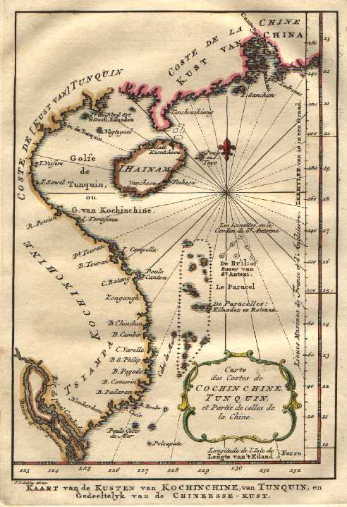
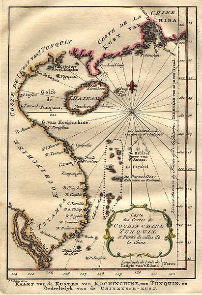
English: acob van der Schley was a Dutch engraver who, in 1754, produced a series of maps identical to those of Jacques Bellin for a Dutch edition of “Histoire Générale des Voyages”. This fine copperplate map from that edition depicts the Chinese and Vietnamese coasts from Macau in the north to the Mekong delta in the south. Hainan Island is prominent with a number of settlements shown while on the mainland of China, Macau and Canton are marked. A compas rose and small decorative title cartouche are nice features. |
| 日期 | |
| 來源 | From Atlas of Mutual Heritage website |
| 作者 | Jacob van der Schley |
授權條款[編輯]
|
本作品在其來源國以及其他著作權期限是作者逝世後100年或以下的國家與地區屬於公有領域。 | |
| 此作品無已知的著作權限制,亦不受所有相關和鄰接的權利限制。 | |
檔案歷史
點選日期/時間以檢視該時間的檔案版本。
| 日期/時間 | 縮圖 | 尺寸 | 使用者 | 備註 | |
|---|---|---|---|---|---|
| 目前 | 2008年6月25日 (三) 03:39 | | 492 × 718(64 KB) | Vinhtantran(留言 | 貢獻) | {{Information |Description={{en|1=acob van der Schley was a Dutch engraver who, in 1754, produced a series of maps identical to those of Jacques Bellin for a Dutch edition of “Histoire Générale des Voyages”. This fine copperplate map from that editi |
無法覆蓋此檔案。
檔案用途
沒有使用此檔案的頁面。
全域檔案使用狀況
以下其他 wiki 使用了這個檔案:
- nl.wikipedia.org 的使用狀況
- vi.wikipedia.org 的使用狀況
- za.wikipedia.org 的使用狀況
- zh.wikipedia.org 的使用狀況