File:Virgin Islands-map-CIA.jpg
跳去導覽
跳去搵嘢

預覽大細:407 × 599 像素。 第啲解像度:163 × 240 像素 | 326 × 480 像素 | 522 × 768 像素 | 1,036 × 1,525 像素。
原本檔案 (1,036 × 1,525 像素,檔案大細:138 KB ,MIME類型:image/jpeg)
Captions
Captions
Add a one-line explanation of what this file represents
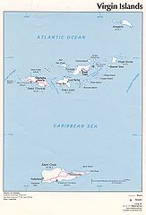
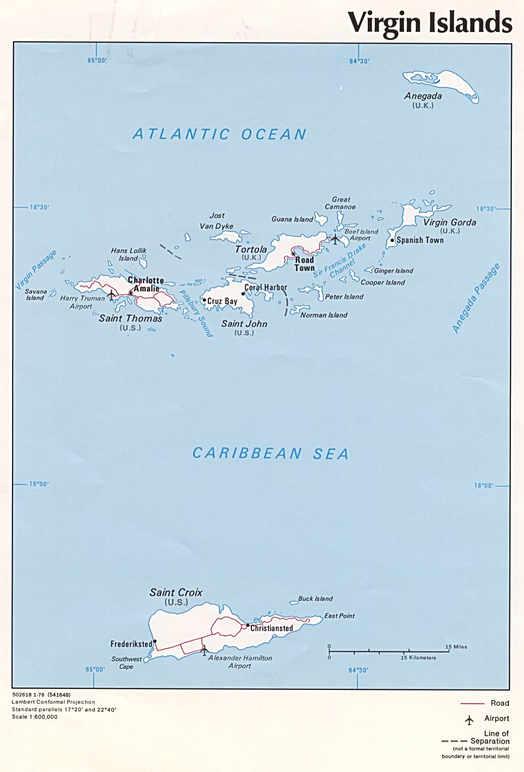
Political map of U.S. Virgin Islands and British Virgin Islands, 1976
摘要[編輯]
| 描述 | Political map of U.S. Virgin Islands and British Virgin Islands, 1976, produced by the U.S. Central Intelligence Agency. |
| 日期 | |
| 來源 | University of Texas Libraries, Perry-Castañeda Library Map Collection: Americas Maps |
| 作者 | CIA |
| Other versions |
|

協議[編輯]
| This image is a work of a Central Intelligence Agency employee, taken or made as part of that person's official duties. As a Work of the United States Government, this image or media is in the public domain in the United States.
|

|
檔案歷史
撳個日期/時間去睇響嗰個時間出現過嘅檔案。
| 日期/時間 | 縮圖 | 尺寸 | 用戶 | 註解 | |
|---|---|---|---|---|---|
| 現時 | 2005年7月3號 (日) 10:02 | | 1,036 × 1,525(138 KB) | Kooma(傾偈 | 貢獻) | CIA map of U.S. Virgin Islands and British Virgin Islands from [http://www.lib.utexas.edu/maps/americas/virginislands.jpg]. {{PD-USGov-CIA}} Category:Caribbean |
你無得衾咗個檔案。
檔案用途
以下嘅3版用到呢個檔:
全域檔案使用情況
下面嘅維基都用緊呢個檔案:
- af.wikipedia.org嘅使用情況
- ar.wikipedia.org嘅使用情況
- azb.wikipedia.org嘅使用情況
- az.wikipedia.org嘅使用情況
- be.wikipedia.org嘅使用情況
- br.wikipedia.org嘅使用情況
- bs.wikipedia.org嘅使用情況
- cs.wikipedia.org嘅使用情況
- da.wikipedia.org嘅使用情況
- el.wikipedia.org嘅使用情況
- en.wikipedia.org嘅使用情況
- Virgin Islands
- Ecclesiastical provinces and dioceses of the Episcopal Church
- List of governors of the Danish West Indies
- Episcopal Diocese of the Virgin Islands
- Dutch Virgin Islands
- HDMS Lougen (1791)
- List of the Episcopal cathedrals of the United States
- List of Episcopal bishops of the United States
- eo.wikipedia.org嘅使用情況
- es.wikipedia.org嘅使用情況
- fi.wikipedia.org嘅使用情況
- frr.wikipedia.org嘅使用情況
- fr.wikipedia.org嘅使用情況
- gl.wikipedia.org嘅使用情況
- hr.wikipedia.org嘅使用情況
- id.wikipedia.org嘅使用情況
- it.wikipedia.org嘅使用情況
- ja.wikipedia.org嘅使用情況
- kk.wikipedia.org嘅使用情況
- ky.wikipedia.org嘅使用情況
- lt.wikipedia.org嘅使用情況
- mrj.wikipedia.org嘅使用情況
- nl.wikipedia.org嘅使用情況
- no.wikipedia.org嘅使用情況
- pl.wikipedia.org嘅使用情況
- pl.wiktionary.org嘅使用情況
- pt.wikipedia.org嘅使用情況
- ro.wikipedia.org嘅使用情況
- ru.wikipedia.org嘅使用情況
睇呢個檔案嘅更多全域使用情況。