File:Vladivostok city urban agglomeration.jpg
Aller à la navigation
Aller à la recherche
Taille de cet aperçu : 749 × 600 pixels. Autres résolutions : 300 × 240 pixels | 600 × 480 pixels | 960 × 768 pixels | 1 279 × 1 024 pixels | 2 559 × 2 048 pixels | 3 543 × 2 836 pixels.
Fichier d’origine (3 543 × 2 836 pixels, taille du fichier : 1,56 Mio, type MIME : image/jpeg)
Légendes
Légendes
Ajoutez en une ligne la description de ce que représente ce fichier
Description
[modifier]| Description |
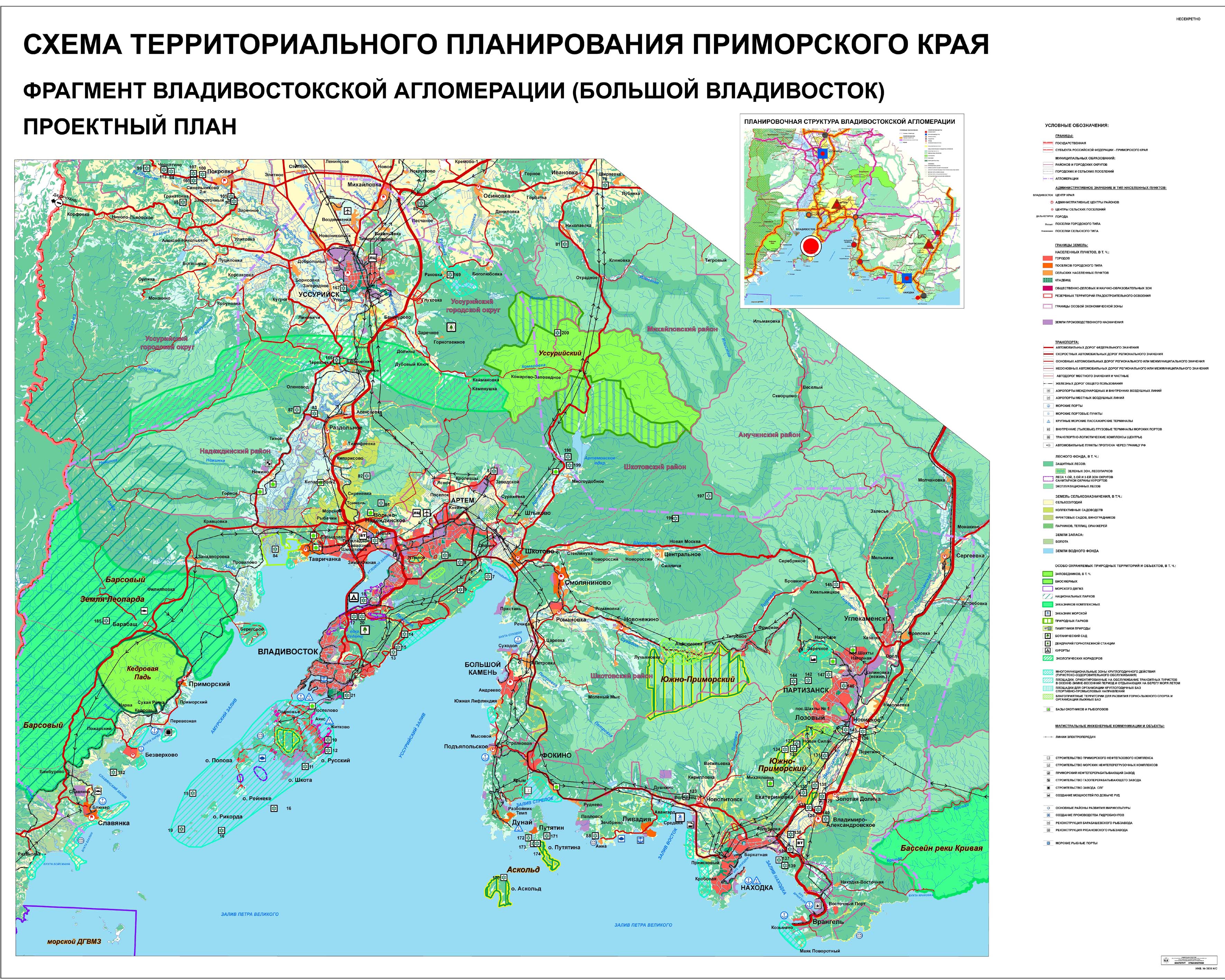
English: Vladivostok city metropolitain area map
Русский: Карта Владивостокской агломерации в составе схемы территориального планирования Приморского края |
| Source | http://www.primorsky.ru/files/9151.jpg |
| Auteur | FGUP RosNIPIUrbanistiki |
| Autres versions |

Conditions d’utilisation
[modifier]
Cette œuvre n'est pas éligible au copyright d'après la section IV du Code Civil n° 230-FZ de la Fédération de Russie du 18 décembre 2006.
Article 1259. Applications du copyright Paragraphe 5
Paragraphe 6
Texte officiel du Code : en russe. |
 | |
|
Comment – According to interstate and international compacts, the Russian Federation is the legal successor of the Russian Soviet Federative Socialist Republic and the Union of Soviet Socialist Republics; therefore, this license tag is also applicable to official symbols and formal documents of the Russian SFSR and the USSR (union level[1]).
Warning – This license tag cannot be applied to proposed official symbols and drafts of formal documents, which can be copyrighted.
|
Historique du fichier
Cliquer sur une date et heure pour voir le fichier tel qu'il était à ce moment-là.
| Date et heure | Vignette | Dimensions | Utilisateur | Commentaire | |
|---|---|---|---|---|---|
| actuel | 9 septembre 2010 à 16:55 | | 3 543 × 2 836 (1,56 Mio) | Bogomolov.PL (d | contributions) | {{Information |Description={{en|1=Vladivostok city metropolitain area map }} {{ru|1=Карта Владивостокской агломерации в составе схемы территориального планирования Приморско� |
Vous ne pouvez pas remplacer ce fichier.
Utilisations locales du fichier
Les 3 pages suivantes utilisent ce fichier :
Utilisations du fichier sur d’autres wikis
Les autres wikis suivants utilisent ce fichier :
- Utilisation sur azb.wikipedia.org
- Utilisation sur fr.wikipedia.org
- Utilisation sur ja.wikipedia.org
- Utilisation sur kk.wikipedia.org
- Utilisation sur ru.wikipedia.org
- Utilisation sur sh.wikipedia.org
- Utilisation sur sr.wikipedia.org
- Utilisation sur www.wikidata.org
- Utilisation sur zh.wikipedia.org