File:Vysoká zahrada Dolní Věstonice 2021 13.jpg
Jump to navigation
Jump to search

Size of this preview: 800 × 600 pixels. Other resolutions: 320 × 240 pixels | 640 × 480 pixels | 1,024 × 768 pixels | 1,280 × 960 pixels | 2,560 × 1,920 pixels | 4,000 × 3,000 pixels.
Original file (4,000 × 3,000 pixels, file size: 7.07 MB, MIME type: image/jpeg)
Captions
Captions
Add a one-line explanation of what this file represents
Summary[edit]
| Description |
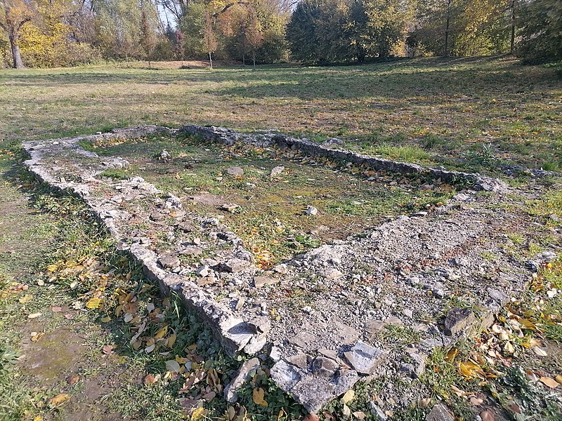
Čeština: Vysoká zahrada (též Strachotíngrad) bylo staroslovanské hradiště z 11. a 12. století, ležící na poloostrově obklopeným dolní a střední Novomlýnskou nádrží a Starou Dyjí, na okraji Dolních Věstonic. Hradiště se nachází napravo od silnice II/420 pokračující na Strachotín. Místem prochází i archeostezka, seznamující s archeologickými lokalitami v okolí Dolních Věstonic a Pavlova. Od roku 1964 je místo chráněno jako kulturní památka.
English: The High Garden (also Strachotíngrad) was an Old Slavic settlement from the 11th and 12th centuries, situated on a peninsula surrounded by the lower and middle Novomlýn Reservoir and the Old Dyje, on the outskirts of Dolní Věstonice. The castle is located on the right side of the road II/420 continuing to Strachotín. An archaeological trail passes through the site, introducing the archaeological sites in the vicinity of Dolní Věstonice and Pavlov. The site has been protected as a cultural monument since 1964.
|
||
| Date | |||
| Source | Own work | ||
| Author | David Kennedy | ||
| Permission (Reusing this file) |
I, the copyright holder of this work, hereby publish it under the following license: This file is licensed under the Creative Commons Attribution-Share Alike 4.0 International license.
|
| Camera location | | View this and other nearby images on: OpenStreetMap |
|---|
File history
Click on a date/time to view the file as it appeared at that time.
| Date/Time | Thumbnail | Dimensions | User | Comment | |
|---|---|---|---|---|---|
| current | 13:06, 31 October 2021 | | 4,000 × 3,000 (7.07 MB) | David Kennedy (talk | contribs) | Uploaded own work with UploadWizard |
You cannot overwrite this file.
File usage on Commons
The following page uses this file:
File usage on other wikis
The following other wikis use this file:
- Usage on cs.wikipedia.org
- Usage on www.wikidata.org