File:WWII-Mediterranean-v1.PNG
Jump to navigation
Jump to search
No higher resolution available.
WWII-Mediterranean-v1.PNG (800 × 448 pixels, file size: 113 KB, MIME type: image/png)
Captions
Captions
Add a one-line explanation of what this file represents
Summary
[edit]
| Description |
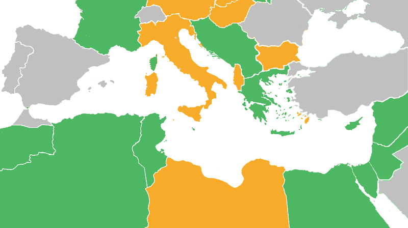
Map with the Participants in World War II:
|
| Date | |
| Source | derived from Image:BlankMap-World6.svg |
| Author | derived from User:Canuckguy's map |
Licensing
[edit]
Reuv at the English Wikipedia, the copyright holder of this work, hereby publishes it under the following license:

|
Permission is granted to copy, distribute and/or modify this document under the terms of the GNU Free Documentation License, Version 1.2 or any later version published by the Free Software Foundation; with no Invariant Sections, no Front-Cover Texts, and no Back-Cover Texts. A copy of the license is included in the section entitled GNU Free Documentation License. |
| This file is licensed under the Creative Commons Attribution-Share Alike 3.0 Unported license. | ||
| Attribution: Reuv at the English Wikipedia | ||
| ||
| This licensing tag was added to this file as part of the GFDL licensing update. |
Original upload log
[edit]
The original description page was here. All following user names refer to en.wikipedia.
- 2011-06-21 03:34 Theirrulez 800×448× (125554 bytes) Borders corrections for Italy, Vichy's Government and Turkey
- 2009-07-18 07:32 Reuv 1305×731× (28321 bytes) Adressed the problems brought up in discussion.
- 2007-10-14 14:29 Reuv 1305×731× (45623 bytes) == Summary == {{Information |Description= map of the Mediterranean theatre of operations in WWII. |Source= derived from [[:Image:BlankMap-World6.svg|Image:BlankMap-World6.svg]] |Date= October 2007 |Author= derived from [[User:Canuckguy]]'s map |Permission
File history
Click on a date/time to view the file as it appeared at that time.
| Date/Time | Thumbnail | Dimensions | User | Comment | |
|---|---|---|---|---|---|
| current | 15:22, 10 May 2012 | | 800 × 448 (113 KB) | OgreBot (talk | contribs) | (BOT): Reverting to most recent version before archival |
| 15:22, 10 May 2012 |  | 1,305 × 731 (28 KB) | OgreBot (talk | contribs) | (BOT): Uploading old version of file from en.wikipedia; originally uploaded on 2009-07-18 07:32:35 by Reuv | |
| 15:22, 10 May 2012 |  | 1,305 × 731 (45 KB) | OgreBot (talk | contribs) | (BOT): Uploading old version of file from en.wikipedia; originally uploaded on 2007-10-14 14:29:14 by Reuv | |
| 17:20, 27 October 2011 |  | 800 × 448 (113 KB) | Spiridon Ion Cepleanu (talk | contribs) | Rectifications : borders 1940-1940 (before June 1940) and countrie's status. | |
| 16:25, 21 June 2011 |  | 800 × 448 (123 KB) | Gigillo83 (talk | contribs) | Borders I-YU | |
| 17:33, 20 June 2011 |  | 800 × 448 (123 KB) | Gigillo83 (talk | contribs) | Borders corrections for Italy, Vichy's Government and Turkey | |
| 11:59, 7 October 2009 |  | 800 × 448 (111 KB) | JJ Georges (talk | contribs) | {{Information |Description=Maps of Mediterranean operations in World War II |Source=http://en.wikipedia.org/wiki/File:WWII-Mediterranean-v1.PNG |Date=10/2007 |Author=http://en.wikipedia.org/wiki/User:Canuckguy |Permission= |other_versions= }} |
You cannot overwrite this file.
File usage on Commons
There are no pages that use this file.
File usage on other wikis
The following other wikis use this file:
- Usage on ar.wikipedia.org
- Usage on ca.wikipedia.org
- Usage on en.wikipedia.org
- Usage on eo.wikipedia.org
- Usage on es.wikipedia.org
- Usage on eu.wikipedia.org
- Usage on fa.wikipedia.org
- Usage on fi.wikipedia.org
- Usage on fr.wikipedia.org
- Usage on he.wikipedia.org
- Usage on hr.wikipedia.org
- Usage on it.wikipedia.org
- Usage on ko.wikipedia.org
- Usage on lt.wikipedia.org
- Usage on ms.wikipedia.org
- Usage on no.wikipedia.org
- Usage on ru.wikipedia.org
- Usage on sr.wikipedia.org
- Usage on ta.wikipedia.org
- Usage on th.wikipedia.org
- Usage on tr.wikipedia.org
- Usage on vi.wikipedia.org
- Usage on zh.wikipedia.org