File:Wakayama Junction Aerial photograph 2022.jpg
Jump to navigation
Jump to search

Size of this preview: 800 × 342 pixels. Other resolutions: 320 × 137 pixels | 640 × 273 pixels | 1,024 × 438 pixels | 1,280 × 547 pixels | 2,560 × 1,094 pixels | 6,694 × 2,860 pixels.
Original file (6,694 × 2,860 pixels, file size: 3.29 MB, MIME type: image/jpeg)
Captions
Captions
Add a one-line explanation of what this file represents
Summary
[edit]
| Description |
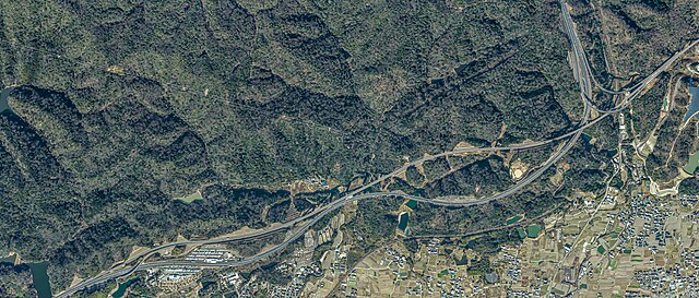
日本語: 大阪府泉佐野市にある阪和自動車道と関西空港自動車道を接続する泉佐野ジャンクションの航空写真。CKK20215-C8-20,21,22,24,25、C10-20,22,24,26から合成。Naokijpが作成。 |
| Date | |
| Source |
English: Ministry of Land, Infrastructure, Transport and Tourism Geospatial Information Authority of Japan Map/aerial photo browsing service 日本語: 国土交通省 国土地理院 地図・空中写真閲覧サービス (https://mapps.gsi.go.jp/maplibSearch.do#1) |
| Author |
English: Geospatial Information Authority of Japan 日本語: 国土地理院 |
Licensing
[edit]

|
The copyright holder of this file, the Ministry of Land, Infrastructure, Transport and Tourism of Japan, allows anyone to use it for any purpose, provided that the copyright holder is properly attributed. Redistribution, derivative work, commercial use, and all other use is permitted. |
Attribution:
Copyright © National Land Image Information (Color Aerial Photographs), Ministry of Land, Infrastructure, Transport and Tourism
|
 |
This image is copyrighted by the Ministry of Land, Infrastructure, Transport and Tourism of Japan. For terms of use, see the stipulation to use of National Land Information (in Japanese) and message from MLIT (in Japanese and English). When you display this image on an article, include the following phrase in the description: "Made based on National Land Image Information (Color Aerial Photographs), Ministry of Land, Infrastructure, Transport and Tourism".
|
File history
Click on a date/time to view the file as it appeared at that time.
| Date/Time | Thumbnail | Dimensions | User | Comment | |
|---|---|---|---|---|---|
| current | 17:02, 8 April 2023 | | 6,694 × 2,860 (3.29 MB) | Naokijp (talk | contribs) | Uploaded a work by {{en|1=Geospatial Information Authority of Japan}}{{ja|1=国土地理院}} from {{en|1=Ministry of Land, Infrastructure, Transport and Tourism Geospatial Information Authority of Japan Map/aerial photo browsing service}}{{ja|1=国土交通省 国土地理院 地図・空中写真閲覧サービス}}(https://mapps.gsi.go.jp/maplibSearch.do#1) with UploadWizard |
You cannot overwrite this file.
File usage on Commons
There are no pages that use this file.
File usage on other wikis
The following other wikis use this file:
- Usage on ja.wikipedia.org
- Usage on www.wikidata.org