File:Warlubie (gmina) location map.png
Jump to navigation
Jump to search
Size of this preview: 647 × 600 pixels. Other resolutions: 259 × 240 pixels | 518 × 480 pixels | 829 × 768 pixels | 1,095 × 1,015 pixels.
Original file (1,095 × 1,015 pixels, file size: 132 KB, MIME type: image/png)
Captions
Captions
Add a one-line explanation of what this file represents
| Description |
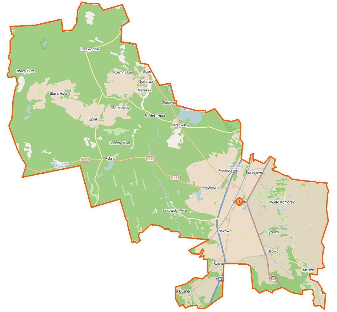
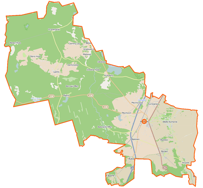
Polski: Mapa gminy Warlubie, Polska
English: Map of Gmina Warlubie, Poland |
|||||||||
| Date | ||||||||||
| Source | You may find a page on the OpenStreetMap wiki page for Warlubie (gmina) | |||||||||
| Creator |
OpenStreetMap contributors OpenStreetMap contributors |
|||||||||
| Permission (Reusing this file) |
OpenStreetMap data is available under the Open Database License (details). Map tiles are licensed under the Creative Commons Attribution-ShareAlike 2.0 license (CC-BY-SA 2.0).
This file is licensed under the Creative Commons Attribution-Share Alike 2.0 Generic license.
|
|||||||||
| Geotemporal data | ||||||||||
| Bounding box |
|
|||||||||
| Georeferencing | If inappropriate please set warp_status = skip to hide. | |||||||||
File history
Click on a date/time to view the file as it appeared at that time.
| Date/Time | Thumbnail | Dimensions | User | Comment | |
|---|---|---|---|---|---|
| current | 09:46, 18 November 2014 | | 1,095 × 1,015 (132 KB) | VanWiel (talk | contribs) | {{OpenStreetMap | name = Warlubie (gmina) | location = Warlubie (gmina) | description = {{pl|Mapa gminy Warlubie, Polska}} {{en|Map of Gmina Warlubie, Poland}} | top = 53.7056 | left = 18.3915 | r... |
You cannot overwrite this file.
File usage on Commons
There are no pages that use this file.
File usage on other wikis
The following other wikis use this file:
- Usage on pl.wikipedia.org
- Warlubie
- Warlubie (gmina)
- Płochocin (wieś w województwie kujawsko-pomorskim)
- Bzowo (wieś w województwie kujawsko-pomorskim)
- Lipinki (powiat świecki)
- Wielki Komorsk
- Bąkowo (wieś w powiecie świeckim)
- Buśnia
- Grabowa Góra (województwo kujawsko-pomorskie)
- Kurzejewo
- Płochocinek
- Przewodnik (województwo kujawsko-pomorskie)
- Rulewo
- Średnia Huta
- Krusze (województwo kujawsko-pomorskie)
- Krzewiny (osada w województwie kujawsko-pomorskim)
- Stara Huta (wieś w województwie kujawsko-pomorskim)
- Komorsk
- Mątasek
- Bąkowski Młyn
- Borowy Młyn (osada w województwie kujawsko-pomorskim)
- Ciemny Las
- Bursztynowo (powiat świecki)
- Blizawy
- Borsukowo (Polska)
- Rynków
- Nowa Huta (województwo kujawsko-pomorskie)
- Kuźnica (województwo kujawsko-pomorskie)
- Rybno (powiat świecki)
- Zamczyska (osada)
- Jeżewnica (województwo kujawsko-pomorskie)
- Dębowe (województwo kujawsko-pomorskie)
- Górna Buśnia
- Trzy Korony (Bąkowo)
- Parafia Niepokalanego Serca Maryi w Warlubiu
- Parafia św. Bartłomieja Apostoła w Wielkim Komorsku
- Parafia św. Wawrzyńca i Matki Kościoła w Płochocinie
- Parafia św. Małgorzaty Antiocheńskiej i Podwyższenia Krzyża Świętego w Bzowie
- Błądziejewo
- Rezerwat przyrody Osiny
- Rezerwat przyrody Jezioro Łyse
- Warlubie (stacja kolejowa)
- Rezerwat przyrody Kuźnica
- Radodzierz
- Gzelowe
- Kamionka (powiat świecki)
- Warlubie (osada leśna w województwie kujawsko-pomorskim)
- Bąkowo (osada leśna w powiecie świeckim)
- Borowy Młyn (osada leśna w województwie kujawsko-pomorskim)
- Bzowo (osada leśna w województwie kujawsko-pomorskim)
View more global usage of this file.
_location_map.png)
_location_map.png&oldid=507287181)