File:West Kazakhstan, administrative divisions - de - colored.svg
Jump to navigation
Jump to search

Size of this PNG preview of this SVG file: 800 × 577 pixels. Other resolutions: 320 × 231 pixels | 640 × 461 pixels | 1,024 × 738 pixels | 1,280 × 923 pixels | 2,560 × 1,845 pixels | 892 × 643 pixels.
Original file (SVG file, nominally 892 × 643 pixels, file size: 144 KB)
Captions
Captions
Add a one-line explanation of what this file represents
Summary[edit]


.svg)


_(Paris_zoom).svg)
.svg)
,_administrative_divisions_-_de_-_colored_(multizoom).svg)
_-_colored.svg)
.svg)
,_administrative_divisions_-_Nmbrs_(multizoom).svg)
,_administrative_divisions_-_de_-_colored.svg)
_-_de_-_colored.svg)

.svg)

.svg)
I, the copyright holder of this work, hereby publish it under the following licenses:
This file is licensed under the Creative Commons Attribution-Share Alike 3.0 Unported license.
- You are free:
- to share – to copy, distribute and transmit the work
- to remix – to adapt the work
- Under the following conditions:
- attribution – You must give appropriate credit, provide a link to the license, and indicate if changes were made. You may do so in any reasonable manner, but not in any way that suggests the licensor endorses you or your use.
- share alike – If you remix, transform, or build upon the material, you must distribute your contributions under the same or compatible license as the original.

|
Permission is granted to copy, distribute and/or modify this document under the terms of the GNU Free Documentation License, Version 1.2 or any later version published by the Free Software Foundation; with no Invariant Sections, no Front-Cover Texts, and no Back-Cover Texts. A copy of the license is included in the section entitled GNU Free Documentation License. |
You may select the license of your choice.
File history
Click on a date/time to view the file as it appeared at that time.
| Date/Time | Thumbnail | Dimensions | User | Comment | |
|---|---|---|---|---|---|
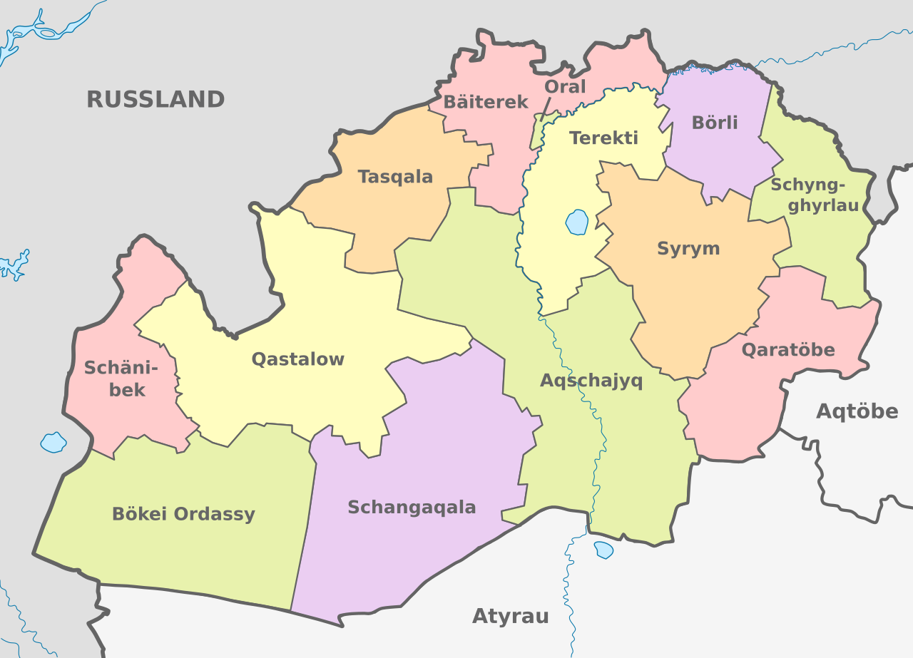
| current | 11:28, 13 December 2020 | | 892 × 643 (144 KB) | Zebra848 (talk | contribs) | Bezeichnungen angepasst |
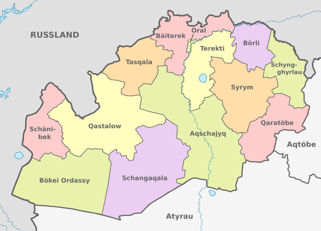
| 16:47, 12 April 2020 |  | 892 × 643 (142 KB) | Zebra848 (talk | contribs) | {{Information |description ={{en|1=Map of administrative divisions of West Kazakhstan Region, Kazakhstan}} {{de|1=Karte der politischen Gliederung des Gebiets Westkasachstan, Kasachstan}} |date =2020 |source ={{own}}{{AttribSVG|Kazakhstan adm location map.svg|NordNordWest}}{{AttribSVG|KZ West Kazakhstan Region Outline.svg|Nzeemin}} |author =Zebra848 |other versions={{SVG labeled maps of administrative divisions (location map scheme)}} }} {{self|cc-by... |
You cannot overwrite this file.
File usage on Commons
There are no pages that use this file.
File usage on other wikis
The following other wikis use this file:
- Usage on de.wikipedia.org
- Usage on ky.wikipedia.org