File:Westport c1790.jpg
Jump to navigation
Jump to search
Size of this preview: 800 × 600 pixels. Other resolutions: 320 × 240 pixels | 640 × 480 pixels | 1,024 × 768 pixels | 1,280 × 960 pixels | 2,560 × 1,920 pixels | 4,032 × 3,024 pixels.
Original file (4,032 × 3,024 pixels, file size: 2.01 MB, MIME type: image/jpeg)
Captions
Captions
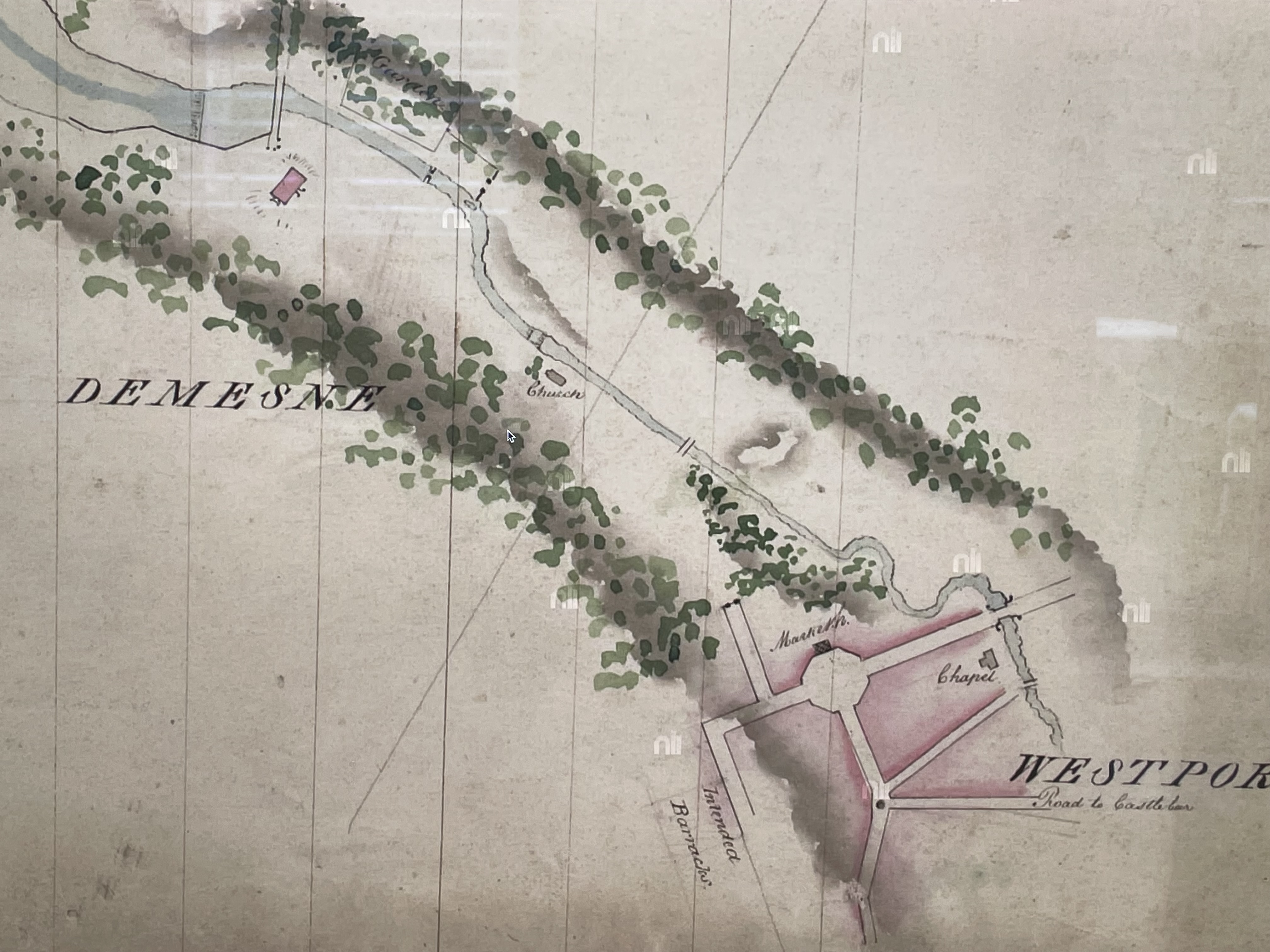
A map of the new town around 1790
Summary
[edit]
| Description |
English: This early map of Westport, around 1790 was prepared by the Dublin firm of Brownrigg, Longfield and Murray. It shows the formal Street layout of the early town. At the time of the map, the malls had not yet been laid out and the road to Castlebar went via Mill Street, not James Street. The only buildings identified are the market house on the Octagon, and the Catholic chapel built near the river in a similar location to the Catholic church of Saint Mary’s today. Westport house, and the old Church of Ireland Church in the grounds of the Demesne are also shown. |
| Date | |
| Source | National Library of Ireland website. |
| Author | Brownrigg, Longfield and Murray |
Licensing
[edit]
|
This work is in the public domain in its country of origin and other countries and areas where the copyright term is the author's life plus 70 years or fewer. This work is in the public domain in the United States because it was published (or registered with the U.S. Copyright Office) before January 1, 1929. | |
| This file has been identified as being free of known restrictions under copyright law, including all related and neighboring rights. | |
File history
Click on a date/time to view the file as it appeared at that time.
| Date/Time | Thumbnail | Dimensions | User | Comment | |
|---|---|---|---|---|---|
| current | 16:51, 23 May 2023 | | 4,032 × 3,024 (2.01 MB) | LAS30a (talk | contribs) | Uploaded a work by Brownrigg, Longfield and Murray from National Library of Ireland website. with UploadWizard |
You cannot overwrite this file.
File usage on Commons
There are no pages that use this file.
File usage on other wikis
The following other wikis use this file:
- Usage on en.wikipedia.org