File:Whitney Ranger Station Utah.jpg
Jump to navigation
Jump to search

Size of this preview: 800 × 312 pixels. Other resolutions: 320 × 125 pixels | 640 × 249 pixels | 1,024 × 399 pixels | 1,280 × 499 pixels | 2,560 × 997 pixels | 9,808 × 3,820 pixels.
Original file (9,808 × 3,820 pixels, file size: 8.34 MB, MIME type: image/jpeg)
Captions
Captions
Add a one-line explanation of what this file represents
Summary
[edit]
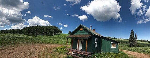
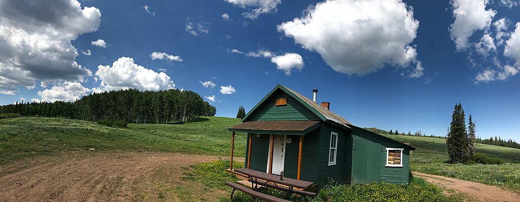
| Description | The Whitney Ranger Station originally served as an administrative outpost for the Unita National Forest. In 1915 the National Forest Land in the Whitney Area was transferred to the Wasatch National Forest. The original two-room log cabin was built in 1915. In 1929, the house was expanded with a 12’ X 14’ feet frame storeroom. The Whitney Ranger Station House provided a permanent station for the Forest Service work crews in the summer and a remote station during the rest of the year until the mid-1920’s, when the Mill Creel Ranger Station was constructed. The station operated as a remote work center for crews until the mid-1960’s when the Utah Division of Wildlife Resources (UDWR) received a special permit to use the house. The UDWR maintained the station until 1986 when the road to Whitney was improved for oil exploration. The house was not used again until 1998 when it was fixed up to use as a warming hut for snowmobilers and for the Incident Command Post (ICP) for the Summit County Search and Rescue during rescue operations. In 1998 a new a new toilet was installed at the Whitney Ranger Station to replace the old one. The Evanston-Mountain View Ranger District maintains the building with help from the Summit County Search and Rescue. |
| Date | Taken on 15 July 2017, 11:40:39 |
| Source | Own work |
| Author | Eddie Rattlehead |
| Camera location | | View this and other nearby images on: OpenStreetMap |
|---|
Licensing
[edit]
I, the copyright holder of this work, hereby publish it under the following license:
This file is licensed under the Creative Commons Attribution-Share Alike 4.0 International license.
- You are free:
- to share – to copy, distribute and transmit the work
- to remix – to adapt the work
- Under the following conditions:
- attribution – You must give appropriate credit, provide a link to the license, and indicate if changes were made. You may do so in any reasonable manner, but not in any way that suggests the licensor endorses you or your use.
- share alike – If you remix, transform, or build upon the material, you must distribute your contributions under the same or compatible license as the original.

|
This image was uploaded as part of Wiki Loves Monuments 2017.
|
 |
File history
Click on a date/time to view the file as it appeared at that time.
| Date/Time | Thumbnail | Dimensions | User | Comment | |
|---|---|---|---|---|---|
| current | 03:40, 8 September 2017 | 9,808 × 3,820 (8.34 MB) | Eddie Rattlehead (talk | contribs) | User created page with UploadWizard |
You cannot overwrite this file.
File usage on Commons
The following page uses this file:
- File:Coalville.jpg (file redirect)