File:Wildfire spreads in Fort McMurray.jpg
Jump to navigation
Jump to search

Size of this preview: 796 × 600 pixels. Other resolutions: 319 × 240 pixels | 637 × 480 pixels | 999 × 753 pixels.
Original file (999 × 753 pixels, file size: 622 KB, MIME type: image/jpeg)
Captions
Captions
Add a one-line explanation of what this file represents
Summary
[edit]
| Description |
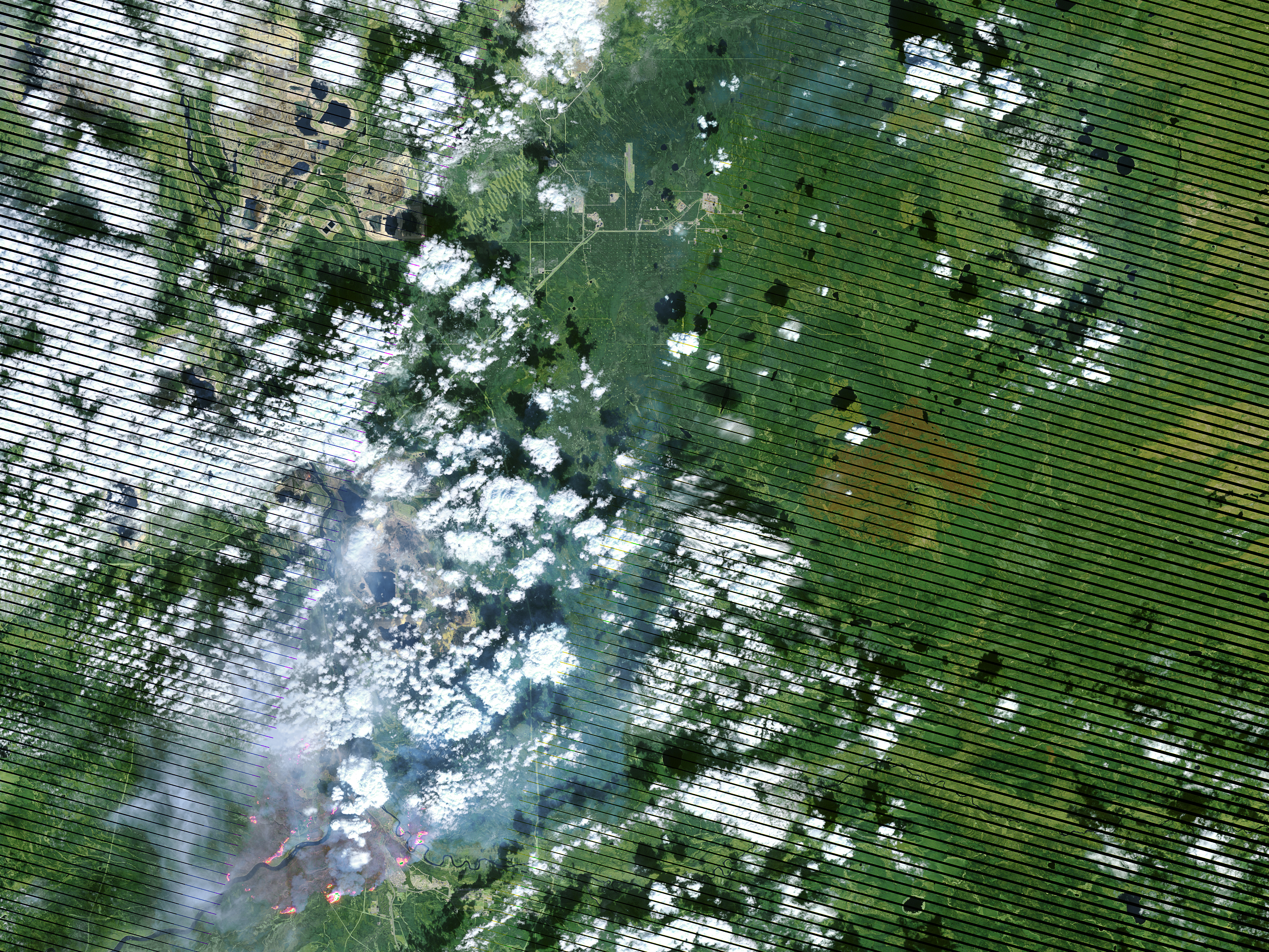
English: On May 4, 2016, the the Enhanced Thematic Mapper Plus (ETM+) on the Landsat 7 satellite acquired this false-color image of the wildfire that burned through Fort McMurray in Alberta, Canada. The image combines shortwave infrared, near infrared, and green light (bands 5-4-2). Near- and short-wave infrared help penetrate clouds and smoke to reveal the hot spots associated with active fires, which appear red. Smoke appears white and burned areas appear brown. |
| Date | |
| Source | Cropped from mcmurray_etm_2016125_swir_lrg.jpg on http://visibleearth.nasa.gov/view.php?id=87988 |
| Author | NASA Earth Observatory image by Joshua Stevens, using Landsat data from the U.S. Geological Survey. Caption by Kathryn Hansen |
Licensing
[edit]
| This file is in the public domain in the United States because it was solely created by NASA. NASA copyright policy states that "NASA material is not protected by copyright unless noted". (See Template:PD-USGov, NASA copyright policy page or JPL Image Use Policy.) | ||
 |
Warnings:
|
File history
Click on a date/time to view the file as it appeared at that time.
| Date/Time | Thumbnail | Dimensions | User | Comment | |
|---|---|---|---|---|---|
| current | 04:09, 6 May 2016 | | 999 × 753 (622 KB) | Kayoty (talk | contribs) | User created page with UploadWizard |
You cannot overwrite this file.
File usage on Commons
The following 2 pages use this file:
- File:WILDFIRE SPREADS IN FORT MCMURRAY.jpg (file redirect)
- File:Wildfire Spreads In Fort McMurray.jpg (file redirect)
File usage on other wikis
The following other wikis use this file:
- Usage on ar.wikipedia.org
- Usage on de.wikipedia.org
- Usage on en.wikipedia.org
- Usage on he.wikipedia.org
- Usage on ru.wikipedia.org
- Usage on uk.wikipedia.org
- Usage on zh.wikipedia.org