File:Wilma 2005-10-24 1815Z.jpg
Jump to navigation
Jump to search

Size of this preview: 800 × 500 pixels. Other resolutions: 320 × 200 pixels | 640 × 400 pixels | 1,024 × 640 pixels | 1,280 × 800 pixels | 1,920 × 1,200 pixels.
Original file (1,920 × 1,200 pixels, file size: 375 KB, MIME type: image/jpeg)
Captions
Captions
Add a one-line explanation of what this file represents
Summary[edit]
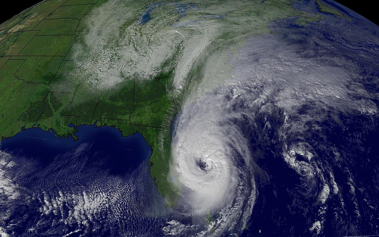
| Description | This image shows the storm and the intense baroclinic trough over the eastern U.S. that Wilma will interact with in the next few days. | |||
| Date | ||||
| Source | http://www.nnvl.noaa.gov/cgi-bin/index.cgi?page=items&ser=109929&large=1 | |||
| Author | NOAA / Satellite and Information Service | |||
| Permission (Reusing this file) |
|
File history
Click on a date/time to view the file as it appeared at that time.
| Date/Time | Thumbnail | Dimensions | User | Comment | |
|---|---|---|---|---|---|
| current | 04:18, 7 November 2006 | | 1,920 × 1,200 (375 KB) | Good kitty (talk | contribs) | |
| 06:09, 26 October 2005 |  | 642 × 482 (68 KB) | っ (talk | contribs) | Hurricane Wilma regional imagery, 2005.10.24 at 1815.jpg Centerpoint Latitude: 32:54:16N Longitude: 81:06:18W. source: http://www.nnvl.noaa.gov/members/images/109929.jpg from: http://www.nnvl.noaa.gov/cgi-bin/index.cgi?page=items&ser=109929&large=1 {{ |
You cannot overwrite this file.
File usage on Commons
The following page uses this file:
- File:Hurricane Wilma 200510241815.jpg (file redirect)
File usage on other wikis
The following other wikis use this file:
- Usage on ja.wikinews.org