File:Winterthur Battle 1799.svg
跳至導覽
跳至搜尋

此 SVG 檔案的 PNG 預覽的大小:506 × 599 像素。 其他解析度:203 × 240 像素 | 405 × 480 像素 | 648 × 768 像素 | 864 × 1,024 像素 | 1,729 × 2,048 像素 | 845 × 1,001 像素。
原始檔案 (SVG 檔案,表面大小:845 × 1,001 像素,檔案大小:426 KB)
說明
說明
添加單行說明來描述出檔案所代表的內容
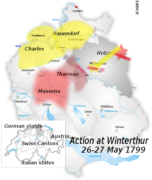
| 描述 | District of Winterthur Map drawn by Tschubby |
| 日期 | (UTC) |
| 來源 |
個人作品,使用:
|
| 作者 |
|
| 這是一張修飾過的圖片,即本圖片是用軟體修改過後的版本,修改的方式或內容有:added location of battle outside Winterthur, May 1799。原版圖片來源:Karte Bezirk Winterthur.png。修改者:Auntieruth55。
|
我,本作品的著作權持有者,決定用以下授權條款發佈本作品:
| 此檔案採用共享創意 姓名標示-相同方式分享 3.0 未在地化版本授權條款。 | ||
| ||
| 已新增授權條款標題至此檔案,作為GFDL授權更新的一部份。 |

|
已授權您依據自由軟體基金會發行的無固定段落、封面文字和封底文字GNU自由文件授權條款1.2版或任意後續版本,對本檔進行複製、傳播和/或修改。該協議的副本列在GNU自由文件授權條款中。 |
您可以選擇您需要的授權條款。
原始上傳日誌
[編輯]
This image is a derivative work of the following images:
- File:Karte_Bezirk_Winterthur.png licensed with Cc-by-sa-3.0-migrated, GFDL
- 2005-06-15T18:08:08Z Tschubby 826x1001 (259741 Bytes) District of Winterthur Map drawn by [[:de:Benutzer:Tschubby|Tschubby]] [[Category:Maps of Canton of Zurich|Winterthur]] {{GFDL}}
Uploaded with derivativeFX
檔案歷史
點選日期/時間以檢視該時間的檔案版本。
| 日期/時間 | 縮圖 | 尺寸 | 用戶 | 備註 | |
|---|---|---|---|---|---|
| 目前 | 2010年2月3日 (三) 22:00 | | 845 × 1,001(426 KB) | Auntieruth55(對話 | 貢獻) | fix size. |
| 2010年2月3日 (三) 21:51 |  | 765 × 1,260(425 KB) | Auntieruth55(對話 | 貢獻) | added location map, geographic info, etc. | |
| 2010年2月3日 (三) 19:46 |  | 765 × 1,260(365 KB) | Auntieruth55(對話 | 貢獻) | Reverted to version as of 19:43, 3 February 2010 | |
| 2010年2月3日 (三) 19:45 |  | 765 × 1,260(365 KB) | Auntieruth55(對話 | 貢獻) | added location map | |
| 2010年2月3日 (三) 19:43 |  | 765 × 1,260(365 KB) | Auntieruth55(對話 | 貢獻) | Clarified location, added location map, additional markers, changed illustration of movements. | |
| 2010年1月13日 (三) 10:41 |  | 826 × 1,001(354 KB) | Fundriver(對話 | 貢獻) | Reverted to version as of 10:34, 13 January 2010 | |
| 2010年1月13日 (三) 10:41 |  | 826 × 1,001(354 KB) | Fundriver(對話 | 貢獻) | ... | |
| 2010年1月13日 (三) 10:34 |  | 826 × 1,001(354 KB) | Fundriver(對話 | 貢獻) | "Schaffhausen" erased (this is a map of the canton of Zurich). | |
| 2009年12月29日 (二) 03:26 |  | 826 × 1,001(355 KB) | Auntieruth55(對話 | 貢獻) | {{Information |Description=District of Winterthur Map drawn by Tschubby |Source=*File:Karte_Bezirk_Winterthur.png |Date=2009-12-29 03:22 (UTC) |Author=*File:Karte_Bezirk_Winterthur.png: Tschubby *de |
無法覆蓋此檔案。
檔案用途
沒有使用此檔案的頁面。
全域檔案使用狀況
以下其他 wiki 使用了這個檔案:
- en.wikipedia.org 的使用狀況
- es.wikipedia.org 的使用狀況
- fa.wikipedia.org 的使用狀況
- hr.wikipedia.org 的使用狀況
- id.wikipedia.org 的使用狀況
- te.wikipedia.org 的使用狀況
- uz.wikipedia.org 的使用狀況
- zh.wikipedia.org 的使用狀況