File:Wołów (gmina) location map.png

Original file (1,748 × 1,538 pixels, file size: 886 KB, MIME type: image/png)
Captions
Captions
Summary[edit]
_location_map.png&action=edit§ion=1)
| Description |
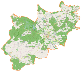
English: Location map |
| Date | |
| Source | Own work |
| Author | Smat |
| Description |
Polski: Mapa gminy Wołów, Polska
English: Map of Wołów (gmina), Poland |
|||||||||
| Date | ||||||||||
| Source | You may find a page on the OpenStreetMap wiki page for Wołów (gmina) | |||||||||
| Creator |
OpenStreetMap contributors OpenStreetMap contributors |
|||||||||
| Permission (Reusing this file) |
OpenStreetMap data is available under the Open Database License (details). Map tiles are licensed under the Creative Commons Attribution-ShareAlike 2.0 license (CC-BY-SA 2.0).
This file is licensed under the Creative Commons Attribution-Share Alike 2.0 Generic license.
|
|||||||||
| Geotemporal data | ||||||||||
| Bounding box |
|
|||||||||
| Georeferencing | If inappropriate please set warp_status = skip to hide. | |||||||||
Licensing[edit]
_location_map.png&action=edit§ion=2)
| This work contains information from OpenStreetMap, which is made available under the Open Database License (ODbL).
The ODbL does not require any particular license for maps produced from ODbL data. Prior to 1 August 2020, map tiles produced by the OpenStreetMap Foundation were licensed under the CC-BY-SA-2.0 license. Maps produced by other people may be subject to other licences. |
File history
Click on a date/time to view the file as it appeared at that time.
| Date/Time | Thumbnail | Dimensions | User | Comment | |
|---|---|---|---|---|---|
| current | 15:10, 11 February 2017 | | 1,748 × 1,538 (886 KB) | Smat (talk | contribs) | User created page with UploadWizard |
You cannot overwrite this file.
File usage on Commons
There are no pages that use this file.
File usage on other wikis
The following other wikis use this file:
- Usage on de.wikipedia.org
- Usage on pl.wikipedia.org
- Lubiąż
- Wołów
- Wołów (gmina)
- Boraszyn
- Bożeń
- Garwół
- Krzydlina Mała
- Krzydlina Wielka
- Łazarzowice
- Łososiowice
- Mikorzyce (województwo dolnośląskie)
- Miłcz
- Moczydlnica Dworska
- Mojęcice
- Pawłoszewo
- Pierusza
- Piotroniowice
- Prawików
- Proszkowa
- Siodłkowice
- Sławowice
- Stary Wołów
- Straszowice
- Tarchalice
- Uskorz Mały
- Uskorz Wielki
- Warzęgowo
- Gliniany (województwo dolnośląskie)
- Golina (województwo dolnośląskie)
- Gródek (województwo dolnośląskie)
- Pełczyn (województwo dolnośląskie)
- Rataje (województwo dolnośląskie)
- Rudno (województwo dolnośląskie)
- Stobno (województwo dolnośląskie)
- Stęszów (województwo dolnośląskie)
- Wróblewo (województwo dolnośląskie)
- Wrzosy (województwo dolnośląskie)
- Zagórzyce (województwo dolnośląskie)
- Dębno (powiat wołowski)
- Domaszków (powiat wołowski)
- Lipnica (powiat wołowski)
- Nieszkowice (powiat wołowski)
- Straża
- Opactwo Cystersów w Lubiążu
- Wołów (stacja kolejowa)
- Krzywy Wołów
- Wodnica (województwo dolnośląskie)
- Łososiowice (przystanek kolejowy)
- Rezerwat przyrody Odrzysko
View more global usage of this file.
_location_map.png)
_location_map.png&oldid=607603120)